File:Hanse-Orden.png
Original file (1,263 × 753 pixels, file size: 210 KB, MIME type: image/png)
Captions
Captions
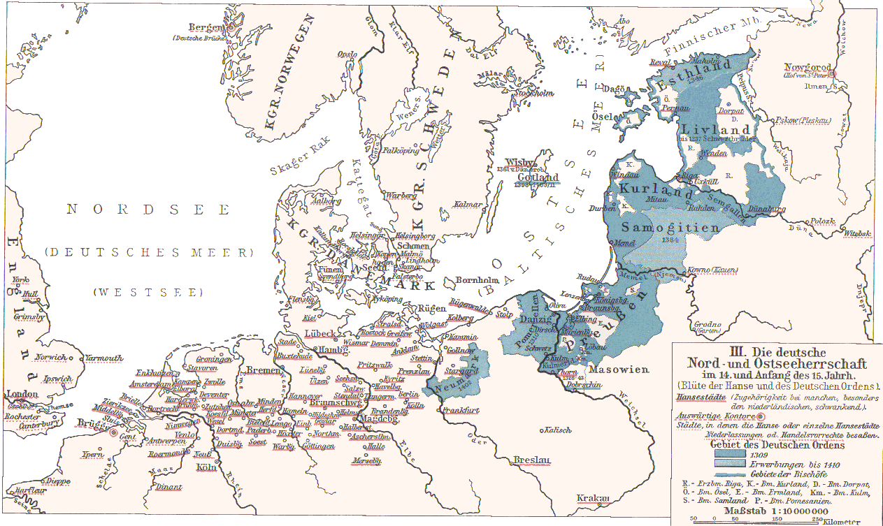
- Hanse cities underlined in red.
- Ordensstaat possessions until 1410 marked in blue colors, with year of acquisition.
- Lands of the bishoprics are marked with first letter:
- Pomesanien, Kulm (Km.), Ermland, Samland in Prussia
- Riga, Kurland, Ösel, Dorpat in the North East
- Towns of Hanseatic League are underlined in red.
Originally from 1901 edition of Putzgers Historischer Schul-Atlas and uploaded to Hanse.jpg as 100+ year old Public Domain by de:Benutzer:Olbertz. Improved quality and reduced file size by Matthead. See also at maproom.org
|
This work is in the public domain in its country of origin and other countries and areas where the copyright term is the author's life plus 70 years or fewer.
| |
| This file has been identified as being free of known restrictions under copyright law, including all related and neighboring rights. | |
File history
Click on a date/time to view the file as it appeared at that time.
| Date/Time | Thumbnail | Dimensions | User | Comment | |
|---|---|---|---|---|---|
| current | 23:31, 2 December 2007 | | 1,263 × 753 (210 KB) | Matthead (talk | contribs) | |
| 10:08, 2 December 2007 |  | 1,263 × 753 (219 KB) | Matthead (talk | contribs) | This map depict the extension of Hanseatic League cities and Teutonic Order lands (blue) in 14th and earl y15th century. Originally from 1901 edition of Putzgers Historischer Schul-Atlas and uploaded to [http://de.wikipedia.org/wiki/Bild:Hans |
You cannot overwrite this file.
File usage on Commons
The following page uses this file:
File usage on other wikis
The following other wikis use this file:
- Usage on af.wikipedia.org
- Usage on be-tarask.wikipedia.org
- Usage on de.wikipedia.org
- Usage on en.wikipedia.org
- Usage on et.wikipedia.org
- Usage on frr.wikipedia.org
- Usage on fr.wikipedia.org
- Usage on lt.wikibooks.org
- Usage on sv.wikipedia.org
- Usage on uk.wikipedia.org