File:Haleakala National Park map 2008.08.jpg
Jump to navigation
Jump to search

Size of this preview: 800 × 546 pixels. Other resolutions: 320 × 218 pixels | 640 × 437 pixels | 1,024 × 698 pixels | 1,280 × 873 pixels | 2,560 × 1,746 pixels | 4,595 × 3,134 pixels.
Original file (4,595 × 3,134 pixels, file size: 1.56 MB, MIME type: image/jpeg)
Captions
Captions
Add a one-line explanation of what this file represents
Summary
[edit]
| Description |
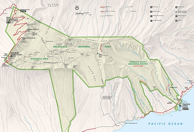
Official National Park Service map of Haleakala National Park, Hawaii. Converted from PDF using Adobe Acrobat 7.0 Professional. Original file name: HALEmap1.pdf |
| Date | |
| Source | http://www.nps.gov/carto |
| Author | National Park Service, Harpers Ferry Center |
| Permission (Reusing this file) |
"The maps at this site are in the public domain. You may use National Park Service maps provided that you agree to assume complete legal responsibility for problems resulting from their use. Although National Park Service maps are easy to modify, understand that modifications can adversely alter the meaning and accuracy of the original data. Law prohibits you from using the National Park Service seal or claiming National Park Service endorsement with downloaded maps." [1] |
Licensing
[edit]
| This image or media file contains material based on a work of a National Park Service employee, created as part of that person's official duties. As a work of the U.S. federal government, such work is in the public domain in the United States. See the NPS website and NPS copyright policy for more information. |
File history
Click on a date/time to view the file as it appeared at that time.
| Date/Time | Thumbnail | Dimensions | User | Comment | |
|---|---|---|---|---|---|
| current | 08:34, 29 August 2016 | | 4,595 × 3,134 (1.56 MB) | NordNordWest (talk | contribs) | CMYK -> RGB |
| 05:41, 9 March 2010 |  | 4,595 × 3,134 (1.15 MB) | Werewombat (talk | contribs) | == {{int:filedesc}} == {{Information |Description = Official National Park Service map of en:Haleakala National Park, en:Hawaii. Converted from PDF using Adobe Acrobat 7.0 Professi |
You cannot overwrite this file.
File usage on Commons
The following 2 pages use this file:
File usage on other wikis
The following other wikis use this file:
- Usage on cs.wikipedia.org
- Usage on de.wikipedia.org
- Usage on en.wikipedia.org
- Usage on eu.wikipedia.org
- Usage on he.wikipedia.org
- Usage on ko.wikipedia.org
- Usage on nl.wikipedia.org
- Usage on tr.wikipedia.org