File:Guy Le Strange, Map to illustrate Syria and Palestine during the middle ages according to the descriptions of the Arab Geographers (FL45584567 3926964).jpg
Jump to navigation
Jump to search

Size of this preview: 327 × 599 pixels. Other resolutions: 131 × 240 pixels | 262 × 480 pixels | 419 × 768 pixels | 559 × 1,024 pixels | 2,422 × 4,435 pixels.
Original file (2,422 × 4,435 pixels, file size: 3.07 MB, MIME type: image/jpeg)
Captions
Captions
Add a one-line explanation of what this file represents
Summary
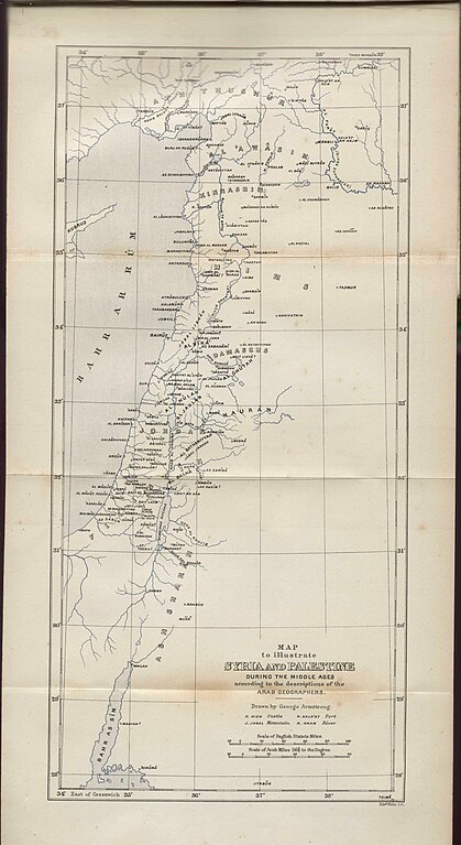
[edit]| Guy Le Strange: Map to illustrate Syria and Palestine during the middle ages according to the descriptions of the Arab Geographers
( |
||||||||||||||||||||||||
|---|---|---|---|---|---|---|---|---|---|---|---|---|---|---|---|---|---|---|---|---|---|---|---|---|
| Artist |
|
|||||||||||||||||||||||
| Title |
Map to illustrate Syria and Palestine during the middle ages according to the descriptions of the Arab Geographers |
|||||||||||||||||||||||
| Publisher |
Committe of the Palestine Exploration Fund |
|||||||||||||||||||||||
| Description |
Map to illustrate Syria and Palestine during the middle ages according to the descriptions of the Arab Geographers. Drawn by George Armstrong, Edwd Weller lith. |
|||||||||||||||||||||||
| Language | English | |||||||||||||||||||||||
| Publication date | 1890 | |||||||||||||||||||||||
| Medium | 1 online resource (1 map). | |||||||||||||||||||||||
| Collection |
|
|||||||||||||||||||||||
| Current location |
|
|||||||||||||||||||||||
| Place of publication | London | |||||||||||||||||||||||
| search Merhav catalog | London | |||||||||||||||||||||||
| Notes | Digital image of the original in Amir Cahanovitc Collection, Israel. ACC 1425-1; Digital image received from donor.; From: Palestine under the moslems: A description of Syria and the Holy Land from A.D. 650 to 1500. Translated from the works of the medieval arab geographers by Guy Le Strange. | |||||||||||||||||||||||
| IE PID | IE45584559 | |||||||||||||||||||||||
| Rosetta filename | FL45584567 | |||||||||||||||||||||||
| NNL item ID (P3959) | 990039269640205171 | |||||||||||||||||||||||
| search Merhav catalog | English, Guy Le Strange | |||||||||||||||||||||||
| search Merhav catalog | Committe of the Palestine Exploration Fund | |||||||||||||||||||||||
| Source/Photographer |
|
|||||||||||||||||||||||
| Other versions | ||||||||||||||||||||||||
| Jpg / Tif version |
|
|||||||||||||||||||||||

.jpg)

.jpg&action=edit§ion=1)
Licensing
[edit].jpg&action=edit§ion=2)
The copyright situation of this work is theoretically uncertain, because in the country of origin copyright lasts 70 years after the death of the author, and the date of the author's death is unknown. However, the date of creation of the work was over 120 years ago, and it is thus a reasonable assumption that the copyright has expired (see here for the community discussion). Do not use this template if the date of death of the author is known.
| |
| This file has been identified as being free of known restrictions under copyright law, including all related and neighboring rights. | |
File history
Click on a date/time to view the file as it appeared at that time.
| Date/Time | Thumbnail | Dimensions | User | Comment | |
|---|---|---|---|---|---|
| current | 19:56, 5 September 2023 | | 2,422 × 4,435 (3.07 MB) | Geagea (talk | contribs) | pattypan 22.03 |
You cannot overwrite this file.
File usage on Commons
The following page uses this file:
.jpg&oldid=798735937)