File:Gullhögarna - KMB - 16001000029606.jpg
Jump to navigation
Jump to search
Size of this preview: 800 × 528 pixels. Other resolutions: 320 × 211 pixels | 640 × 422 pixels | 814 × 537 pixels.
Original file (814 × 537 pixels, file size: 116 KB, MIME type: image/jpeg)
Captions
Captions
Add a one-line explanation of what this file represents
| Gullhögarna
( |
|||||||||||||||||||||||||||
|---|---|---|---|---|---|---|---|---|---|---|---|---|---|---|---|---|---|---|---|---|---|---|---|---|---|---|---|
| Photographer |
|
||||||||||||||||||||||||||
| Title |
Gullhögarna |
||||||||||||||||||||||||||
| Original caption |
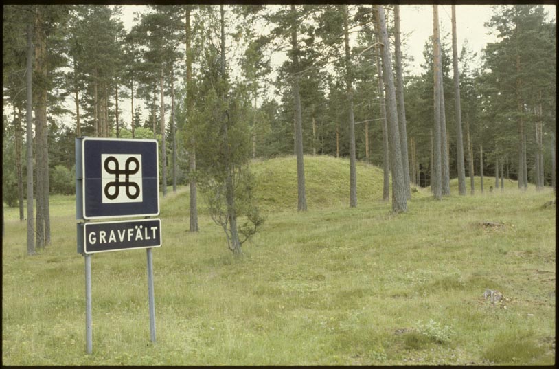
Notera Av dokumentationsskäl har originalbeskrivningen från Riksantikvarieämbetet behållits. Tillrättalägganden och alternativa beskrivningar bör införas separat från nedanstående information. Gravfält, 150x80 m (NÖ-SV), bestående av 16 fornlämningar. Dessa utgörs av högar. Högarna är 7-24 m diam och 0,7-4 m h. Den största högen, belägen längst åt NÖ, är 24 m diam och ca 4 m h.Felaktigheter kan även anmälas till denna sida. Motiv: Dädesjö 401:1 |
||||||||||||||||||||||||||
| Description |
Gravfält, 150x80 m (NÖ-SV), bestående av 16 fornlämningar. Dessa utgörs av högar. Högarna är 7-24 m diam och 0,7-4 m h. Den största högen, belägen längst åt NÖ, är 24 m diam och ca 4 m h. Dädesjö 401:1.
|
||||||||||||||||||||||||||
| Depicted place | Sweden, Växjö Municipality, Dädesjö parish | ||||||||||||||||||||||||||
| Date | between 1 January 1976 and 31 December 1992 | ||||||||||||||||||||||||||
| Collection |
|
||||||||||||||||||||||||||
| Accession number | |||||||||||||||||||||||||||
| Source |
John-Eric Gustafsson / Kulturmiljöbild, Riksantikvarieämbetet
|
||||||||||||||||||||||||||
| Permission (Reusing this file) |
This file is licensed under the Creative Commons Attribution 2.5 Generic license. Attribution: John-Eric Gustafsson / Riksantikvarieämbetet
|
||||||||||||||||||||||||||


| Object location | | View this and other nearby images on: OpenStreetMap |
|---|
File history
Click on a date/time to view the file as it appeared at that time.
| Date/Time | Thumbnail | Dimensions | User | Comment | |
|---|---|---|---|---|---|
| current | 15:24, 11 July 2017 | | 814 × 537 (116 KB) | AndreCostaWMSE-bot (talk | contribs) | {{Kulturmiljöbild-image | short title = Gullhögarna | original description = Gravfält, 150x80 m (NÖ-SV), bestående av 16 fornlämningar. Dessa utgörs av högar. Högarna är 7-24 m diam och 0,7-4 m h. Den största högen, belägen längst åt NÖ... |
You cannot overwrite this file.
File usage on Commons
The following 2 pages use this file:
File usage on other wikis
The following other wikis use this file:
- Usage on sv.wikipedia.org