File:Grodno region location map.svg
Jump to navigation
Jump to search

Size of this PNG preview of this SVG file: 502 × 600 pixels. Other resolutions: 201 × 240 pixels | 402 × 480 pixels | 642 × 768 pixels | 857 × 1,024 pixels | 1,713 × 2,048 pixels.
Original file (SVG file, nominally 502 × 600 pixels, file size: 130 KB)
Captions
Captions
Add a one-line explanation of what this file represents
Summary
[edit]
| Description |
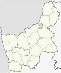
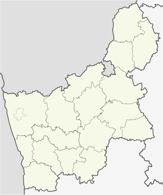
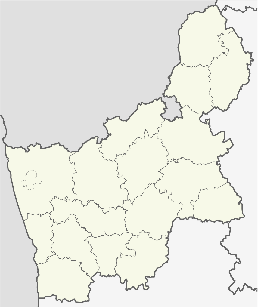
English: Location map of Grodno region
Equirectangular projection. Geographic limits of the map:
|
| Date | |
| Source | Own work, based on OpenStreetMap |
| Author |
V4711 This W3C-unspecified vector image was created with Adobe Illustrator. |
Licensing
[edit]
I, the copyright holder of this work, hereby publish it under the following licenses:

|
Permission is granted to copy, distribute and/or modify this document under the terms of the GNU Free Documentation License, Version 1.2 or any later version published by the Free Software Foundation; with no Invariant Sections, no Front-Cover Texts, and no Back-Cover Texts. A copy of the license is included in the section entitled GNU Free Documentation License. |
This file is licensed under the Creative Commons Attribution-Share Alike Attribution-Share Alike 4.0 International, 3.0 Unported, 2.5 Generic, 2.0 Generic and 1.0 Generic license.
- You are free:
- to share – to copy, distribute and transmit the work
- to remix – to adapt the work
- Under the following conditions:
- attribution – You must give appropriate credit, provide a link to the license, and indicate if changes were made. You may do so in any reasonable manner, but not in any way that suggests the licensor endorses you or your use.
- share alike – If you remix, transform, or build upon the material, you must distribute your contributions under the same or compatible license as the original.
You may select the license of your choice.
File history
Click on a date/time to view the file as it appeared at that time.
| Date/Time | Thumbnail | Dimensions | User | Comment | |
|---|---|---|---|---|---|
| current | 21:23, 1 October 2015 | | 502 × 600 (130 KB) | ערן (talk | contribs) | removing borders from other countries |
| 03:54, 9 October 2014 |  | 502 × 600 (176 KB) | V4711 (talk | contribs) | minor correx | |
| 03:49, 9 October 2014 |  | 502 × 600 (176 KB) | V4711 (talk | contribs) | Minor correx | |
| 01:25, 9 October 2014 |  | 470 × 560 (145 KB) | V4711 (talk | contribs) | Minor cx | |
| 17:38, 8 October 2014 |  | 376 × 449 (145 KB) | V4711 (talk | contribs) | New svg | |
| 10:38, 7 March 2011 |  | 468 × 559 (3.82 MB) | Чаховіч Уладзіслаў (talk | contribs) | {{Information |Description ={{en|1={{en|1=Location map of Grodno region}} Equirectangular projection. Geographic limits of the map: * N: 55.03° N * S: 52.71° N * W: 26.75° E * E: 54.28° E}}}} |Source ={{own}} |
You cannot overwrite this file.
File usage on Commons
The following 16 pages use this file:
- Category:Births in Grodno Region
- Category:Births in Hrodna
- Category:Catholic churches in Hrodna Region
- Category:Education in Hrodna
- Category:Geography of Grodno Region
- Category:Grodno Region
- Category:Hrodna
- Category:Maps of Grodno Region
- Category:Maps of Hrodna
- Category:Orthodox churches in Hrodna Region
- Category:People of Hrodna
- Category:Populated places in Hrodna Region
- Category:Rivers of Hrodna Region
- Category:Sports in Hrodna
- Category:Theaters in Hrodna
- Category:Views of Hrodna
File usage on other wikis
The following other wikis use this file:
- Usage on ar.wikipedia.org
- Usage on ast.wikipedia.org
- Usage on az.wikipedia.org
- Usage on ba.wikipedia.org
- Usage on be-tarask.wikipedia.org
- Ашмяны
- Наваградак
- Слонім
- Ліда
- Шчучын
- Іўе
- Горадня
- Астравец
- Гальшаны
- Смаргонь
- Альхоўка (Астравецкі раён)
- Бабарыха
- Глінішча (Міхалішкаўскі сельсавет)
- Відзюны
- Вялікае Туроўе
- Бжэгі
- Барынова
- Баравыя (Астравецкі раён)
- Бабічы (Міхалішкаўскі сельсавет)
- Дваржышча
- Дубнікі (Міхалішкаўскі сельсавет)
- Жукойні
- Залуцкоўшчына
- Заборцы (Астравецкі раён)
- Забелішкі (вёска)
- Радзюшы-Тушча
- Радзюшы
- Малое Туроўе
- Лазавыя (Міхалішкаўскі сельсавет)
- Купшчына
- Крываносы (Гарадзенская вобласьць)
- Каценавічы
- Кайміна Дольная
- Супраненты
- Хацілкі
- Тумкі
- Завідзіненты
- Недрашля
- Лягаўцы
- Ласі (Гарадзенская вобласьць)
- Міхалішкі
- Лукавыя
- Маркуны
- Мельніца Сарочча
- Мілайшуны (Міхалішкаўскі сельсавет)
View more global usage of this file.