File:Greifswald Panorama Dom Nordosten.jpg
Jump to navigation
Jump to search

Size of this preview: 799 × 175 pixels. Other resolutions: 320 × 70 pixels | 640 × 140 pixels | 1,024 × 225 pixels | 1,280 × 281 pixels | 7,830 × 1,717 pixels.
Original file (7,830 × 1,717 pixels, file size: 4.67 MB, MIME type: image/jpeg)
Captions
Captions
Add a one-line explanation of what this file represents
Summary[edit]
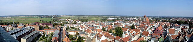
| Description | Greifswald vom Dom Richtung Nordosten | ||
| Date | |||
| Source | Own work | ||
| Author | Schiwago | ||
| Permission (Reusing this file) |
I, the copyright holder of this work, hereby publish it under the following licenses:
This file is licensed under the Creative Commons Attribution 3.0 Unported license.
You may select the license of your choice. |

| Camera location | | View this and other nearby images on: OpenStreetMap |
|---|
File history
Click on a date/time to view the file as it appeared at that time.
| Date/Time | Thumbnail | Dimensions | User | Comment | |
|---|---|---|---|---|---|
| current | 09:43, 25 September 2010 | 7,830 × 1,717 (4.67 MB) | Schiwago (talk | contribs) | == Summary == {{Information |Description=Greifswald vom Dom Richtung Nordosten |Source={{own}} |Date=2010-09-24 |Author=Schiwago |Permission={{self|GFDL|cc-by-3.0}} |other_versions= }} Greifswald |
You cannot overwrite this file.
File usage on Commons
The following page uses this file:
File usage on other wikis
The following other wikis use this file:
- Usage on azb.wikipedia.org