File:Greenland Sea Ice at an all-time record low (Copernicus).jpg
Original file (4,027 × 2,567 pixels, file size: 5.46 MB, MIME type: image/jpeg)
Captions
Captions
Summary[edit]
.jpg&action=edit§ion=1)
| Description |
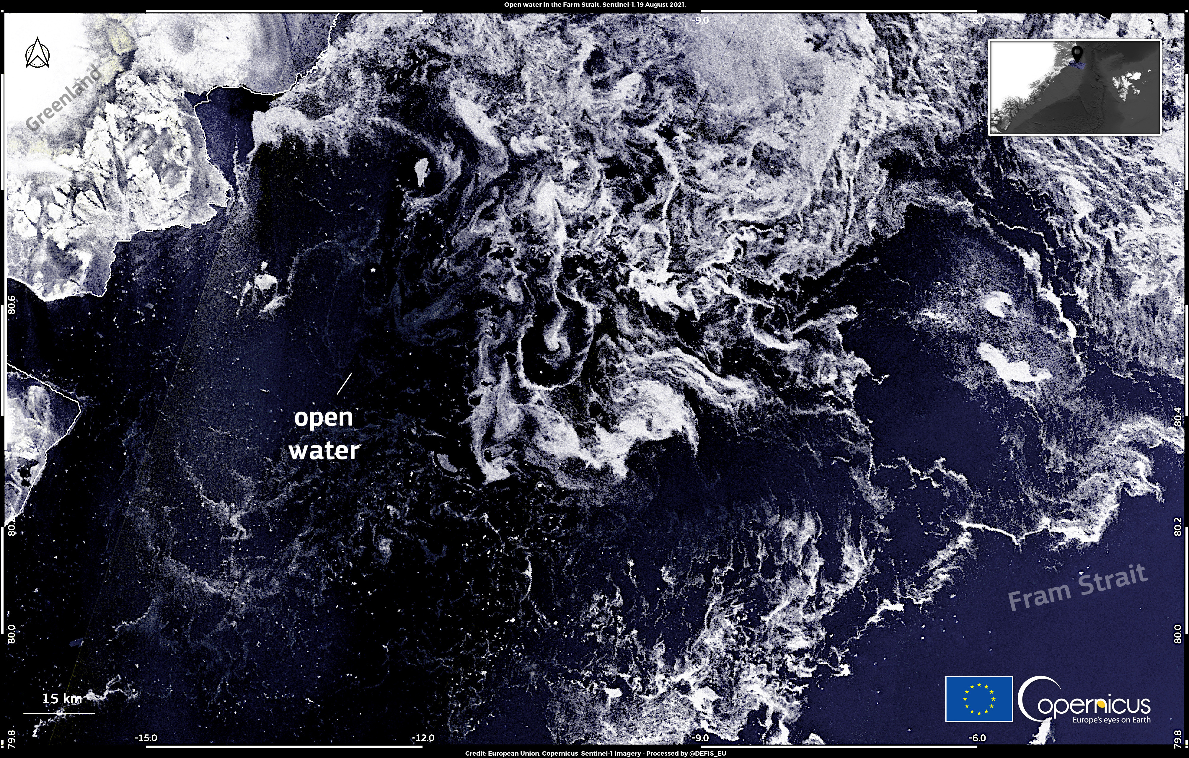
English: Arctic sea ice usually reaches its lowest extent of the year in September. In 2021, according to data published by the US National Snow and Ice Data Center, the extent of Arctic sea ice will be one of the highest in the last decade; however, the distribution of ice is not uniform across the Arctic. Sea ice in the Greenland Sea is currently, in fact, at an all-time record low. This image, acquired by the radar onboard one of the Copernicus Sentinel-1 satellites on 19 September, provides evidence of an absence of sea ice, and therefore open waters, in the Fram Strait, the northernmost part of the Greenland Sea. Open data provided by Copernicus products and services allow for the development of authoritative assessments of the state of sea ice coverage in polar regions. |
| Date | Taken on 19 September 2021 |
| Source | Greenland Sea Ice at an all-time record low |
| Author | European Union, Copernicus Sentinel-1 imagery |
Licensing[edit]
.jpg&action=edit§ion=2)

|
This image contains data from a satellite in the Copernicus Programme, such as Sentinel-1, Sentinel-2 or Sentinel-3. Attribution is required when using this image.
Attribution: Contains modified Copernicus Sentinel data 2021
The use of Copernicus Sentinel Data is regulated under EU law (Commission Delegated Regulation (EU) No 1159/2013 and Regulation (EU) No 377/2014). Relevant excerpts:
Free access shall be given to GMES dedicated data [...] made available through GMES dissemination platforms [...].
Access to GMES dedicated data [...] shall be given for the purpose of the following use in so far as it is lawful:
GMES dedicated data [...] may be used worldwide without limitations in time.
GMES dedicated data and GMES service information are provided to users without any express or implied warranty, including as regards quality and suitability for any purpose. |
File history
Click on a date/time to view the file as it appeared at that time.
| Date/Time | Thumbnail | Dimensions | User | Comment | |
|---|---|---|---|---|---|
| current | 15:30, 9 September 2023 | | 4,027 × 2,567 (5.46 MB) | OptimusPrimeBot (talk | contribs) | #Spacemedia - Upload of https://www.copernicus.eu/system/files/2021-09/image_day/20210922_SeaIceGreenland%20%28002%29.jpg via Commons:Spacemedia |
You cannot overwrite this file.
File usage on Commons
There are no pages that use this file.
.jpg&oldid=800037190)