File:Greenland.A2004208.1810.250m.jpg
Jump to navigation
Jump to search

Size of this preview: 800 × 600 pixels. Other resolutions: 320 × 240 pixels | 640 × 480 pixels | 1,024 × 768 pixels | 1,280 × 960 pixels | 2,560 × 1,920 pixels | 3,200 × 2,400 pixels.
Original file (3,200 × 2,400 pixels, file size: 1.11 MB, MIME type: image/jpeg)
Captions
Captions
Add a one-line explanation of what this file represents
Summary[edit]
| Description |
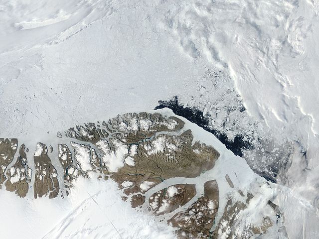
English: Northern Greenland (Peary Land): Moderate Resolution Imaging Spectroradiometer (MODIS) on NASA’s Terra satellite |
| Date | |
| Source | http://visibleearth.nasa.gov/view.php?id=71935 |
| Author | NASA |
Licensing[edit]
| This file is in the public domain in the United States because it was solely created by NASA. NASA copyright policy states that "NASA material is not protected by copyright unless noted". (See Template:PD-USGov, NASA copyright policy page or JPL Image Use Policy.) | ||
 |
Warnings:
|
| Annotations | This image is annotated: View the annotations at Commons |
File history
Click on a date/time to view the file as it appeared at that time.
| Date/Time | Thumbnail | Dimensions | User | Comment | |
|---|---|---|---|---|---|
| current | 06:06, 18 July 2012 | | 3,200 × 2,400 (1.11 MB) | Ratzer (talk | contribs) | {{Information |Description ={{en|1=Northern Greenland (Peary Land): Moderate Resolution Imaging Spectroradiometer (MODIS) on NASA’s Terra satellite}} |Source =http://visibleearth.nasa.gov/view.php?id=71935 |Author =NASA |Date ... |
You cannot overwrite this file.
File usage on Commons
The following 2 pages use this file:
File usage on other wikis
The following other wikis use this file:
- Usage on be.wikipedia.org
- Usage on ca.wikipedia.org
- Usage on ceb.wikipedia.org
- Usage on cs.wikipedia.org
- Usage on da.wikipedia.org
- Usage on de.wikipedia.org
- Usage on en.wikipedia.org
- Peary Land
- Independence I culture
- Sverdrup Island (Greenland)
- East Jensen Island
- Hazenland
- John Murray Island
- Princess Dagmar Island
- Princess Thyra Island
- Borup Island
- Stephenson Island (Greenland)
- Princess Margaret Island
- De Long Fjord
- Beaumont Island (Greenland)
- Roosevelt Range
- Johannes V. Jensen Land
- Nansen Land
- Stjernebannertinde
- Roosevelt Land
- Amundsen Land
- Melville Land
View more global usage of this file.