File:Gran.Temuco Satelital.png
Jump to navigation
Jump to search

Size of this preview: 800 × 506 pixels. Other resolutions: 320 × 203 pixels | 640 × 405 pixels | 970 × 614 pixels.
Original file (970 × 614 pixels, file size: 1.4 MB, MIME type: image/png)
Captions
Captions
Add a one-line explanation of what this file represents
Summary[edit]
| Description |
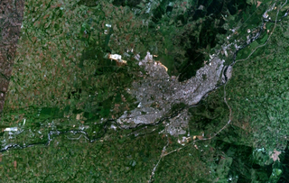
Español: Imagen satelital de la conurbación del Gran Temuco (Temuco y Padre Las Casas), la ciudad de Labranza y la localidad de Cajón, en la región de La Araucanía, Chile. |
| Date | |
| Source | Imagen satelital de la NASA |
| Author | NASA |
Licensing[edit]
| This file is in the public domain in the United States because it was solely created by NASA. NASA copyright policy states that "NASA material is not protected by copyright unless noted". (See Template:PD-USGov, NASA copyright policy page or JPL Image Use Policy.) | ||
 |
Warnings:
|
File history
Click on a date/time to view the file as it appeared at that time.
| Date/Time | Thumbnail | Dimensions | User | Comment | |
|---|---|---|---|---|---|
| current | 22:43, 4 September 2011 | | 970 × 614 (1.4 MB) | Cavero.H (talk | contribs) |
You cannot overwrite this file.
File usage on Commons
There are no pages that use this file.
File usage on other wikis
The following other wikis use this file:
- Usage on es.wikipedia.org