File:Gorch-Fock-Wall 15-17 (Hamburg-Neustadt).Fisheye.ajb.jpg
Jump to navigation
Jump to search

Size of this preview: 800 × 402 pixels. Other resolutions: 320 × 161 pixels | 640 × 322 pixels | 1,024 × 515 pixels | 1,280 × 643 pixels | 2,997 × 1,506 pixels.
Original file (2,997 × 1,506 pixels, file size: 5.28 MB, MIME type: image/jpeg)
Captions
Captions
Add a one-line explanation of what this file represents
Summary[edit]
.Fisheye.ajb.jpg&action=edit§ion=1)
| Description |
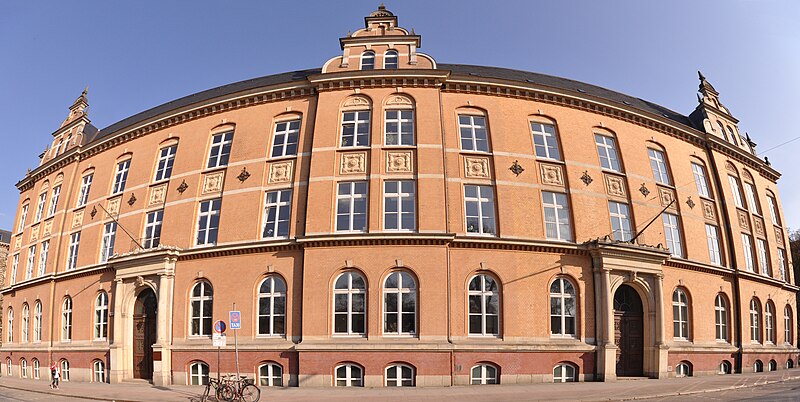
Deutsch: Gorch-Fock-Wall 15-17:Ehemalige (Behörde für das Versicherungswesen)? in Hamburg-Neustadt. Heute Sitz der Generalstaatsanwaltschaft und der Staatsanwaltschaft Hamburg.
https://www.hamburg.de/contentblob/9495654/c3d451f868ff4b18b2d34674fd3d810c/data/hu-jubilaeumsbericht-2017.pdfVon 1946 bis 1986 : Durch die Choleraepidemie des Jahres 1892 Gründung des „Hygienisches Institut“ 1982. Im Juli 1944 wurde das Hauptinstitut in der Jungiusstraße durch Bombenangriffe sehr beschädigt.Die Arbeit musste eingestellt werden. Aufgrund der starken Beschädigung Umzug 1946 in das Gebäude am Gorch-Fock-Wall 15-17. Im Februar 1986 Umzug des Instituts in die Marckmannstraße im Stadtteil Rothenburgsort.1997 umbenannt in „Hygiene Institut“ und 2003 den heutigen Namen „Institut für Hygiene und Umwelt“. |
| Date | |
| Source | Own work |
| Author | Ajepbah |
| Camera location | | View this and other nearby images on: OpenStreetMap |
|---|
.Fisheye.ajb.jpg¶ms=053.556996_N_0009.981894_E_globe:Earth_type:camera_region:DE-HH_dim:250_heading:135.00&language=en)
Licensing[edit]
.Fisheye.ajb.jpg&action=edit§ion=2)
I, the copyright holder of this work, hereby publish it under the following license:
This file is licensed under the Creative Commons Attribution-Share Alike 3.0 Unported license.
- You are free:
- to share – to copy, distribute and transmit the work
- to remix – to adapt the work
- Under the following conditions:
- attribution – You must give appropriate credit, provide a link to the license, and indicate if changes were made. You may do so in any reasonable manner, but not in any way that suggests the licensor endorses you or your use.
- share alike – If you remix, transform, or build upon the material, you must distribute your contributions under the same or compatible license as the original.
File history
Click on a date/time to view the file as it appeared at that time.
| Date/Time | Thumbnail | Dimensions | User | Comment | |
|---|---|---|---|---|---|
| current | 21:07, 24 April 2013 | | 2,997 × 1,506 (5.28 MB) | Ajepbah (talk | contribs) |
You cannot overwrite this file.
File usage on Commons
The following page uses this file:
File usage on other wikis
The following other wikis use this file:
- Usage on de.wikipedia.org
.Fisheye.ajb.jpg&oldid=529759048)