File:Georgia Blank Map (de facto borders).png
Jump to navigation
Jump to search

Size of this preview: 800 × 403 pixels. Other resolutions: 320 × 161 pixels | 640 × 322 pixels | 1,024 × 516 pixels | 1,280 × 645 pixels | 2,560 × 1,289 pixels | 4,096 × 2,063 pixels.
Original file (4,096 × 2,063 pixels, file size: 590 KB, MIME type: image/png)
Captions
Captions
Add a one-line explanation of what this file represents
Summary[edit]
.png&action=edit§ion=1)
| Description |
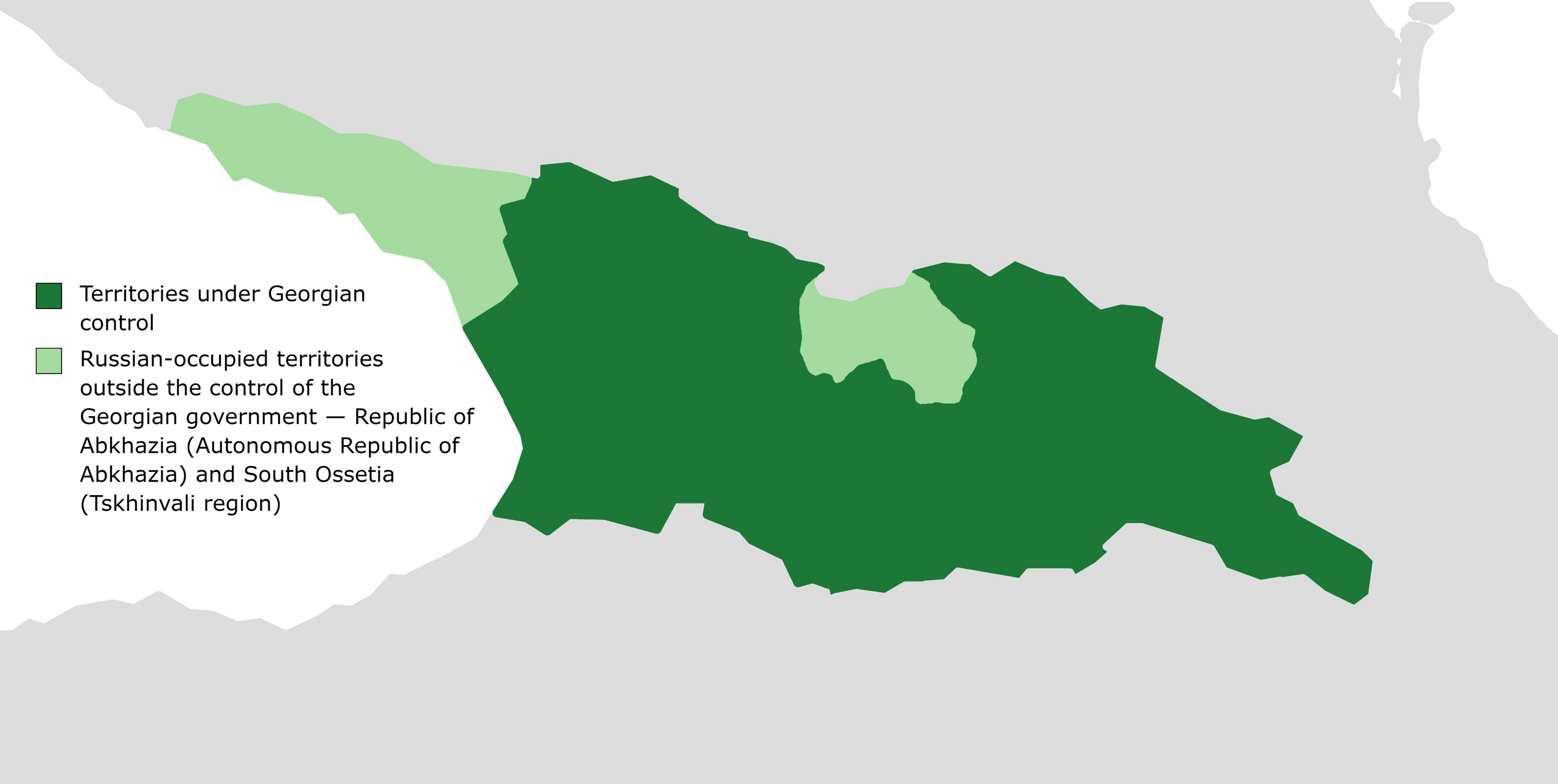
English: Blank map of Georgia. Internationally recognized territories of Georgia that are currently outside the control of the Georgian government are highlighted in light green (in fact, these territories are under the control of the pro-Russian proxy states of Abkhazia and South Ossetia). |
| Date | |
| Source | Own work |
| Author | Iktsokh |
Licensing[edit]
.png&action=edit§ion=2)
I, the copyright holder of this work, hereby publish it under the following license:
| This file is made available under the Creative Commons CC0 1.0 Universal Public Domain Dedication. | |
| The person who associated a work with this deed has dedicated the work to the public domain by waiving all of their rights to the work worldwide under copyright law, including all related and neighboring rights, to the extent allowed by law. You can copy, modify, distribute and perform the work, even for commercial purposes, all without asking permission.
|
File history
Click on a date/time to view the file as it appeared at that time.
| Date/Time | Thumbnail | Dimensions | User | Comment | |
|---|---|---|---|---|---|
| current | 20:20, 7 January 2024 | | 4,096 × 2,063 (590 KB) | Iktsokh (talk | contribs) | Uploaded own work with UploadWizard |
You cannot overwrite this file.
File usage on Commons
There are no pages that use this file.
.png&oldid=839368501)