File:Garni Temple - panoramique.JPG
Original file (7,191 × 2,409 pixels, file size: 4.94 MB, MIME type: image/jpeg)
Captions
Summary[edit]
DescriptionGarni Temple - panoramique.JPG |
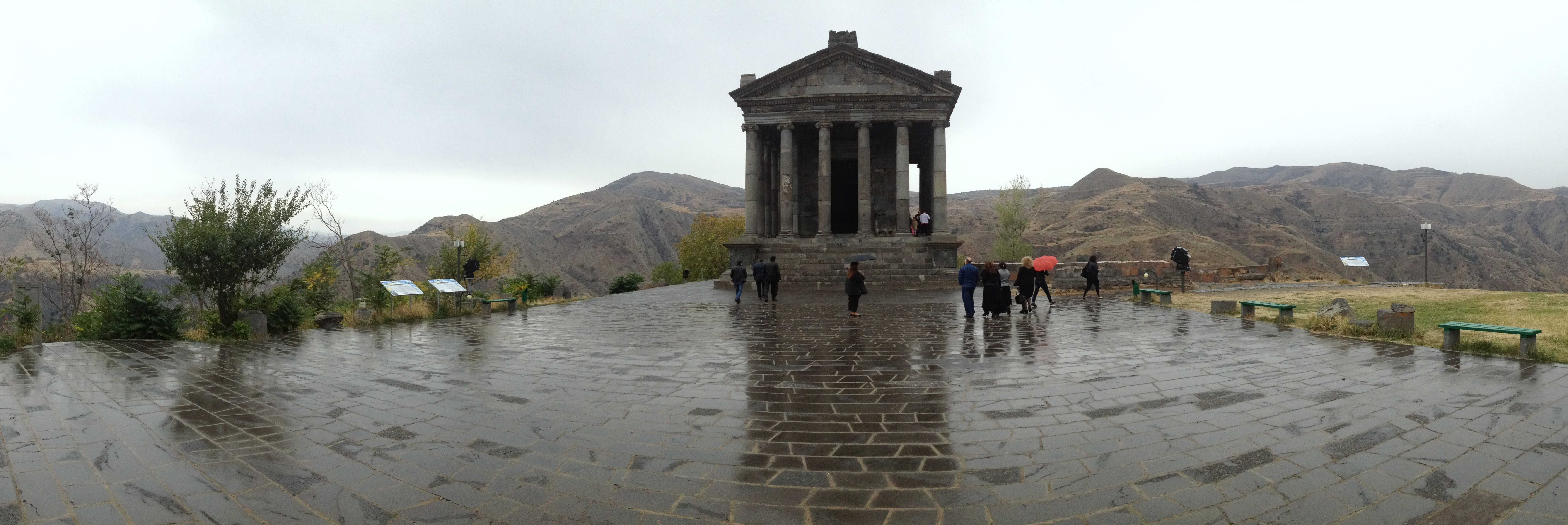
Français : Temple païen de Garni, Arménie. |
|||||||||||||||||
Date | ||||||||||||||||||
Source | Own work | |||||||||||||||||
Author |
creator QS:P170,Q42790984 |
|||||||||||||||||
Permission (Reusing this file) |
|
Camera location | 40° 06′ 45.97″ N, 44° 43′ 48.15″ E | View this and other nearby images on: OpenStreetMap | 40.112769; 44.730042 |
---|
File history
Click on a date/time to view the file as it appeared at that time.
Date/Time | Thumbnail | Dimensions | User | Comment | |
---|---|---|---|---|---|
current | 20:42, 7 October 2013 | 7,191 × 2,409 (4.94 MB) | Benoît Prieur (talk | contribs) |
You cannot overwrite this file.
File usage on Commons
There are no pages that use this file.
File usage on other wikis
The following other wikis use this file:
- Usage on pt.wikipedia.org
Metadata
This file contains additional information such as Exif metadata which may have been added by the digital camera, scanner, or software program used to create or digitize it. If the file has been modified from its original state, some details such as the timestamp may not fully reflect those of the original file. The timestamp is only as accurate as the clock in the camera, and it may be completely wrong.
Camera manufacturer | Apple |
---|---|
Camera model | iPhone 4S |
Author | Picasa |
Exposure time | 1/905 sec (0.0011049723756906) |
F-number | f/2.4 |
ISO speed rating | 200 |
Date and time of data generation | 16:13, 6 October 2013 |
Lens focal length | 4.28 mm |
Latitude | 40° 6′ 45.97″ N |
Longitude | 44° 43′ 48.15″ E |
Altitude | 1,404 meters above sea level |
Horizontal resolution | 72 dpi |
Vertical resolution | 72 dpi |
Software used | 7.0.2 |
File change date and time | 21:06, 7 October 2013 |
Y and C positioning | Centered |
Exposure Program | Normal program |
Exif version | 2.21 |
Date and time of digitizing | 16:13, 6 October 2013 |
Meaning of each component |
|
APEX shutter speed | 9.8217378321887 |
APEX aperture | 2.5260688216893 |
APEX brightness | 7.2496423462089 |
Metering mode | Pattern |
Flash | Flash did not fire |
DateTimeOriginal subseconds | 137 |
DateTimeDigitized subseconds | 137 |
Supported Flashpix version | 1 |
Color space | sRGB |
Sensing method | One-chip color area sensor |
Scene type | A directly photographed image |
Custom image processing | Panorama |
Exposure mode | Auto exposure |
White balance | Auto white balance |
Focal length in 35 mm film | 35 mm |
Scene capture type | Standard |
Unique image ID | ddedba3f958c2655a9cac68c07925ed0 |
GPS time (atomic clock) | 12:13:7.38 |
Reference for direction of image | True direction |
Direction of image | 274.61616161616 |
GPS tag version | 2.2.0.0 |
IIM version | 4 |
Structured data
Items portrayed in this file
depicts
6 October 2013
40°6'45.96998"N, 44°43'48.15001"E
image/jpeg
fd27e65c68287826e20e385940d307a9c2b11f34
5,180,453 byte
2,409 pixel
7,191 pixel
- CC-Zero
- Files with coordinates missing SDC location of creation
- Photographs by Benoît Prieur
- Images of Garni by Benoît Prieur
- Armenia photographs taken on 2013-10-06
- Images of WikiConference Yerevan 2013 by Benoît Prieur
- Pictures taken during the WikiConference Yerevan 2013
- Panoramics by Benoît Prieur
- 2013 images by Benoît Prieur
- Pages with maps