File:Gangshan Air Force Base Lin Yun Building 20111015a.jpg
From Wikimedia Commons, the free media repository
Jump to navigation
Jump to search
Size of this preview: 800 × 441 pixels. Other resolutions: 320 × 176 pixels | 640 × 353 pixels | 1,024 × 564 pixels | 1,280 × 706 pixels | 2,560 × 1,411 pixels | 4,568 × 2,518 pixels.
Original file (4,568 × 2,518 pixels, file size: 3.92 MB, MIME type: image/jpeg)
File information
Structured data
Captions
Summary[edit]
DescriptionGangshan Air Force Base Lin Yun Building 20111015a.jpg |
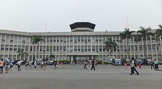
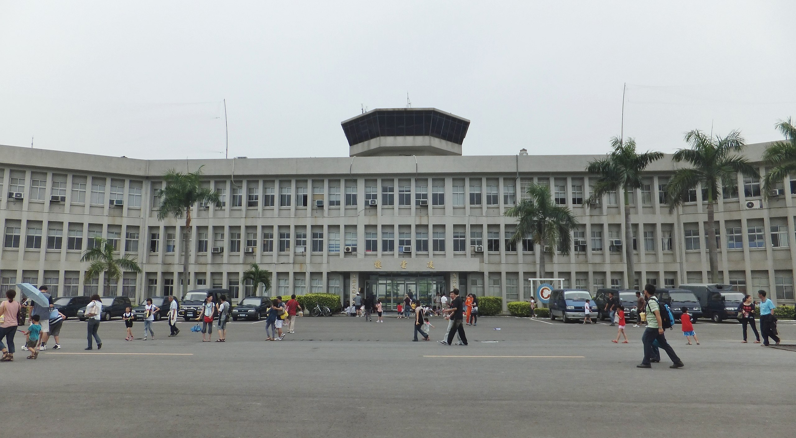
中文(臺灣):空軍岡山基地凌雲樓正面,攝於2011年營區開放活動日。 |
Date | |
Source | Own work |
Author | 玄史生 |
Camera location | 22° 47′ 11.36″ N, 120° 16′ 03.98″ E | View this and other nearby images on: OpenStreetMap | 22.786490; 120.267773 |
---|
Licensing[edit]
I, the copyright holder of this work, hereby publish it under the following license:
This file is made available under the Creative Commons CC0 1.0 Universal Public Domain Dedication. | |
The person who associated a work with this deed has dedicated the work to the public domain by waiving all of their rights to the work worldwide under copyright law, including all related and neighboring rights, to the extent allowed by law. You can copy, modify, distribute and perform the work, even for commercial purposes, all without asking permission.
http://creativecommons.org/publicdomain/zero/1.0/deed.enCC0Creative Commons Zero, Public Domain Dedicationfalsefalse |
File history
Click on a date/time to view the file as it appeared at that time.
Date/Time | Thumbnail | Dimensions | User | Comment | |
---|---|---|---|---|---|
current | 17:54, 23 December 2012 | 4,568 × 2,518 (3.92 MB) | 玄史生 (talk | contribs) | {{Information |Description ={{zh-tw|1=空軍岡山基地凌雲樓正面,攝於2011年營區開放活動日。}} |Source ={{Own}} |Author =玄史生 |Date =2011-10-15 |Permission = |other_versions = ... |
You cannot overwrite this file.
File usage on Commons
The following page uses this file:
Metadata
This file contains additional information such as Exif metadata which may have been added by the digital camera, scanner, or software program used to create or digitize it. If the file has been modified from its original state, some details such as the timestamp may not fully reflect those of the original file. The timestamp is only as accurate as the clock in the camera, and it may be completely wrong.
Camera manufacturer | FUJIFILM |
---|---|
Camera model | FinePix F550EXR |
Exposure time | 1/320 sec (0.003125) |
F-number | f/7.1 |
ISO speed rating | 100 |
Date and time of data generation | 12:44, 15 October 2011 |
Lens focal length | 4.4 mm |
Latitude | 22° 47′ 11.36″ N |
Longitude | 120° 16′ 3.98″ E |
Altitude | 25.3 meters above sea level |
Orientation | Normal |
Horizontal resolution | 72 dpi |
Vertical resolution | 72 dpi |
Software used | Digital Camera FinePix F550EXR Ver1.13 |
File change date and time | 01:46, 24 December 2012 |
Y and C positioning | Co-sited |
Exposure Program | Normal program |
Exif version | 2.3 |
Date and time of digitizing | 12:44, 15 October 2011 |
Meaning of each component |
|
Image compression mode | 3.2 |
APEX shutter speed | 8.3 |
APEX aperture | 5.7 |
APEX brightness | 8.69 |
APEX exposure bias | 0 |
Maximum land aperture | 3.6 APEX (f/3.48) |
Metering mode | Pattern |
Light source | Shade |
Flash | Flash did not fire, auto mode |
Supported Flashpix version | 1 |
Color space | sRGB |
Focal plane X resolution | 7,166 |
Focal plane Y resolution | 7,166 |
Focal plane resolution unit | 3 |
Sensing method | One-chip color area sensor |
File source | Digital still camera |
Scene type | A directly photographed image |
Custom image processing | Normal process |
Exposure mode | Auto exposure |
White balance | Manual white balance |
Scene capture type | Standard |
Sharpness | Normal |
Subject distance range | Unknown |
Unique image ID | 792529DB522F4710A9BC2FD3A45DA848 |
GPS time (atomic clock) | 04:44 |
Satellites used for measurement | 09 |
Receiver status | Measurement in progress |
Measurement mode | 3-dimensional measurement |
Measurement precision | Poor (2.1) |
Speed unit | Kilometers per hour |
Speed of GPS receiver | 0 |
Geodetic survey data used | WGS-84 |
GPS date | 15 October 2011 |
GPS tag version | 2.3.0.0 |