File:Gallaecia-roman-province.png
Jump to navigation
Jump to search
No higher resolution available.
Gallaecia-roman-province.png (601 × 444 pixels, file size: 210 KB, MIME type: image/png)
Captions
Captions
Add a one-line explanation of what this file represents
Summary
[edit]
| Description |
|
| Date | 22 March 2009 (original upload date) |
| Source | Transferred from gl.wikipedia to Commons. |
| Author | The original uploader was Alexandre Vigo at Galician Wikipedia. |
Licensing
[edit]

|
Permission is granted to copy, distribute and/or modify this document under the terms of the GNU Free Documentation License, Version 1.2 or any later version published by the Free Software Foundation; with no Invariant Sections, no Front-Cover Texts, and no Back-Cover Texts. A copy of the license is included in the section entitled GNU Free Documentation License. |
| This file is licensed under the Creative Commons Attribution-Share Alike 3.0 Unported license. | ||
| ||
| This licensing tag was added to this file as part of the GFDL licensing update. |
Original upload log
[edit]
The original description page was here. All following user names refer to gl.wikipedia.
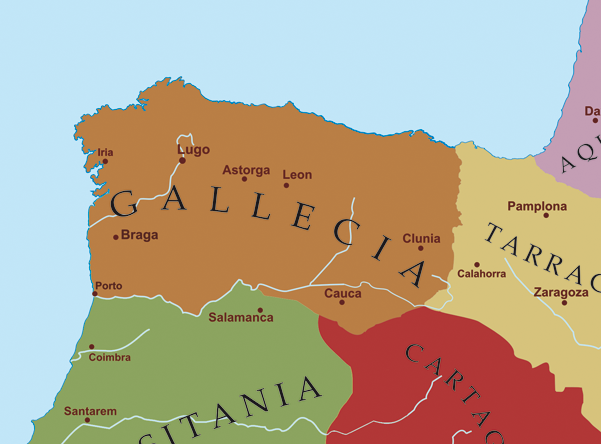
- 2009-03-22 21:26 Alexandre Vigo 601×444× (215204 bytes) Descrición/Description: Mapa das provincias romanas do noroeste da peninsula ibérica, a comezos do século V d.C, previamente á chegada dos pobos xermánicos. Orixe/Source: Traballo propio. Autor/Author: Atoría propia Copyright: Contido GFDL creado po
File history
Click on a date/time to view the file as it appeared at that time.
| Date/Time | Thumbnail | Dimensions | User | Comment | |
|---|---|---|---|---|---|
| current | 22:20, 22 March 2009 | | 601 × 444 (210 KB) | Elvire (talk | contribs) | {{Information |Description=*{{gl|Mapa das provincias romanas do noroeste da peninsula ibérica, a comezos do século V d.C, previamente á chegada dos pobos xermánicos.}} *{{fr|Carte des provinces romaines du nord ouest de la péninsule ibérique au déb |
You cannot overwrite this file.
File usage on Commons
There are no pages that use this file.
File usage on other wikis
The following other wikis use this file:
- Usage on es.wikipedia.org
- Usage on fr.wikipedia.org
- Usage on fy.wikipedia.org
- Usage on gl.wikipedia.org
- Usage on it.wikipedia.org
- Usage on oc.wikipedia.org
- Usage on pt.wiktionary.org