File:Gado.png
Jump to navigation
Jump to search

Size of this preview: 549 × 600 pixels. Other resolutions: 220 × 240 pixels | 629 × 687 pixels.
Original file (629 × 687 pixels, file size: 65 KB, MIME type: image/png)
Captions
Captions
Add a one-line explanation of what this file represents
Summary[edit]
| Description |
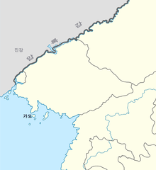
English: Gado(椵島), Pido(皮島)
한국어: 가도 대한민국 벡터지도에서 잘랐음. |
| Date | |
| Source | Own work |
| Author | Asfreeas |
Licensing[edit]
| I, the copyright holder of this work, release this work into the public domain. This applies worldwide. In some countries this may not be legally possible; if so: I grant anyone the right to use this work for any purpose, without any conditions, unless such conditions are required by law. |
File history
Click on a date/time to view the file as it appeared at that time.
| Date/Time | Thumbnail | Dimensions | User | Comment | |
|---|---|---|---|---|---|
| current | 22:34, 21 November 2010 | | 629 × 687 (65 KB) | Asfreeas (talk | contribs) | {{Information |Description={{en|1=Gado(椵島), Pido(皮島)}} {{ko|1=가도}} |Source={{own}} |Author=Asfreeas |Date=2010-11-22 |Permission= |other_versions= }} 대한민국 벡터지도에서 잘랐음. [[Category:Maps of the Ming Dy |
You cannot overwrite this file.
File usage on Commons
There are no pages that use this file.
File usage on other wikis
The following other wikis use this file:
- Usage on ja.wikipedia.org
- Usage on ko.wikipedia.org
- Usage on zh.wikipedia.org