File:GS Karlshamn.svg
Jump to navigation
Jump to search

Size of this PNG preview of this SVG file: 800 × 596 pixels. Other resolutions: 320 × 238 pixels | 640 × 476 pixels | 1,024 × 762 pixels | 1,280 × 953 pixels | 2,560 × 1,906 pixels | 5,930 × 4,415 pixels.
Original file (SVG file, nominally 5,930 × 4,415 pixels, file size: 734 KB)
Captions
Captions
Add a one-line explanation of what this file represents
| Description |
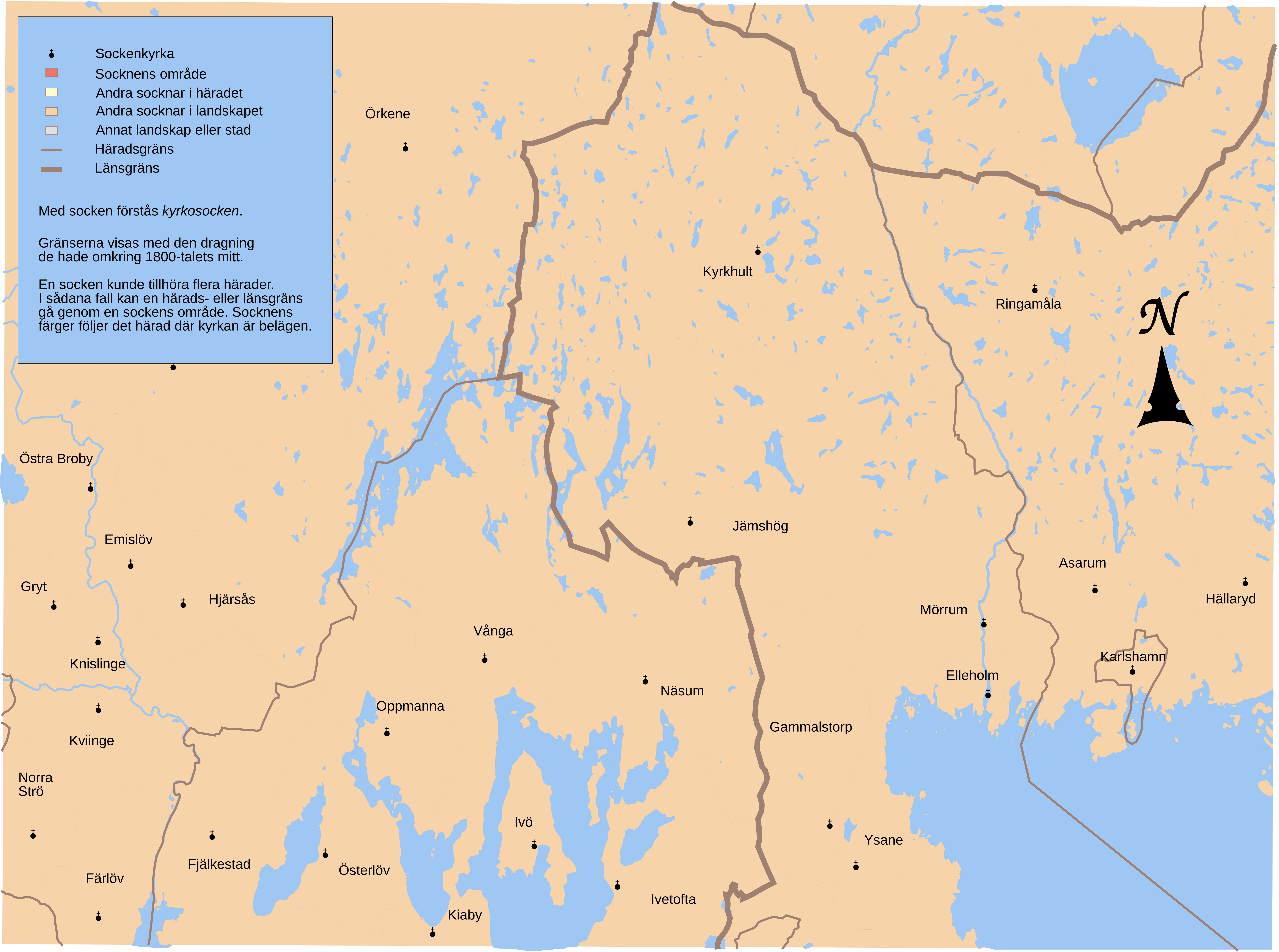
English: Map showing borders of parishes and hundreds in the vicinity of Karlshamn, based on information from map by Topografiska Corpsen.
10. Karlshamn Grav. af Ebbesen. Topografiska Corpsens karta öfver Sverige 1869. (Christianstads och Kronobergs ländelarne uppmätte 1862-63. Blekinge ländelen uppmätt 1843, öfversedd 1866.) |
| Date | (1869) |
| Source | Lantmäteriet |
| Author | Own work and Topografiska Corpsen |
| Permission (Reusing this file) |
This file is licensed under the Creative Commons Attribution 3.0 Unported license. Attribution: Edaen
|
| Other versions |
Derivative works of this file: |
File history
Click on a date/time to view the file as it appeared at that time.
| Date/Time | Thumbnail | Dimensions | User | Comment | |
|---|---|---|---|---|---|
| current | 17:38, 29 September 2010 | | 5,930 × 4,415 (734 KB) | Edaen (talk | contribs) | {{Information |Description={{en|1=Map showing borders of parishes and hundreds in the vicinity of Karlshamn, based on information from map by Topografiska Corpsen. <small>'''10. Karlshamn''' Grav. af Ebbesen. Topografiska Corpsens karta öfver Sverige |
You cannot overwrite this file.
File usage on Commons
There are no pages that use this file.