File:Fuller projection with largest islands.svg
Jump to navigation
Jump to search

Size of this PNG preview of this SVG file: 512 × 288 pixels. Other resolutions: 320 × 180 pixels | 640 × 360 pixels | 1,024 × 576 pixels | 1,280 × 720 pixels | 2,560 × 1,440 pixels.
Original file (SVG file, nominally 512 × 288 pixels, file size: 554 KB)
Captions
Captions
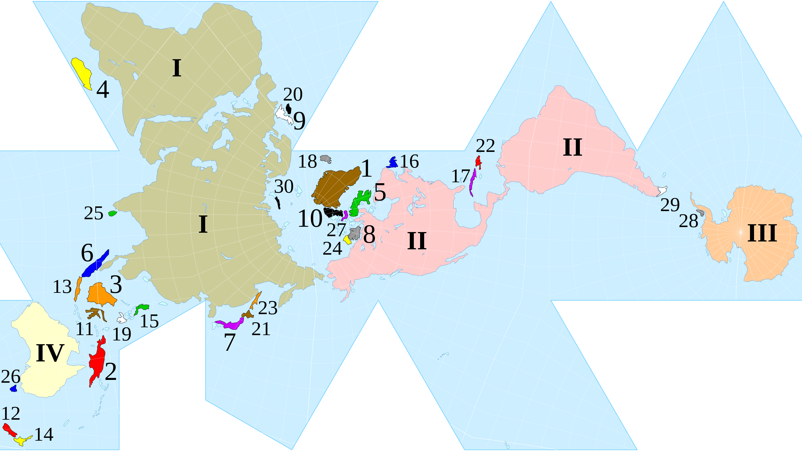
Dymaxion Map of the world with the continental landmasses (Roman numerals) and 30 largest islands (Hindu-Arabic numerals) highlighted.
Summary[edit]
| Description |
English: Dymaxion map of the world with the continental landmasses (Roman numerals) and 30 largest islands (Hindu-Arabic numerals) highlighted. (The list stops at 30 as the next few islands are north of Canada, and space is insufficient for their labels.) |
|||
| Date | ||||
| Source |
|
|||
| Author | cmglee, Justin Kunimune | |||
| Other versions |
|


Licensing[edit]
This file is licensed under the Creative Commons Attribution-Share Alike 4.0 International license.
- You are free:
- to share – to copy, distribute and transmit the work
- to remix – to adapt the work
- Under the following conditions:
- attribution – You must give appropriate credit, provide a link to the license, and indicate if changes were made. You may do so in any reasonable manner, but not in any way that suggests the licensor endorses you or your use.
- share alike – If you remix, transform, or build upon the material, you must distribute your contributions under the same or compatible license as the original.
File history
Click on a date/time to view the file as it appeared at that time.
| Date/Time | Thumbnail | Dimensions | User | Comment | |
|---|---|---|---|---|---|
| current | 00:15, 25 October 2020 | | 512 × 288 (554 KB) | Cmglee (talk | contribs) | Uploaded a work by cmglee, Justin Kunimune from {{source thumb|Dymaxion_with_Tissot's_Indicatrices_of_Distortion.svg}} with UploadWizard |
You cannot overwrite this file.
File usage on Commons
The following 4 pages use this file:
File usage on other wikis
The following other wikis use this file:
- Usage on en.wikipedia.org
- Usage on fa.wikipedia.org
- Usage on hi.wikipedia.org
- Usage on kk.wikipedia.org
- Usage on si.wikipedia.org
- Usage on zh.wikipedia.org