File:French vineyards.svg
Jump to navigation
Jump to search

Size of this PNG preview of this SVG file: 599 × 599 pixels. Other resolutions: 240 × 240 pixels | 480 × 480 pixels | 768 × 768 pixels | 1,023 × 1,024 pixels | 2,047 × 2,048 pixels | 1,796 × 1,797 pixels.
Original file (SVG file, nominally 1,796 × 1,797 pixels, file size: 634 KB)
Captions
Captions
Add a one-line explanation of what this file represents
| Description |
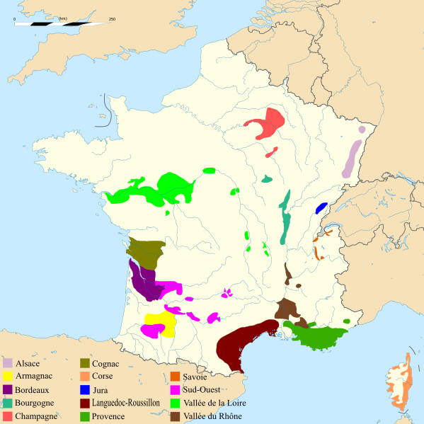
English: Map of French vineyards. Français : Carte des principaux vignobles français. Español: Regiones vitivinícolas de Francia. |
| Date | (UTC) |
| Source | |
| Author |
|
| Other versions |
 |
I, the copyright holder of this work, hereby publish it under the following license:
This file is licensed under the Creative Commons Attribution-Share Alike 2.5 Generic license.
- You are free:
- to share – to copy, distribute and transmit the work
- to remix – to adapt the work
- Under the following conditions:
- attribution – You must give appropriate credit, provide a link to the license, and indicate if changes were made. You may do so in any reasonable manner, but not in any way that suggests the licensor endorses you or your use.
- share alike – If you remix, transform, or build upon the material, you must distribute your contributions under the same or compatible license as the original.
Original upload log
[edit]
This image is a derivative work of the following images:
- File:France_blank.svg licensed with Cc-by-sa-2.5
- 2008-11-07T13:50:25Z Sting 1796x1797 (572016 Bytes) + boundary for the Channel Islands ; - canals
- 2008-09-25T02:46:38Z Sting 1796x1797 (577116 Bytes) Completely new version using NGDC WDBII data and with known projection
- 2006-09-21T16:34:27Z Sting 1796x1796 (996002 Bytes) Colours
- 2006-09-20T00:34:58Z Sting 1796x1796 (996902 Bytes) {{Information |Description=SVG map of France |Source=Own work |Date=September 2006 |Author=Eric Gaba ([[User:Sting|Sting]]) |Permission=CC-BY-SA-2.5 |other_versions= }} ---- {{fr}} * '''Sujet :''' Carte vectorielle de la
Uploaded with derivativeFX
File history
Click on a date/time to view the file as it appeared at that time.
| Date/Time | Thumbnail | Dimensions | User | Comment | |
|---|---|---|---|---|---|
| current | 20:12, 11 December 2009 | | 1,796 × 1,797 (634 KB) | Sdaubert (talk | contribs) | Ajout de calques (dont un pour la légende et un pour les vignobles). Devrait permettre de créer plus facilement des cartes de régions par extraction. |
| 21:27, 17 July 2009 |  | 1,796 × 1,797 (1.03 MB) | Archimatth (talk | contribs) | police problématique | |
| 16:38, 6 June 2009 |  | 1,796 × 1,797 (649 KB) | Archimatth (talk | contribs) | texte légende | |
| 01:18, 19 May 2009 |  | 1,796 × 1,797 (657 KB) | Archimatth (talk | contribs) | Police légende | |
| 23:49, 18 May 2009 |  | 1,796 × 1,797 (653 KB) | Archimatth (talk | contribs) | problème police légende | |
| 23:32, 18 May 2009 |  | 1,796 × 1,797 (653 KB) | Archimatth (talk | contribs) | Légende, échelle | |
| 18:09, 17 May 2009 |  | 1,796 × 1,797 (648 KB) | Sdaubert (talk | contribs) | Change some colors, move scale. | |
| 14:25, 17 May 2009 |  | 1,796 × 1,797 (648 KB) | Sdaubert (talk | contribs) | Change some colors. "Vallée du Rhône" instead of "Rhône" in legend. | |
| 14:21, 17 May 2009 |  | 1,796 × 1,797 (648 KB) | Sdaubert (talk | contribs) | Change some colors. "Vallée du Rhône" instead of "Rhône" in legend. | |
| 13:05, 17 May 2009 |  | 1,796 × 1,797 (648 KB) | Sdaubert (talk | contribs) | Coordinates deleted. Spanish rivers deleted (to ease reading of legend) |
You cannot overwrite this file.
File usage on Commons
The following 2 pages use this file:
File usage on other wikis
The following other wikis use this file:
- Usage on cs.wikipedia.org
- Usage on cv.wikipedia.org
- Usage on fi.wikipedia.org
- Usage on fr.wikipedia.org
- Usage on fr.wikivoyage.org
- Usage on km.wikipedia.org
- Usage on ru.wikipedia.org
- Usage on uk.wikipedia.org