File:French Shore Newfoundland 1785.png
Jump to navigation
Jump to search
Size of this preview: 795 × 600 pixels. Other resolutions: 318 × 240 pixels | 636 × 480 pixels | 1,018 × 768 pixels | 1,189 × 897 pixels.
Original file (1,189 × 897 pixels, file size: 2.03 MB, MIME type: image/png)
Captions
Captions
Add a one-line explanation of what this file represents
Summary[edit]
| Description |
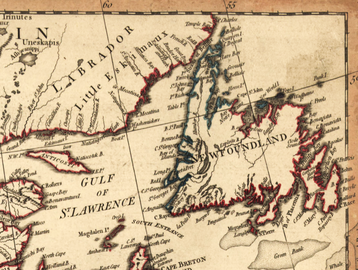
English: The Gulf of St. Lawrence and Newfoundland with Newfoundland's so-called 'French Shore' or 'Treaty Shore' highlighted in blue (explained on the map as the area of "The French Fisheries on the Coast of Newfoundland"). Cropped from a map by British map engraver and publisher William Faden issued in 1785 titled "The United States of North America, with the British & Spanish territories according to the treaty of 1784" (the Treaty of Versailles of 1783, ratified in 1784). |
| Date | |
| Source | Library of Congress Geography and Map Division, U.S. |
| Author | William Faden, London, 1785 |
Licensing[edit]
|
This work is in the public domain in its country of origin and other countries and areas where the copyright term is the author's life plus 100 years or fewer. | |
| This file has been identified as being free of known restrictions under copyright law, including all related and neighboring rights. | |
File history
Click on a date/time to view the file as it appeared at that time.
| Date/Time | Thumbnail | Dimensions | User | Comment | |
|---|---|---|---|---|---|
| current | 21:33, 20 February 2016 | | 1,189 × 897 (2.03 MB) | Lubiesque (talk | contribs) | User created page with UploadWizard |
You cannot overwrite this file.
File usage on Commons
There are no pages that use this file.
File usage on other wikis
The following other wikis use this file:
- Usage on ie.wikipedia.org