File:French Polynesia relief map with communes-mk.svg
Jump to navigation
Jump to search

Size of this PNG preview of this SVG file: 600 × 600 pixels. Other resolutions: 240 × 240 pixels | 480 × 480 pixels | 768 × 768 pixels | 1,024 × 1,024 pixels | 2,048 × 2,048 pixels | 1,260 × 1,260 pixels.
Original file (SVG file, nominally 1,260 × 1,260 pixels, file size: 1.4 MB)
Captions
Captions
Add a one-line explanation of what this file represents
| Description |
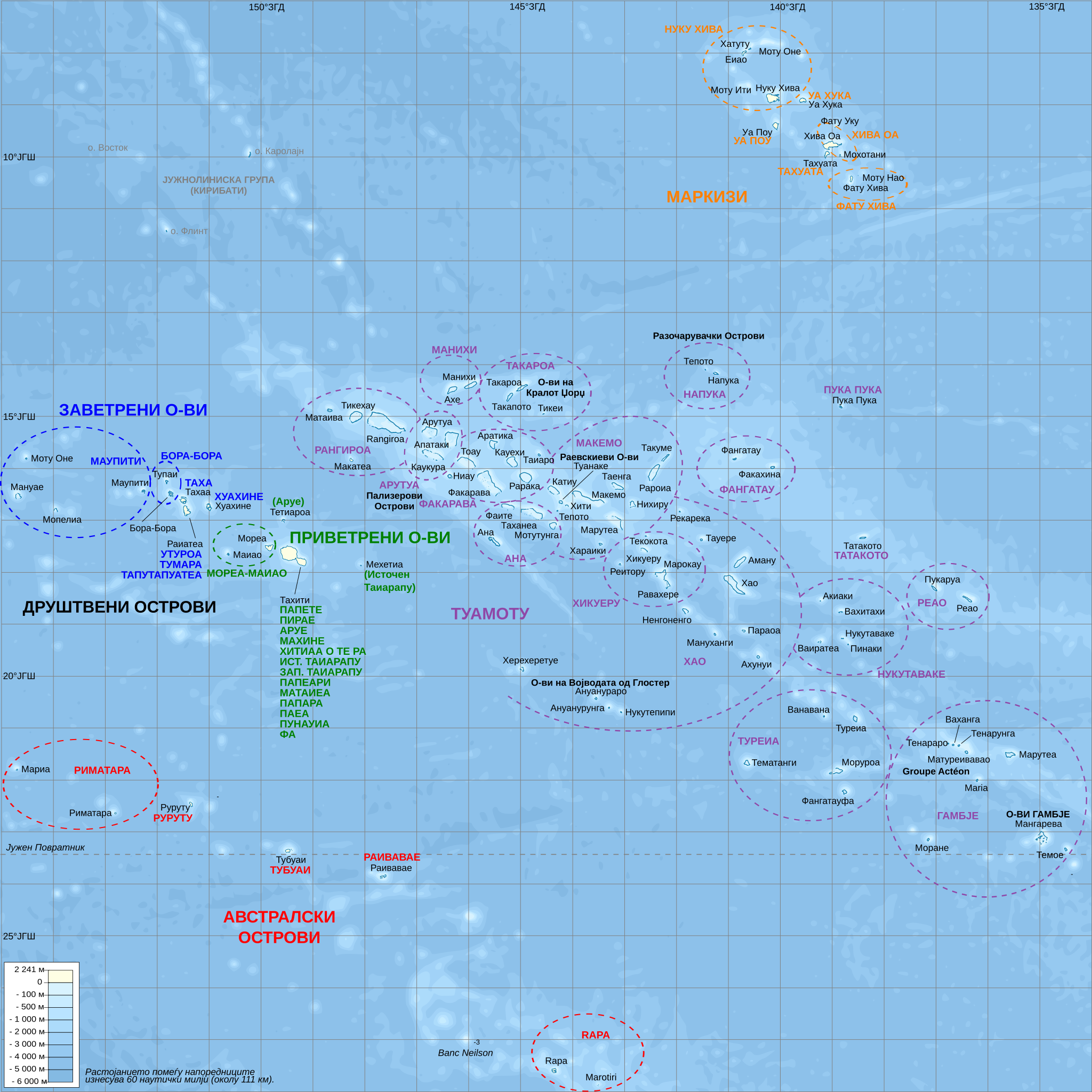
English: Топографска и административна карта на Француска Полинезија.
English: Topographic map with subdivision names of French Polynesia (in Macedonian). |
| Date | (UTC) |
| Source | |
| Author |
|
| Other versions |
[]
|


| This is a retouched picture, which means that it has been digitally altered from its original version. Modifications: Translated to Macedonian. The original can be viewed here: French Polynesia relief map with communes.svg:
|
I, the copyright holder of this work, hereby publish it under the following licenses:
This file is licensed under the Creative Commons Attribution-Share Alike 3.0 Unported, 2.5 Generic, 2.0 Generic and 1.0 Generic license.
- You are free:
- to share – to copy, distribute and transmit the work
- to remix – to adapt the work
- Under the following conditions:
- attribution – You must give appropriate credit, provide a link to the license, and indicate if changes were made. You may do so in any reasonable manner, but not in any way that suggests the licensor endorses you or your use.
- share alike – If you remix, transform, or build upon the material, you must distribute your contributions under the same or compatible license as the original.

|
Permission is granted to copy, distribute and/or modify this document under the terms of the GNU Free Documentation License, Version 1.2 or any later version published by the Free Software Foundation; with no Invariant Sections, no Front-Cover Texts, and no Back-Cover Texts. A copy of the license is included in the section entitled GNU Free Documentation License. |
You may select the license of your choice.
Original upload log
[edit]
This image is a derivative work of the following images:
- File:French_Polynesia_relief_map_with_communes.svg licensed with Cc-by-sa-3.0,2.5,2.0,1.0, GFDL
- 2008-10-16T20:32:08Z Sardon 1260x1260 (1472890 Bytes) {{Information |Description={{en|1=Topographic map with subdivision names of French Polynesia (in French)}} {{fr|1=Carte topographique de la Polynésie française, en français, avec les noms des subdivisions (communes et arch
Uploaded with derivativeFX
File history
Click on a date/time to view the file as it appeared at that time.
| Date/Time | Thumbnail | Dimensions | User | Comment | |
|---|---|---|---|---|---|
| current | 01:04, 14 November 2010 | | 1,260 × 1,260 (1.4 MB) | Bjankuloski06en (talk | contribs) | {{Information |Description={{en|1=Топографска и административна карта на Француска Полинезија.}} {{en|1=Topographic map with subdivision names of French |
You cannot overwrite this file.
File usage on Commons
The following 6 pages use this file:
File usage on other wikis
The following other wikis use this file:
- Usage on mk.wikipedia.org