File:Fort du Portalet.jpg
Jump to navigation
Jump to search
Size of this preview: 800 × 531 pixels. Other resolutions: 320 × 213 pixels | 640 × 425 pixels | 1,024 × 680 pixels | 1,280 × 850 pixels | 2,560 × 1,701 pixels | 4,435 × 2,946 pixels.
Original file (4,435 × 2,946 pixels, file size: 8.17 MB, MIME type: image/jpeg)
Captions
Captions
Add a one-line explanation of what this file represents
Summary[edit]

|
This image has been assessed under the valued image criteria and is considered the most valued image on Commons within the scope: Fort du Portalet. You can see its nomination here. |
| Description |
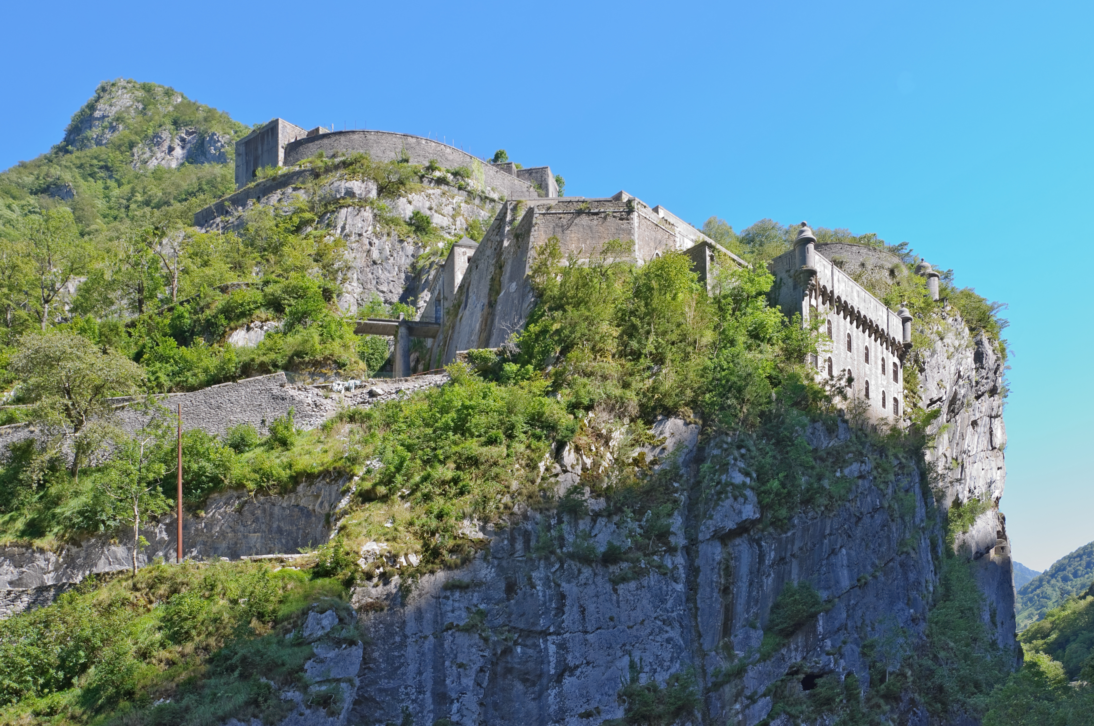
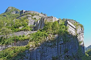
English: The 'Fort du Portalet' in the French Pyrenees (Pyrénées-Atlantiques, France).
Français : Le fort du Portalet dans les Pyrénées-Atlantiques, France.
|
||
| Date | |||
| Source | Own work | ||
| Author | Myrabella | ||
| Attribution (required by the license) | Photo: Myrabella / Wikimedia Commons / | ||
| Camera location | | View this and other nearby images on: OpenStreetMap |
|---|
| This is a retouched picture, which means that it has been digitally altered from its original version. Modifications: perspective correction.
|
Licensing[edit]
I, the copyright holder of this work, hereby publish it under the following licenses:
This file is licensed under the Creative Commons Attribution-Share Alike 3.0 Unported license.
- You are free:
- to share – to copy, distribute and transmit the work
- to remix – to adapt the work
- Under the following conditions:
- attribution – You must give appropriate credit, provide a link to the license, and indicate if changes were made. You may do so in any reasonable manner, but not in any way that suggests the licensor endorses you or your use.
- share alike – If you remix, transform, or build upon the material, you must distribute your contributions under the same or compatible license as the original.

|
Permission is granted to copy, distribute and/or modify this document under the terms of the GNU Free Documentation License, Version 1.2 or any later version published by the Free Software Foundation; with no Invariant Sections, no Front-Cover Texts, and no Back-Cover Texts. A copy of the license is included in the section entitled GNU Free Documentation License. |
You may select the license of your choice.
File history
Click on a date/time to view the file as it appeared at that time.
| Date/Time | Thumbnail | Dimensions | User | Comment | |
|---|---|---|---|---|---|
| current | 18:41, 17 September 2010 | | 4,435 × 2,946 (8.17 MB) | Myrabella (talk | contribs) | == {{int:filedesc}} == {{Information |Description= {{fr|1=Le fort du Portalet dans les Pyrénées-Atlantiques, France.}} {{en|1=The 'Fort du Portalet' in the French Pyrenees (Pyrénées-Atlantiques, France).}} {{Mérimée|type=cla |
You cannot overwrite this file.
File usage on Commons
The following 4 pages use this file:
File usage on other wikis
The following other wikis use this file:
- Usage on ca.wikipedia.org
- Usage on de.wikipedia.org
- Usage on en.wikipedia.org
- Usage on es.wikipedia.org
- Usage on eu.wikipedia.org
- Usage on fr.wikipedia.org
- Béarn
- Borce
- Etsaut
- Fort du Portalet
- Frontière entre l'Espagne et la France
- Utilisateur:Bulwersator/Echo/Images/Fr-communes
- Liste des monuments historiques des Pyrénées-Atlantiques (A-L)
- Utilisateur:Trizek/Brouillon/ListeMH
- Liste des châteaux des Pyrénées-Atlantiques
- Liste des sites retenus pour le loto du patrimoine en 2023
- Liste des sites classés et inscrits des Pyrénées-Atlantiques
- Usage on he.wikipedia.org
- Usage on oc.wikipedia.org
- Usage on pl.wikipedia.org
- Usage on pt.wikipedia.org
- Usage on ru.wikipedia.org
- Usage on sl.wikipedia.org
- Usage on tr.wikipedia.org
- Usage on www.wikidata.org
- Usage on zh.wikipedia.org