File:Fort York and the lower reaches of Garrison Creek.jpg
Fort_York_and_the_lower_reaches_of_Garrison_Creek.jpg (544 × 535 pixels, file size: 111 KB, MIME type: image/jpeg)
Captions
Captions
| Description |
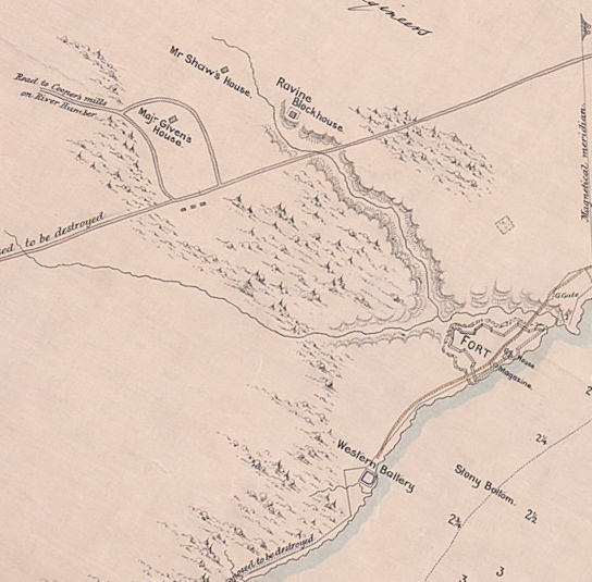
English: A few years later, Elias W. Durnford produced the following plan of the fort. It indicates the construction materials used for specific buildings
|
|||||||||||||||||
| Date | ||||||||||||||||||
| Source | http://oldtorontomaps.blogspot.com/2013/01/1816-nicolls-plan-of-fort-at-york-upper.html | |||||||||||||||||
| Author |
|
|||||||||||||||||
| Permission (Reusing this file) |
|
|||||||||||||||||
| Other versions | ||||||||||||||||||


_E.W._Durnford,_Sept_24,_1823.jpg)
File history
Click on a date/time to view the file as it appeared at that time.
| Date/Time | Thumbnail | Dimensions | User | Comment | |
|---|---|---|---|---|---|
| current | 00:58, 18 June 2021 | | 544 × 535 (111 KB) | Geo Swan (talk | contribs) | File:Plan of York, no. 24, See General Plan of the Canadies (y) E.W. Durnford, Sept 24, 1823.jpg cropped 72 % horizontally, 66 % vertically, rotated 30° using CropTool with precise mode. |
You cannot overwrite this file.
File usage on Commons
The following page uses this file: