File:Fog and Fire in Oregon (MODIS).jpg
Jump to navigation
Jump to search

Size of this preview: 795 × 600 pixels. Other resolutions: 318 × 240 pixels | 636 × 480 pixels | 1,018 × 768 pixels | 1,280 × 966 pixels | 2,163 × 1,632 pixels.
Original file (2,163 × 1,632 pixels, file size: 409 KB, MIME type: image/jpeg)
Captions
Captions
The Moderate Resolution Imaging Spectroradiometer (MODIS) on board NASA’s Terra satellite acquired a true-color image of the region on that same day.
Summary
[edit].jpg&action=edit§ion=1)
| Description |
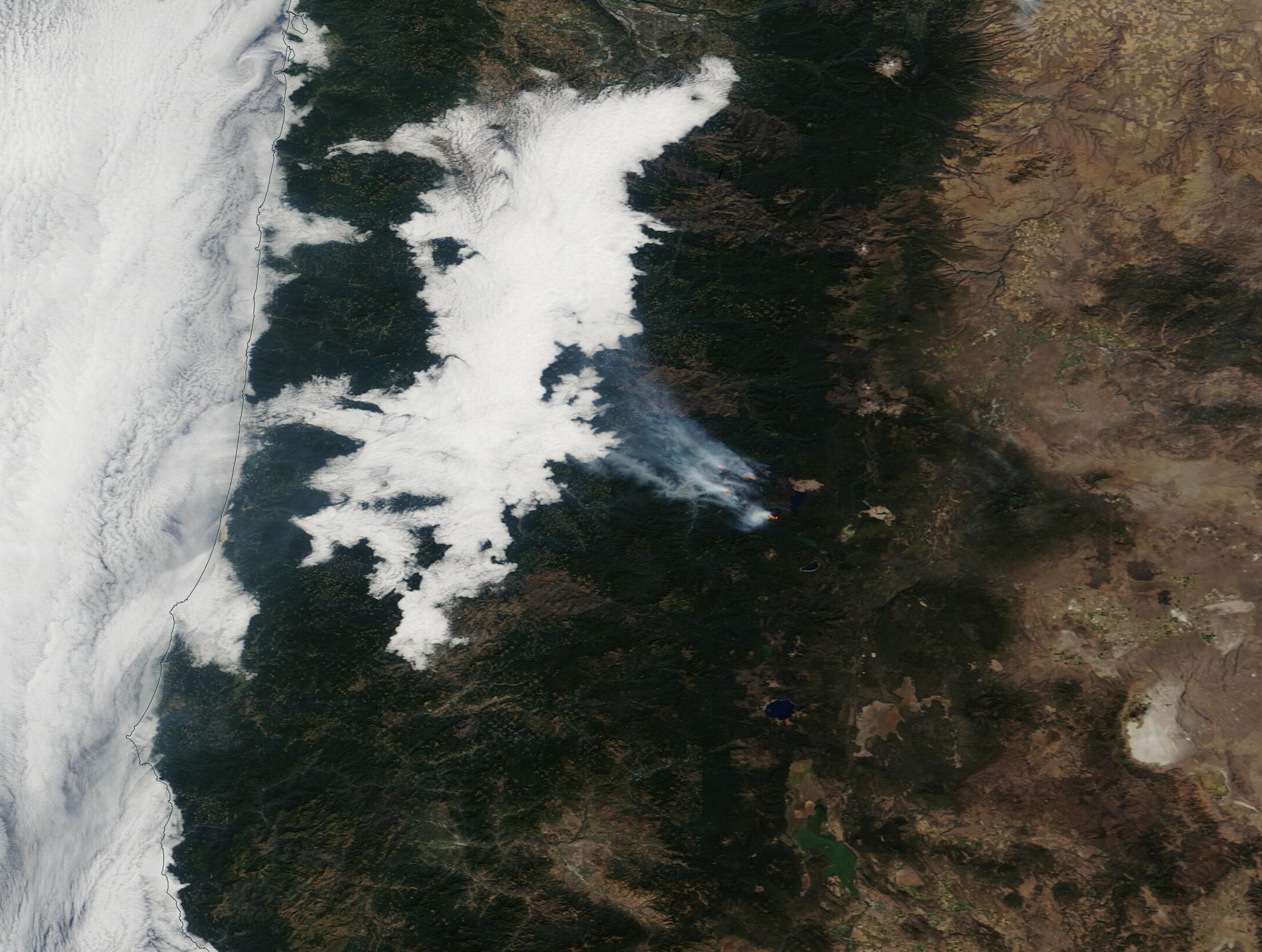
English: On October 6, 2022, a bank of bright white fog hung over the Willamette Valley and the West Slope of Oregon’s Cascades Mountains while gray smoke poured from several fires burning on the drier eastern side of the ridgeline. The Moderate Resolution Imaging Spectroradiometer (MODIS) on board NASA’s Terra satellite acquired a true-color image of the region on that same day.
Fog frequently forms over the Willamette Valley and the West Slopes, thanks to the proximity to bountiful quantities of moist air that blows in from over the Pacific Ocean. The tall peaks of the Cascades form a barrier to moisture, effectively keeping moisture from reaching the eastern side. This area, called a “rain shadow”, is a perfect spot for wildfires to spark, especially in hot weather that dries out vegetation. The largest fire visible is the Cedar Creek Fire. This fire is burning on several fronts, as can be seen by the red “hot spots” seen in the image. Cedar Creek Fire sparked to life on August 1 due to a lightning strike. As of October 7, it had expanded to cover 121, 249 acres and is burning in very difficult and steep territory. Because of the high-risk location, firefighting has primarily been indirect, building fire lines near roads and trails where the fire can be contained when it reaches those lines. It has reached 38 percent containment. |
||
| Date | Taken on 6 October 2022 | ||
| Source |
Fog and Fire in Oregon (direct link)
|
||
| Author | MODIS Land Rapid Response Team, NASA GSFC |
| This media is a product of the Terra mission Credit and attribution belongs to the mission team, if not already specified in the "author" row |
Licensing
[edit].jpg&action=edit§ion=2)
| This file is in the public domain in the United States because it was solely created by NASA. NASA copyright policy states that "NASA material is not protected by copyright unless noted". (See Template:PD-USGov, NASA copyright policy page or JPL Image Use Policy.) | ||
 |
Warnings:
|
File history
Click on a date/time to view the file as it appeared at that time.
| Date/Time | Thumbnail | Dimensions | User | Comment | |
|---|---|---|---|---|---|
| current | 00:20, 13 September 2023 | | 2,163 × 1,632 (409 KB) | OptimusPrimeBot (talk | contribs) | #Spacemedia - Upload of http://modis.gsfc.nasa.gov/gallery/images/image10082022_250m.jpg via Commons:Spacemedia |
You cannot overwrite this file.
File usage on Commons
There are no pages that use this file.
.jpg&oldid=801225676)