File:Flag of Dokuzparinsky district.png
Flag_of_Dokuzparinsky_district.png (750 × 500 pixels, file size: 273 KB, MIME type: image/png)
Captions
Captions
Summary[edit]
| Description |
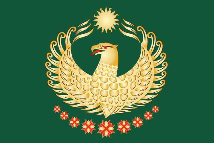
English: Flag of Dokuzparinsky rayon, Dagestan, Russia
Русский: Флаг муниципального образования «Докузпаринский район», Республика Дагестан, Россия
«Прямоугольное полотнище зелёного цвета с отношением ширины к длине 2:3, в центре которого — геральдический орёл без ног и хвоста жёлтого цвета, выше которого — солнце с чередующимися прямыми и пламенеющими лучами жёлтого цвета, а ниже — расположенные опрокинутым полумесяцем, уменьшающиеся от центра к краям девять вырубных крестов красного цвета с тонкой каймой жёлтого цвета, поверх каждого из которых — Андреевский крест с заострёнными концами красного цвета с тонкой каймой жёлтого цвета». |
||||
| Date | |||||
| Source | http://www.vexillographia.ru/russia/subjects/towns/dokuzpar.htm | ||||
| Author | Администрация района | ||||
| Permission (Reusing this file) |
|

File history
Click on a date/time to view the file as it appeared at that time.
| Date/Time | Thumbnail | Dimensions | User | Comment | |
|---|---|---|---|---|---|
| current | 20:47, 21 October 2020 | | 750 × 500 (273 KB) | Permjak (talk | contribs) | {{Information |Description = {{en|Flag of Dokuzparinsky rayon, Dagestan, Russia}} {{ru|Флаг муниципального образования «Докузпаринский район», Республика Дагестан, Россия}} {{Quote box|«Прямоугольное полотнище зелёного цвета с отношением ширины к длине 2:3, в центре которого — геральдический орёл без ног и хвоста жёлтого цвета, выше которого — солнце с чередующимися прямыми и пламенеющими лучами жёлтого цвета, а ниже — расположенные опрокинутым полумесяцем, уменьшающиеся от центра к краям дев... |
You cannot overwrite this file.
File usage on Commons
The following 3 pages use this file:
File usage on other wikis
The following other wikis use this file:
- Usage on az.wikipedia.org
- Usage on ce.wikipedia.org
- Usage on cs.wikipedia.org
- Usage on en.wikipedia.org
- Dokuzparinsky District
- Kurush, Dokuzparinsky District, Republic of Dagestan
- Avadan, Dagestan
- Usukhchay
- Kaladzhukh, Republic of Dagestan
- Karakyure
- Gandurar
- Demirar
- Kavalar
- Kerimkhanar
- Kiler, Republic of Dagestan
- Esetar
- Mikrakh
- Tekipirkent
- Miskindzha
- Novoye Karakyure
- Template:Rural localities in Dokuzparinsky District
- Usage on fa.wikipedia.org
- Usage on hu.wikipedia.org
- Usage on hy.wikipedia.org
- Usage on it.wikipedia.org
- Usage on os.wikipedia.org
- Usage on pl.wikipedia.org
- Usage on ru.wikipedia.org
- Куруш (Докузпаринский район)
- Мискинджа
- Флаг Дагестана
- Административно-территориальное деление Дагестана
- Докузпаринский район
- Усухчай
- Участник:Chinar2011
- Шаблон:Населённые пункты Докузпаринского района
- Микрах
- Каладжух
- Каракюре
- Авадан
- Гандурар
- Демирар
- Кавалар
- Керимханар
- Чувалар
- Эсетар
- Килер (село)
- Текипиркент
- Новое Каракюре
- Флаг Докузпаринского района
- Usage on uk.wikipedia.org
View more global usage of this file.