File:Figure25.PNG
Jump to navigation
Jump to search
Size of this preview: 800 × 571 pixels. Other resolutions: 320 × 228 pixels | 640 × 457 pixels | 916 × 654 pixels.
Original file (916 × 654 pixels, file size: 37 KB, MIME type: image/png)
Captions
Captions
Add a one-line explanation of what this file represents
Summary[edit]
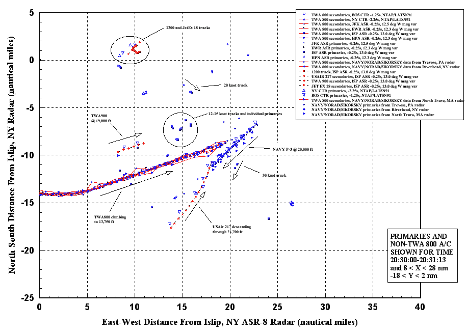
| Description | Radar data showing vehicle and/or object tracks within 10 nm of TWA flight 800 just before the accident. |
| Source | FAA |
| Author | NTSB/AAR-00/03 pg.90 |
Licensing[edit]
This image is a work of a National Transportation Safety Board employee, taken or made as part of an employee's official duties. As a work of the U.S. federal government, all NTSB images are in the public domain in the United States.
|
Original upload log[edit]
The original description page was here. All following user names refer to en.wikipedia.
| Date/Time | Dimensions | User | Comment |
|---|---|---|---|
| 2010-01-14 01:43:34 | 862× 538× | Lipsticked Pig | {{Information |Description = Radar data showing vehicle and/or object tracks within 10 nm of TWA flight 800 just before the accident. |Source = FAA |Date = ~~~~~ |Author = NTSB/AAR-00/03 pg.90 |Permission = |other_v |
File history
Click on a date/time to view the file as it appeared at that time.
| Date/Time | Thumbnail | Dimensions | User | Comment | |
|---|---|---|---|---|---|
| current | 03:01, 9 March 2020 | | 916 × 654 (37 KB) | Ras67 (talk | contribs) | new extracted in higher resolution |
| 08:04, 20 July 2016 |  | 862 × 538 (48 KB) | FastilyClone (talk | contribs) | Transferred from en.wikipedia (MTC!) |
You cannot overwrite this file.
File usage on Commons
The following 2 pages use this file:
File usage on other wikis
The following other wikis use this file:
- Usage on en.wikipedia.org
- Usage on en.wikibooks.org