File:Ferrovias da Bahia.svg
Jump to navigation
Jump to search

Size of this PNG preview of this SVG file: 579 × 600 pixels. Other resolutions: 232 × 240 pixels | 463 × 480 pixels | 741 × 768 pixels | 988 × 1,024 pixels | 1,977 × 2,048 pixels | 886 × 918 pixels.
Original file (SVG file, nominally 886 × 918 pixels, file size: 244 KB)
Captions
Captions
Add a one-line explanation of what this file represents
| Description |
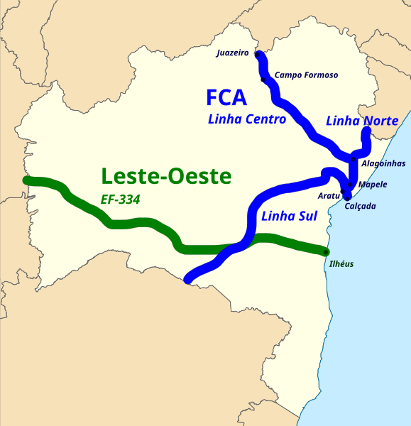
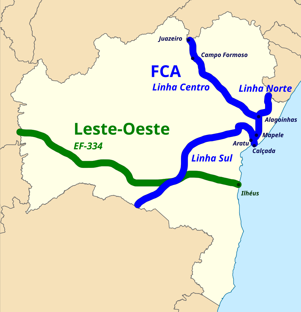
Português: Mapa da Bahia com as ferrovias que cortam o estado, a Ferrovia Centro Atlântica (FCA) e a Ferrovia Leste-Oeste. |
| Date | |
| Source |
This file was derived from: Brazil Bahia location map.svg:  |
| Author |
by Luan |
| Permission (Reusing this file) |
I, the copyright holder of this work, hereby publish it under the following license: This file is licensed under the Creative Commons Attribution-Share Alike 3.0 Brazil license.
 |
File history
Click on a date/time to view the file as it appeared at that time.
| Date/Time | Thumbnail | Dimensions | User | Comment | |
|---|---|---|---|---|---|
| current | 05:56, 20 October 2012 | | 886 × 918 (244 KB) | Luan (talk | contribs) | linhas da FCA e estações e cruzamentos |
| 16:35, 23 September 2012 |  | 886 × 918 (236 KB) | Luan (talk | contribs) | {{subst:User:Luan/byme |Description={{pt|Mapa da Bahia com as ferrovias que cortam o estado, a pt:Ferrovia Centro Atlântica (FCA) e a pt:Ferrovia Leste-Oeste.}} |Source={{Derived from|Brazil_Bahia_location_map.svg|display=50}} |Date=2012-0... |
You cannot overwrite this file.
File usage on Commons
The following page uses this file:
File usage on other wikis
The following other wikis use this file:
- Usage on pt.wikipedia.org