File:Evergreen Point Floating Bridge.jpg
Jump to navigation
Jump to search
Size of this preview: 800 × 600 pixels. Other resolutions: 320 × 240 pixels | 640 × 480 pixels | 1,024 × 768 pixels | 1,280 × 960 pixels | 2,560 × 1,920 pixels | 3,264 × 2,448 pixels.
Original file (3,264 × 2,448 pixels, file size: 3.07 MB, MIME type: image/jpeg)
Captions
Captions
Add a one-line explanation of what this file represents
Summary
[edit]
| Description |
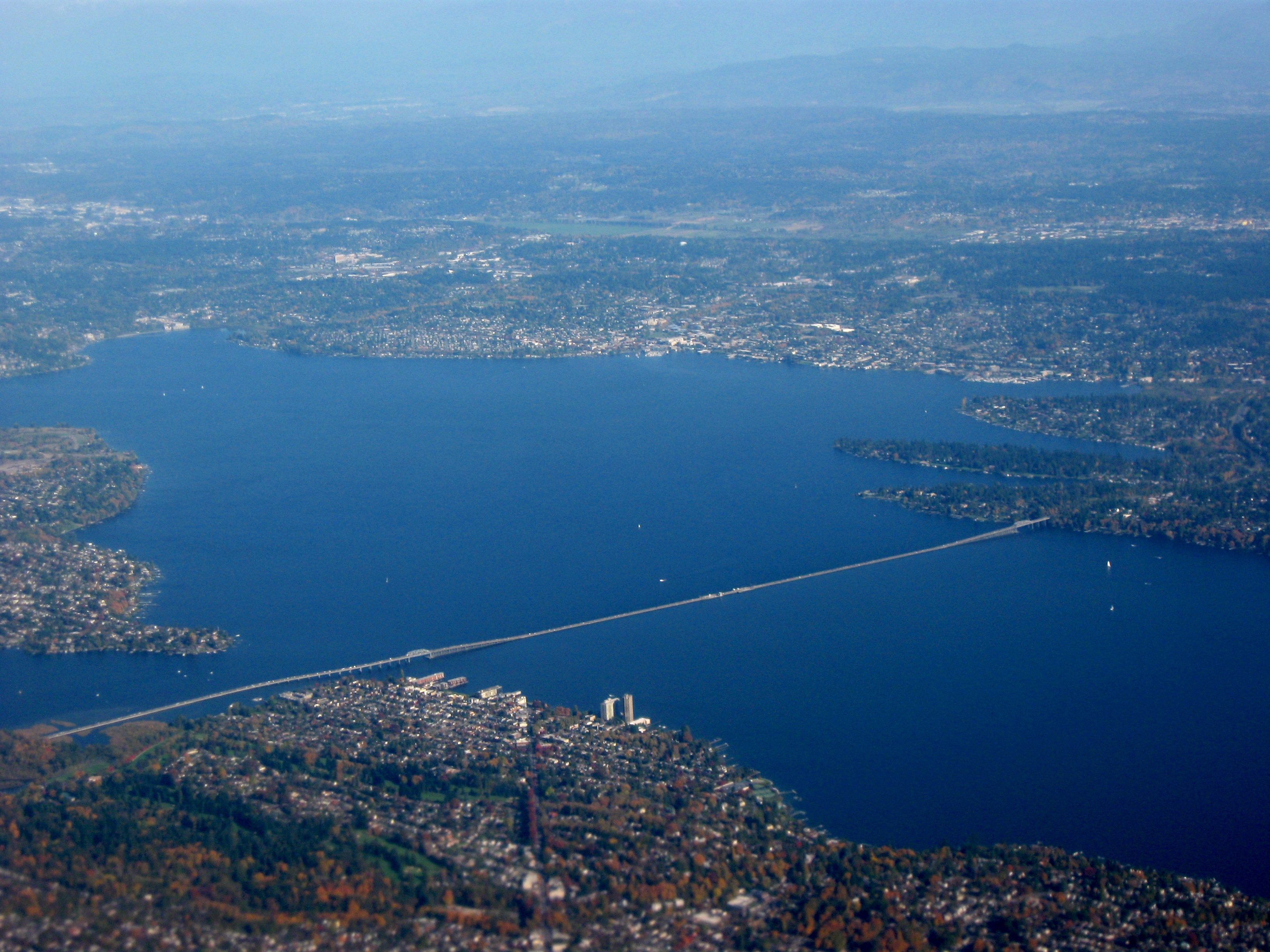
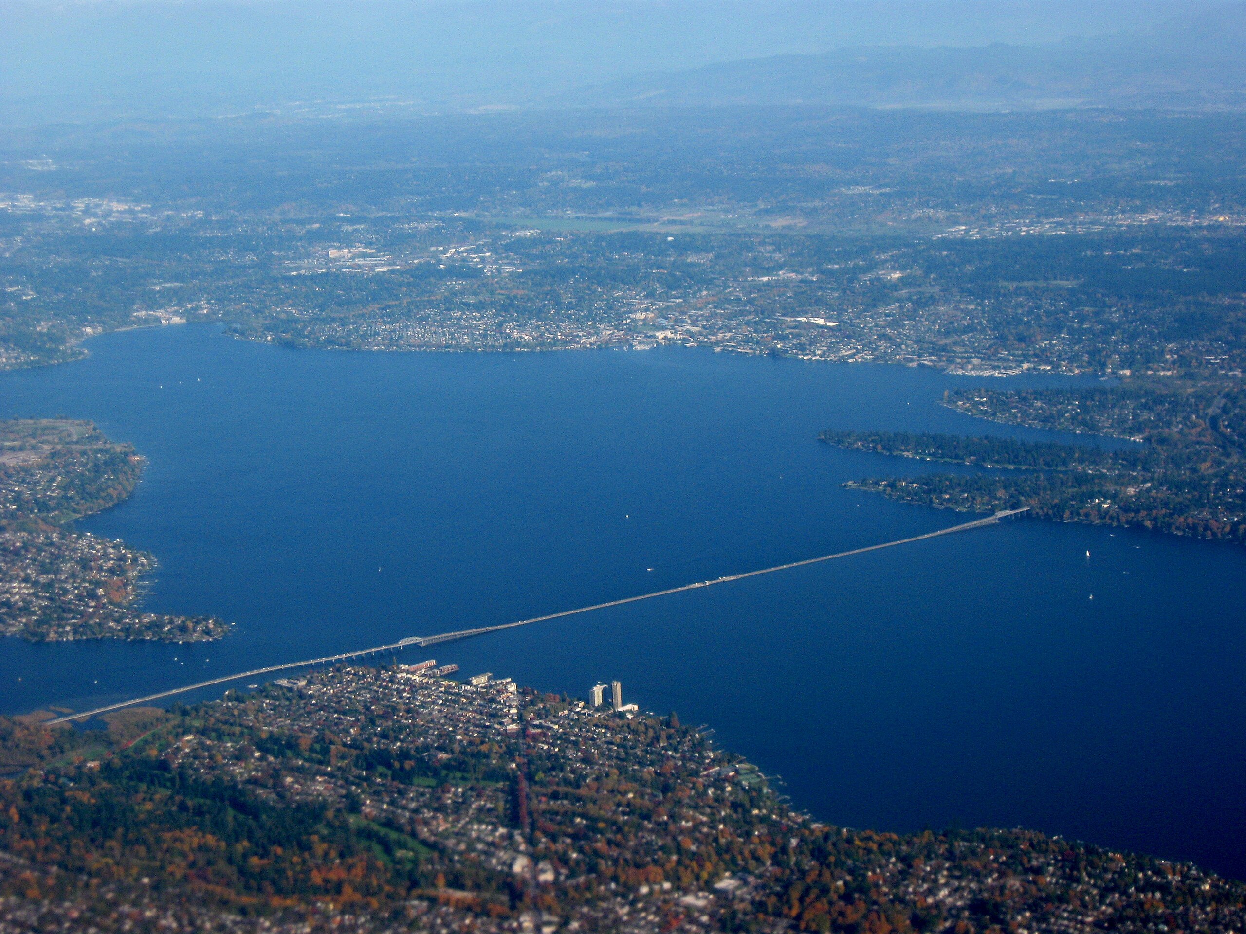
English: Evergreen Point Floating Bridge (Washington State Route 520) from Medina (center right) to Portage Bay (bottom left) and Laurelhurst (center left) and Madison Park (center) area of Seattle across Lake Washington. Facing northwest from Seattle. Taken by myself from a commercial airliner window. Beyond Medina are the peninsula communities of Hunts Point and Yarrow Point; on the far shore of Lake Washington is Kirkland. |
| Date | |
| Source | Own work |
| Author | Dcoetzee |
| Camera location | | View this and other nearby images on: OpenStreetMap |
|---|
Licensing
[edit]
| I, the copyright holder of this work, release this work into the public domain. This applies worldwide. In some countries this may not be legally possible; if so: I grant anyone the right to use this work for any purpose, without any conditions, unless such conditions are required by law. |
File history
Click on a date/time to view the file as it appeared at that time.
| Date/Time | Thumbnail | Dimensions | User | Comment | |
|---|---|---|---|---|---|
| current | 02:43, 27 May 2009 | | 3,264 × 2,448 (3.07 MB) | Dcoetzee (talk | contribs) | {{Information |Description={{en|1=Interstate Highway 520 bridge from Medina (center right) to Portage Bay (bottom left) and University District (center left) area of Seattle across Lake Washington. Facing northwest from Seattle. Taken by myself from a com |
You cannot overwrite this file.
File usage on Commons
The following 3 pages use this file:
File usage on other wikis
The following other wikis use this file:
- Usage on cs.wikipedia.org
- Usage on en.wikipedia.org