File:Evening Forestry.jpg
Jump to navigation
Jump to search
Size of this preview: 450 × 600 pixels. Other resolutions: 180 × 240 pixels | 360 × 480 pixels | 576 × 768 pixels | 768 × 1,024 pixels | 2,448 × 3,264 pixels.
Original file (2,448 × 3,264 pixels, file size: 2.27 MB, MIME type: image/jpeg)
Captions
Captions
Add a one-line explanation of what this file represents
Summary[edit]
| Description |
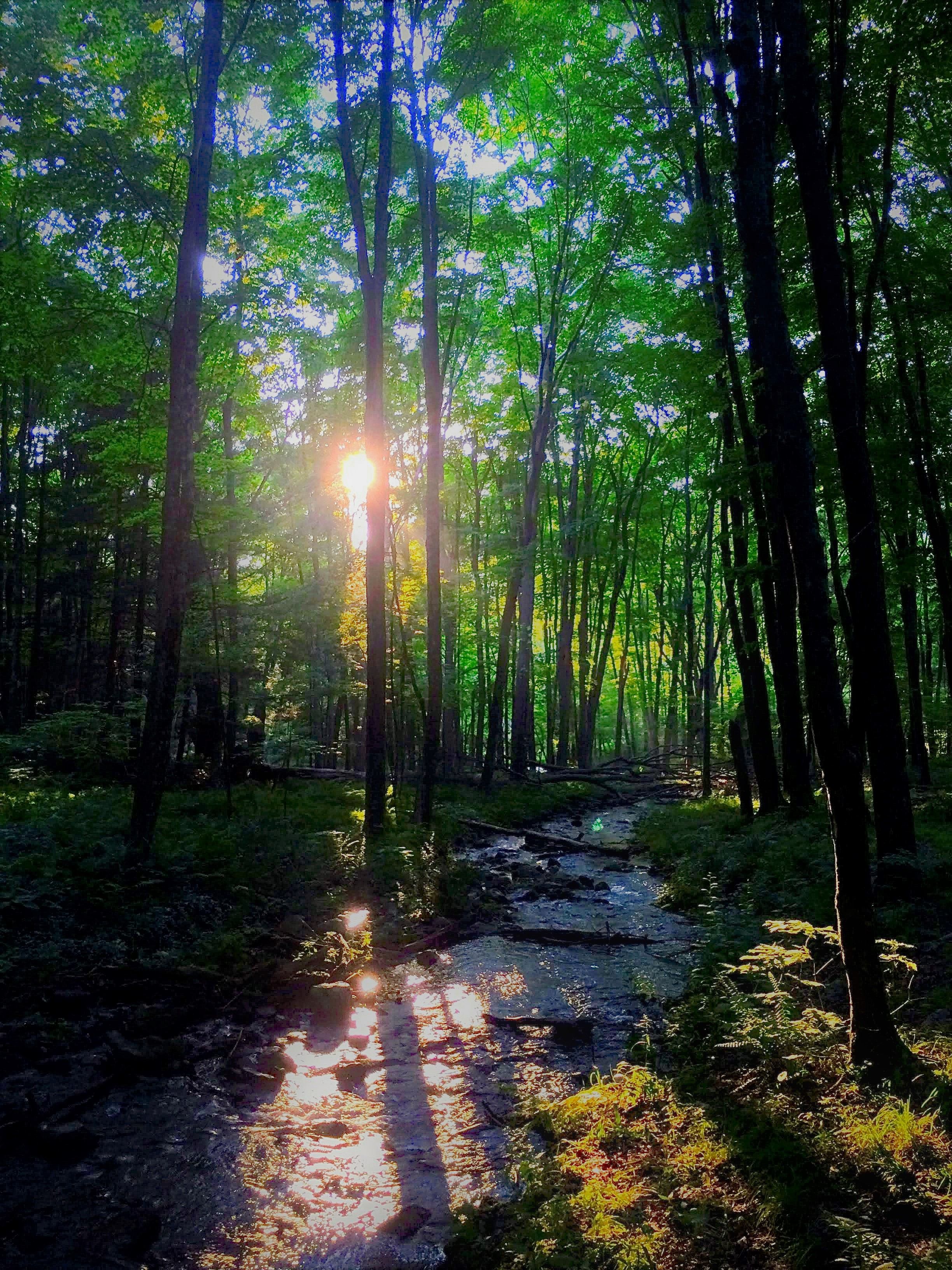
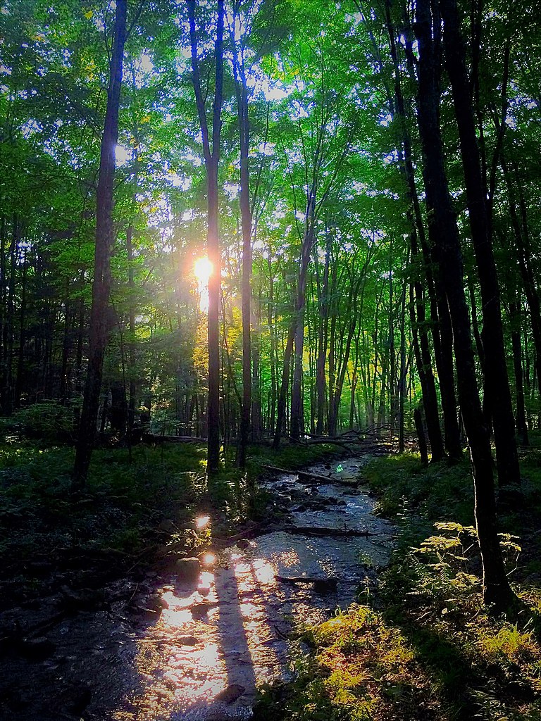
English: The sun sets, illuminating the forest ground through the gaps between tall, verdant trees. A river splits the landscape, running from the foreground to a distant point beyond the foliage. Shadows of the vegetation overlay the greenery and tributary below. |
| Date | |
| Source | Own work |
| Author | Ananya Venkatachalam |
| Camera location | | View this and other nearby images on: OpenStreetMap |
|---|
I took this photo while hiking with family friends at the Delaware Water Gap. The sunlight slipping through the gaps between foliage reminded me of scenes from Attenborough's Planet Earth, a documentary that I watched dutifully as a child, so I quickly used my phone to preserve this transient landscape.
I also balanced quite precariously on a log to take this photo and may or may not have fallen off afterward.
Licensing[edit]
I, the copyright holder of this work, hereby publish it under the following license:
This file is licensed under the Creative Commons Attribution 4.0 International license.
- You are free:
- to share – to copy, distribute and transmit the work
- to remix – to adapt the work
- Under the following conditions:
- attribution – You must give appropriate credit, provide a link to the license, and indicate if changes were made. You may do so in any reasonable manner, but not in any way that suggests the licensor endorses you or your use.
| This file was uploaded as part of Wiki Science Competition 2021. |
File history
Click on a date/time to view the file as it appeared at that time.
| Date/Time | Thumbnail | Dimensions | User | Comment | |
|---|---|---|---|---|---|
| current | 03:57, 6 December 2021 | | 2,448 × 3,264 (2.27 MB) | Ananyavenk (talk | contribs) | Uploaded own work with UploadWizard |
You cannot overwrite this file.
File usage on Commons
There are no pages that use this file.