File:Ethiopia regions numbered.svg
Jump to navigation
Jump to search

Size of this PNG preview of this SVG file: 709 × 567 pixels. Other resolutions: 300 × 240 pixels | 600 × 480 pixels | 960 × 768 pixels | 1,280 × 1,024 pixels | 2,560 × 2,047 pixels.
Original file (SVG file, nominally 709 × 567 pixels, file size: 29 KB)
Captions
Captions
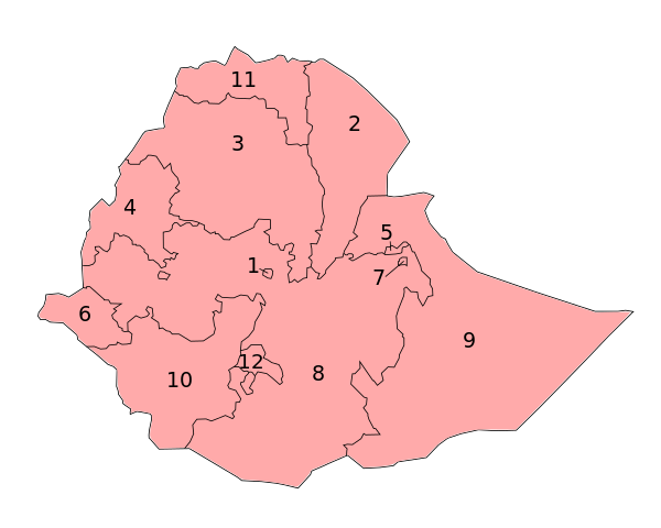
Map of the regions of Ethiopia
Summary[edit]
| Description |
English: Map of the regions of Ethiopia in alphabetical order. |
| Date | |
| Source | Own work |
| Author | Bärtiger |
based on:Ethiopia_regions_numbered.png by User Golbez
Licensing[edit]
I, the copyright holder of this work, hereby publish it under the following license:
This file is licensed under the Creative Commons Attribution-Share Alike 3.0 Unported license.
- You are free:
- to share – to copy, distribute and transmit the work
- to remix – to adapt the work
- Under the following conditions:
- attribution – You must give appropriate credit, provide a link to the license, and indicate if changes were made. You may do so in any reasonable manner, but not in any way that suggests the licensor endorses you or your use.
- share alike – If you remix, transform, or build upon the material, you must distribute your contributions under the same or compatible license as the original.
File history
Click on a date/time to view the file as it appeared at that time.
| Date/Time | Thumbnail | Dimensions | User | Comment | |
|---|---|---|---|---|---|
| current | 17:25, 3 September 2020 | | 709 × 567 (29 KB) | Kolomaznik (talk | contribs) | Sidama (12) is federal region from June 2020. |
| 21:15, 23 January 2012 |  | 744 × 1,052 (27 KB) | Bärtiger (talk | contribs) |
You cannot overwrite this file.
File usage on Commons
The following 2 pages use this file:
File usage on other wikis
The following other wikis use this file:
- Usage on pl.wikipedia.org
- Usage on trv.wikipedia.org
- Usage on tr.wikipedia.org
- Usage on uk.wikipedia.org