File:Elgin Ohare Expressway Map 2018.png
Jump to navigation
Jump to search
Size of this preview: 800 × 474 pixels. Other resolutions: 320 × 190 pixels | 640 × 379 pixels | 960 × 569 pixels.
Original file (960 × 569 pixels, file size: 203 KB, MIME type: image/png)
Captions
Captions
Add a one-line explanation of what this file represents
Summary
[edit]
| Description |
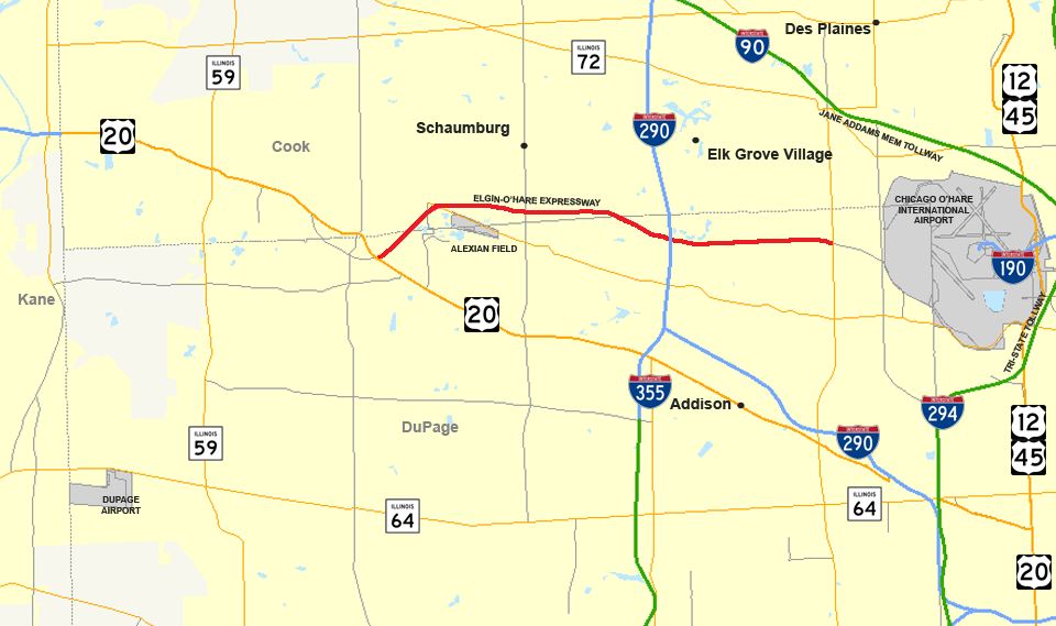
English: Elgin - O'Hare Expressway Map 2018 |
| Date | |
| Source | Own work |
| Author | Zcarstvnz |
This file is based on the following file.
| Description |
English: map of Elgin-O'Hare Expressway. |
| Date | |
| Source | Own work - using Quantum GIS 0.10.0 based on data collected from the Census Bureau (borders, water, urban areas) and the Federal Highway Administration (the roads). |
| Author | User:Master son |
| Permission (Reusing this file) |
Permission is granted to copy, distribute and/or modify this document under the terms of the GNU Free Documentation License, Version 1.2 or any later version published by the Free Software Foundation; with no Invariant Sections, no Front-Cover Texts, and no Back-Cover Texts. |
This new version shows the length of the completed road, darkens the color red, and increases the width to make the road easier to see.
Licensing
[edit]
I, the copyright holder of this work, hereby publish it under the following license:
This file is licensed under the Creative Commons Attribution-Share Alike 4.0 International license.
- You are free:
- to share – to copy, distribute and transmit the work
- to remix – to adapt the work
- Under the following conditions:
- attribution – You must give appropriate credit, provide a link to the license, and indicate if changes were made. You may do so in any reasonable manner, but not in any way that suggests the licensor endorses you or your use.
- share alike – If you remix, transform, or build upon the material, you must distribute your contributions under the same or compatible license as the original.
File history
Click on a date/time to view the file as it appeared at that time.
| Date/Time | Thumbnail | Dimensions | User | Comment | |
|---|---|---|---|---|---|
| current | 14:34, 25 February 2018 | | 960 × 569 (203 KB) | Zcarstvnz (talk | contribs) | User created page with UploadWizard |
You cannot overwrite this file.
File usage on Commons
The following 3 pages use this file: