File:El Pont de Suert i la Noguera Ribagorçana.jpg
Jump to navigation
Jump to search
Size of this preview: 800 × 400 pixels. Other resolutions: 320 × 160 pixels | 640 × 320 pixels | 1,024 × 512 pixels.
Original file (1,024 × 512 pixels, file size: 76 KB, MIME type: image/jpeg)
Captions
Captions
Add a one-line explanation of what this file represents
Summary[edit]
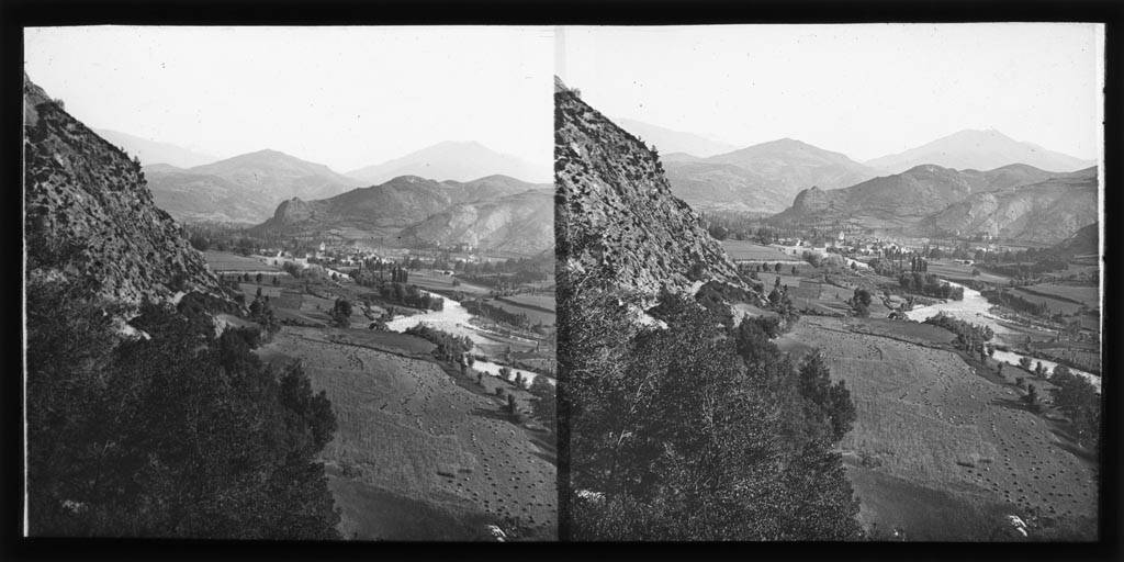
| Català: El Pont de Suert i la Noguera Ribagorçana
( |
|||||||||||||||||||||
|---|---|---|---|---|---|---|---|---|---|---|---|---|---|---|---|---|---|---|---|---|---|
| Photographer |
|
||||||||||||||||||||
| Title |
Català: El Pont de Suert i la Noguera Ribagorçana |
||||||||||||||||||||
| Description |
Català: El Pont de Suert i la Noguera Ribagorçana. Frederic Bordas i Altarriba (ca. 1890) |
||||||||||||||||||||
| Depicted place | Pont de Suert (Alta Ribagorça) | ||||||||||||||||||||
| Date | circa 1890 | ||||||||||||||||||||
| Collection |
|
||||||||||||||||||||
| Current location |
Fons Frederic Bordas i Altarriba |
||||||||||||||||||||
| Accession number |
AFCEC_BORDAS_X_369 |
||||||||||||||||||||
| Credit line | Centre Excursionista de Catalunya (depositor) | ||||||||||||||||||||
| Source | http://mdc.csuc.cat/cdm/singleitem/collection/afcecag/id/1919/rec/1524 | ||||||||||||||||||||
| Permission (Reusing this file) |
|
||||||||||||||||||||


| Camera location | | View this and other nearby images on: OpenStreetMap |
|---|
Licensing[edit]
File history
Click on a date/time to view the file as it appeared at that time.
| Date/Time | Thumbnail | Dimensions | User | Comment | |
|---|---|---|---|---|---|
| current | 19:04, 4 March 2019 | | 1,024 × 512 (76 KB) | KRLS (talk | contribs) | == {{int:filedesc}} == {{Photograph |photographer = {{Creator:Frederic Bordas i Altarriba}} |title = {{ca|Vista general de la vall del Segre amb la Seu d'Urgell}} |description = {{ca|''Vista general de la vall del Segre amb la Seu d'Urgell''. Frederic Bordas i Altarriba (ca. 1890)}} |depicted people = |depicted place = Segre (Curs d'aigua) (Seu d'Urgell) |date = ca. 1890 |medium = |dimensions = |institution... |
You cannot overwrite this file.
File usage on Commons
The following 2 pages use this file:
File usage on other wikis
The following other wikis use this file:
- Usage on ca.wikipedia.org