File:East of England districts 2019 map (EP results).svg
Jump to navigation
Jump to search

Size of this PNG preview of this SVG file: 470 × 492 pixels. Other resolutions: 229 × 240 pixels | 459 × 480 pixels | 734 × 768 pixels | 978 × 1,024 pixels | 1,956 × 2,048 pixels.
Original file (SVG file, nominally 470 × 492 pixels, file size: 5.79 MB)
Captions
Captions
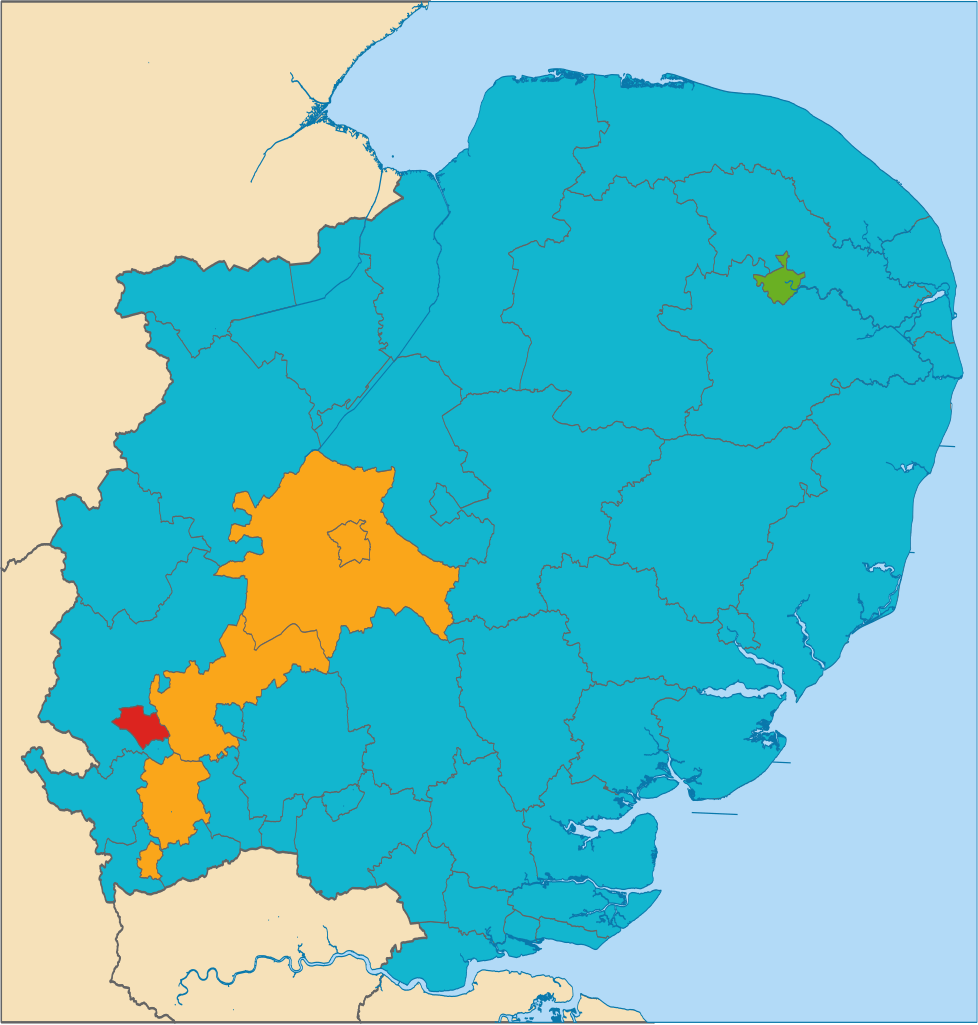
Results of the 2019 European Parliament election in the East of England
Summary
[edit].svg&action=edit§ion=1)
| Description |
English: The party obtaining the most votes in each district in the East of England in the 2019 European Parliament election, shown on a map |
| Date | |
| Source | https://en.wikipedia.org/wiki/File:East_of_England_districts_2019_map.svg |
| Author | T85753 |
Licensing
[edit].svg&action=edit§ion=2)
_(St_Edwards_Crown).svg)
|
This file is licensed under the United Kingdom Open Government Licence v3.0. |
See also: Meta for information on usage on Wikimedia wikis.
|
File history
Click on a date/time to view the file as it appeared at that time.
| Date/Time | Thumbnail | Dimensions | User | Comment | |
|---|---|---|---|---|---|
| current | 20:49, 27 May 2019 | | 470 × 492 (5.79 MB) | T85753 (talk | contribs) | User created page with UploadWizard |
You cannot overwrite this file.
File usage on Commons
There are no pages that use this file.
File usage on other wikis
The following other wikis use this file:
- Usage on en.wikipedia.org
- Usage on fr.wikipedia.org
.svg&oldid=669084378)