File:EarthCenteredOnSouthShetlandIslands.jpg
Jump to navigation
Jump to search

Size of this preview: 800 × 600 pixels. Other resolutions: 320 × 240 pixels | 640 × 480 pixels | 1,024 × 768 pixels | 1,278 × 958 pixels.
Original file (1,278 × 958 pixels, file size: 103 KB, MIME type: image/jpeg)
Captions
Captions
Add a one-line explanation of what this file represents
| Description |
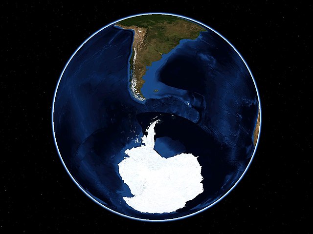
Français : Vue de la terre, centrée sur les îles Shetland du Sud. Cette vue est composée de photographies prises en juillet 2004 et reconstituée par la NASA dans son projet BlueMarble.
English: The earth, centered on the South Shetland islands. View composed from photos taken in july 2004, for the NASA's BlueMarble project. |
|||
| Date | ||||
| Source | Nasa World Wind | |||
| Author | Sémhur ·✉·✍· | |||
| Permission (Reusing this file) |
|
|||
| Other versions | Image:Livingston-Location.JPG |

| Camera location | | View this and other nearby images on: OpenStreetMap |
|---|
File history
Click on a date/time to view the file as it appeared at that time.
| Date/Time | Thumbnail | Dimensions | User | Comment | |
|---|---|---|---|---|---|
| current | 13:59, 3 August 2007 | | 1,278 × 958 (103 KB) | Sémhur (talk | contribs) | {{Information |Description= {{fr|Vue de la terre, centrée sur les îles Shetland du Sud. Cette vue est composée de photographies prises en juillet 2004 et reconstituée par la NASA dans son projet BlueMarble.}} {{en|The ear |
You cannot overwrite this file.
File usage on Commons
There are no pages that use this file.
File usage on other wikis
The following other wikis use this file:
- Usage on es.wikipedia.org