File:EU OCT and OMR map.png
Jump to navigation
Jump to search
Size of this preview: 800 × 403 pixels. Other resolutions: 320 × 161 pixels | 640 × 322 pixels | 1,024 × 516 pixels | 1,280 × 645 pixels | 2,560 × 1,290 pixels | 7,000 × 3,526 pixels.
Original file (7,000 × 3,526 pixels, file size: 3.22 MB, MIME type: image/png)
Captions
Captions
Add a one-line explanation of what this file represents

|
This map of the world image could be re-created using vector graphics as an SVG file. This has several advantages; see Commons:Media for cleanup for more information. If an SVG form of this image is available, please upload it and afterwards replace this template with
{{vector version available|new image name}}.
It is recommended to name the SVG file “EU OCT and OMR map.svg”—then the template Vector version available (or Vva) does not need the new image name parameter. |
Summary[edit]
| Description |
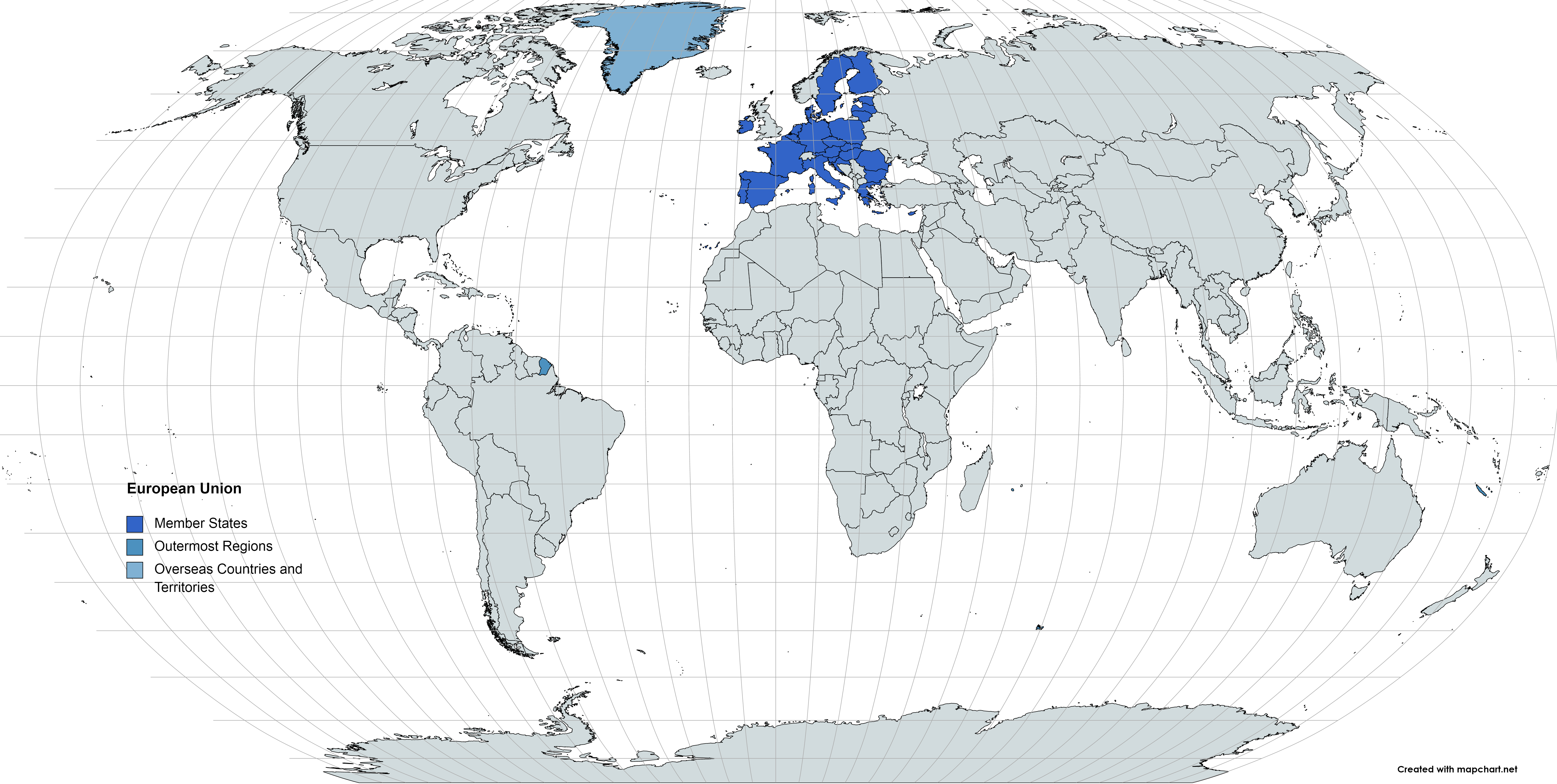
Deutsch: Karte der EU – Überseeische Länder und Hoheitsgebiete (OCT) und die Gebiete in äußerster Randlage (OMR). Diese Karte zeigt den räumlichen Geltungsbereich der Verträge der EU gemäß Artikel 52 des Vertrags über die Europäische Union und Artikel 355 des Vertrags über die Arbeitsweise der Europäischen Union.
Français : Carte de l’Union Européenne, en particulier les Pays et territoires d’outre-mer et les Régions ultrapériphériques. Cette carte montre la portée d’action territoriale des Traités de l’UE comme spécifié par l’Article 52 du Traité sur l’Union Européenne et l’Article 355 du Traité sur le Fonctionnement de l’Union Européenne.
English: Map of the EU – Overseas Countries and Territories (OCT) and Outermost Regions (OMR). This map shows the territorial scope of the Treaties of the EU as specified by Article 52 of the Treaty on European Union and Article 355 of the Treaty on the Functioning of the European Union. |
|
| Date | ||
| Source | Own work | |
| Author | Soumya-8974 | |
| Permission (Reusing this file) |
I, the copyright holder of this work, hereby publish it under the following license: This file is licensed under the Creative Commons Attribution-Share Alike 4.0 International license.
|
File history
Click on a date/time to view the file as it appeared at that time.
| Date/Time | Thumbnail | Dimensions | User | Comment | |
|---|---|---|---|---|---|
| current | 11:12, 9 June 2021 | | 7,000 × 3,526 (3.22 MB) | Sbb1413 (talk | contribs) | Changed the font. |
| 13:42, 16 May 2021 |  | 7,000 × 3,526 (3.22 MB) | Sbb1413 (talk | contribs) | {{Information |Description= {{de|1=Karte der EU – Überseeische Länder und Hoheitsgebiete (OCT) und die Gebiete in äußerster Randlage (OMR). Diese Karte zeigt den räumlichen Geltungsbereich der Verträge der EU gemäß Artikel 52 des Vertrags über die Europäische Union und Artikel 355 des [[:de:Vertrag über die Arbeitsweise der Europäischen Union|Vertrags über die Arbeitsweise d... |
You cannot overwrite this file.
File usage on Commons
The following 2 pages use this file: