File:EF4DaltonMNtornadoJuly2020.png
Jump to navigation
Jump to search

Size of this preview: 800 × 535 pixels. Other resolutions: 320 × 214 pixels | 640 × 428 pixels | 1,085 × 726 pixels.
Original file (1,085 × 726 pixels, file size: 1.04 MB, MIME type: image/png)
Captions
Captions
Add a one-line explanation of what this file represents
Summary
[edit]
| Description |
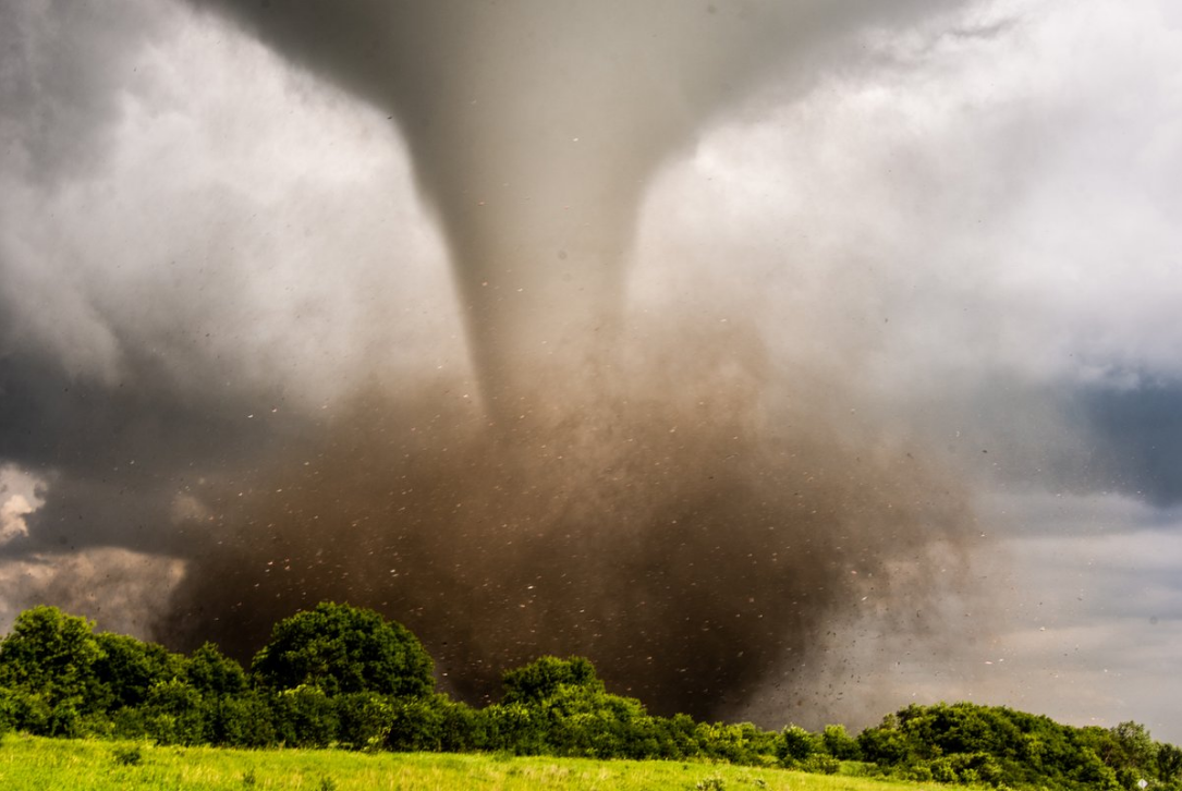
English: An EF4 tornado doing damage near Dalton, Minnesota on July 8, 2020. |
| Date | |
| Source | https://www.weather.gov/fgf/2020_07_08_Tornadoes (Exact URL & Archived URL) |
| Author | Brad Nelson |
Licensing
[edit]
This image is in the public domain because it was stored on the web servers of the U.S. National Weather Service. NWS-created images are automatically public domain in the U.S. since the NWS is a part of the U.S. government. However, the NWS sites also host non-NWS images which have been submitted by individuals: these are generally shown as "Courtesy of ...". Such images have explicitly been released to the public domain by the copyright owner as part of the upload process.
As stated at https://www.weather.gov/fsd/disclaimer: "By submitting images, you understand that your image is being released into the public domain. This means that your photo or video may be downloaded, copied, and used by others." Thus, all* images on NWS servers are public domain (including "Courtesy of ..." and “Photo by ...” images) unless specifically stated otherwise through a copyright (©) watermark.
*A deletion discussion in November 2023 ruled that Getty Images on the web servers of NWS, are to be considered copyrighted, even without a copyright (©) watermark and are the sole exception to this rule.
|
File history
Click on a date/time to view the file as it appeared at that time.
| Date/Time | Thumbnail | Dimensions | User | Comment | |
|---|---|---|---|---|---|
| current | 23:55, 12 July 2020 | | 1,085 × 726 (1.04 MB) | TornadoInformation12 (talk | contribs) | {{Information |description ={{en|1=EF4 tornado doing damage near Dalton, Minnesota.}} |date =July 8, 2020 |source =https://www.weather.gov/fgf/2020_07_08_Tornadoes |author =NWS Grand Forks, ND and Brad Nelson }} |
You cannot overwrite this file.
File usage on Commons
The following page uses this file:
File usage on other wikis
The following other wikis use this file:
- Usage on en.wikipedia.org
- Tornado
- Talk:Tornado
- Cyclone
- Dust devil
- Talk:Thunderstorm
- Horse latitudes
- Subtropical cyclone
- Anticyclone
- Supercell
- Mesocyclone
- Tornado warning
- Talk:Ball lightning
- Talk:Tornado watch
- Tri-State tornado outbreak
- Hypercane
- Talk:1990 Plainfield tornado
- Talk:1947 Glazier–Higgins–Woodward tornado outbreak
- Tornado records
- Talk:1965 Palm Sunday tornado outbreak
- High-pressure area
- Low-pressure area
- Talk:Dust devil
- Talk:Tri-State tornado outbreak
- Synoptic scale meteorology
- Talk:1974 Super Outbreak
- South Atlantic tropical cyclone
- Talk:Flint–Worcester tornado outbreak sequence
- Talk:1936 Tupelo–Gainesville tornado outbreak
- Waterspout
- Wall cloud
- Talk:Wall cloud
- Talk:Tornado records
- Tornado Alley
- Talk:Fujita scale
- Polar low
- Talk:Lubbock tornado
- Cyclogenesis
- Talk:List of disasters in Great Britain and Ireland by death toll
- Siberian High
- North American High
- Anticyclonic storm
- Polar vortex
- Talk:Storm chasing
- Funnel cloud
- Multiple-vortex tornado
- Gustnado
- Talk:Hailstorm (disambiguation)
- Talk:Waterspout
- Talk:Flash flood
- Polar High
View more global usage of this file.