File:Dkillsmouthjeh.JPG
Jump to navigation
Jump to search

Size of this preview: 781 × 600 pixels. Other resolutions: 313 × 240 pixels | 625 × 480 pixels | 1,000 × 768 pixels | 1,280 × 983 pixels | 2,560 × 1,966 pixels | 3,000 × 2,304 pixels.
Original file (3,000 × 2,304 pixels, file size: 630 KB, MIME type: image/jpeg)
Captions
Captions
Add a one-line explanation of what this file represents
Summary[edit]
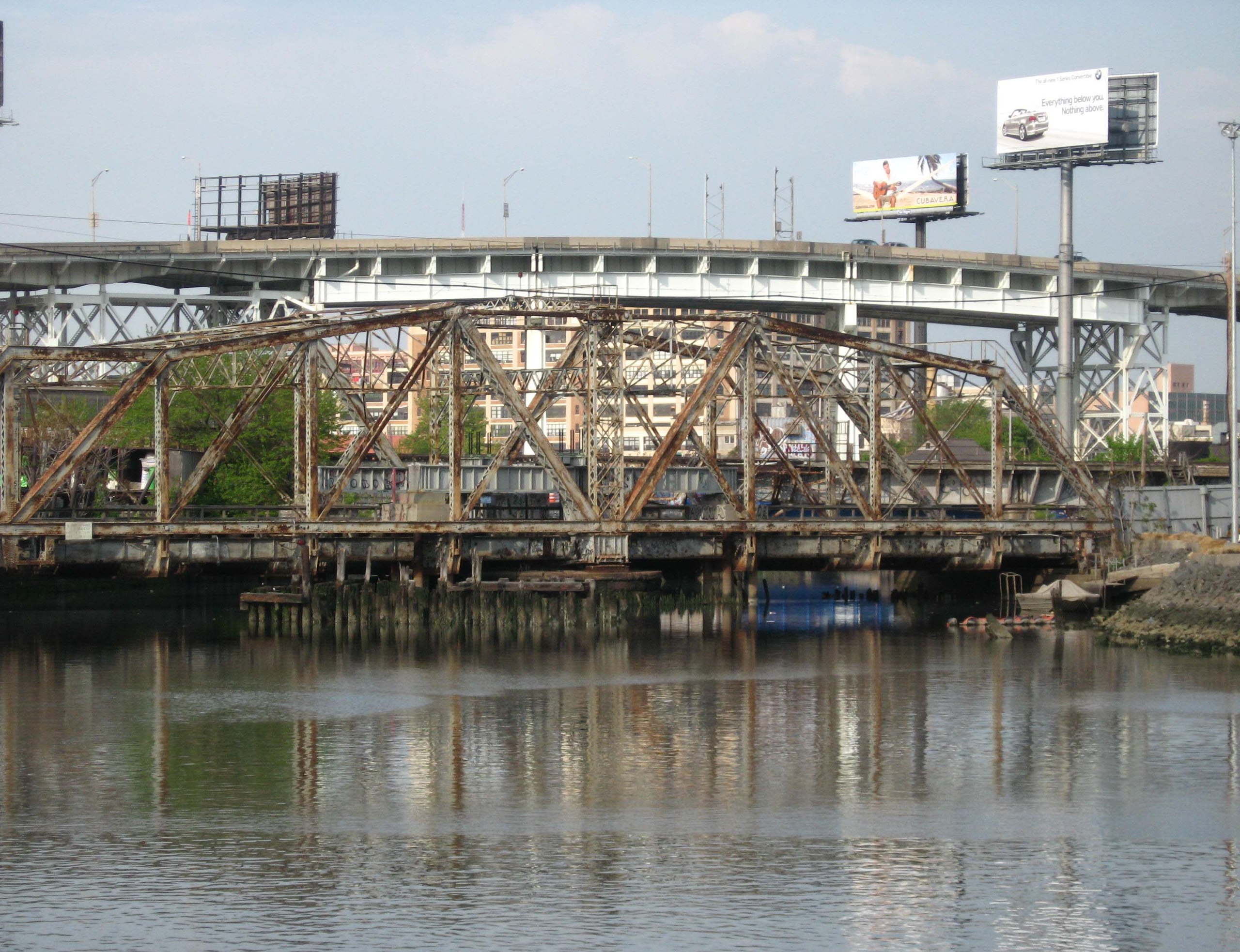
| Description | Looking east across Newtown Creek at mouth of Dutch Kills, Queens from left bank of Whale Creek showing two LIRR bridges of Lower Montauk Branch with Long Island Expressway high bridge in background. |
| Date | |
| Source | Own work |
| Author | Jim.henderson |
| Camera location | | View this and other nearby images on: OpenStreetMap |
|---|
Licensing[edit]
| I, the copyright holder of this work, release this work into the public domain. This applies worldwide. In some countries this may not be legally possible; if so: I grant anyone the right to use this work for any purpose, without any conditions, unless such conditions are required by law. |
File history
Click on a date/time to view the file as it appeared at that time.
| Date/Time | Thumbnail | Dimensions | User | Comment | |
|---|---|---|---|---|---|
| current | 22:29, 23 May 2008 | | 3,000 × 2,304 (630 KB) | Jim.henderson (talk | contribs) | {{Information |Description=Mouth of Dutch Kills from left bank of Whale Creek showing two LIRR bridges of Lower Montauk. |Source=self-made |Date= |Author= Jim.henderson |Permission= |other_versions= }} |
You cannot overwrite this file.
File usage on Commons
There are no pages that use this file.
File usage on other wikis
The following other wikis use this file:
- Usage on de.wikipedia.org