File:Distance radar.svg
Jump to navigation
Jump to search

Size of this PNG preview of this SVG file: 512 × 429 pixels. Other resolutions: 287 × 240 pixels | 573 × 480 pixels | 917 × 768 pixels | 1,222 × 1,024 pixels | 2,444 × 2,048 pixels.
Original file (SVG file, nominally 512 × 429 pixels, file size: 12 KB)
Captions
Captions
Add a one-line explanation of what this file represents
Summary
[edit]
| Description |
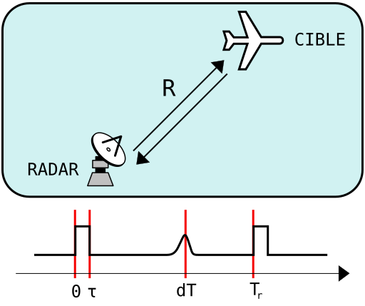
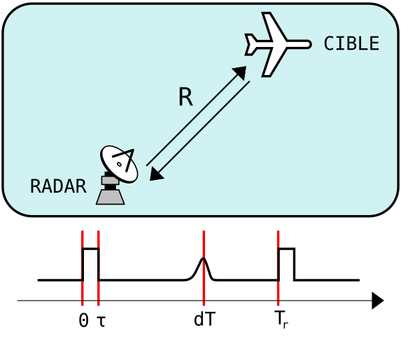
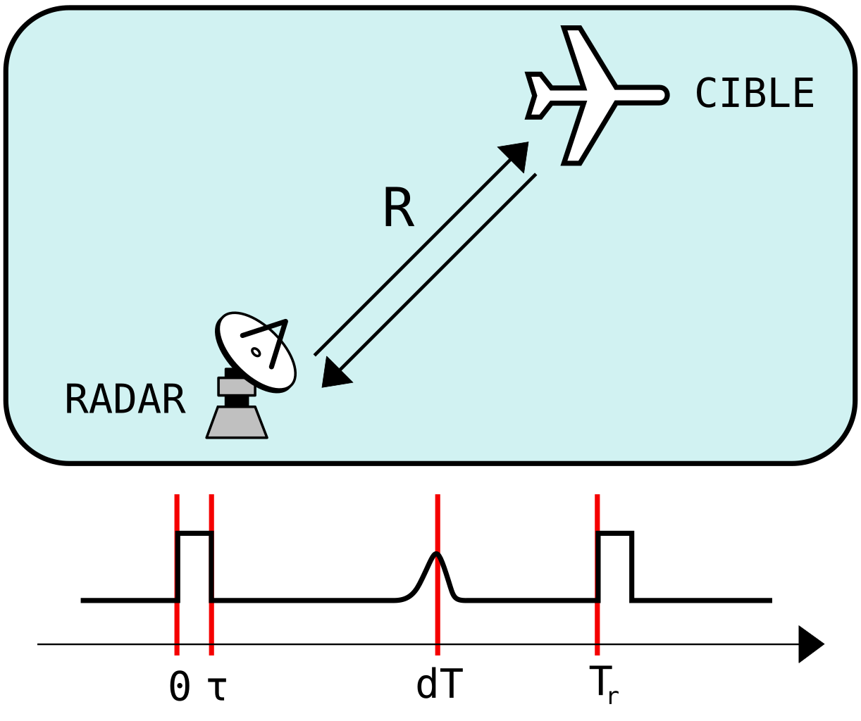
Français : schéma pour le calcul de la distance par écho radar : τ est la durée de l'impulsion radar, dT le temps aller-retour radar-cible et Tr est le temps entre deux impulsions
Italiano: Diagramma per il calcolo della distanza mediante eco radar: τ è la durata dell'impulso radar, dT il tempo impiegato per raggiungere l'obiettivo (sia in andata, sia in ritorno), Tr è il tempo tra due impulsi. |
| Date | |
| Source |
Own work |
| Author | Kilom691 |
| SVG development | This diagram was created with Inkscape. This diagram uses embedded text that can be easily translated using a text editor. |
Licensing
[edit]
I, the copyright holder of this work, hereby publish it under the following license:
This file is licensed under the Creative Commons Attribution-Share Alike 3.0 Unported license.
- You are free:
- to share – to copy, distribute and transmit the work
- to remix – to adapt the work
- Under the following conditions:
- attribution – You must give appropriate credit, provide a link to the license, and indicate if changes were made. You may do so in any reasonable manner, but not in any way that suggests the licensor endorses you or your use.
- share alike – If you remix, transform, or build upon the material, you must distribute your contributions under the same or compatible license as the original.
File history
Click on a date/time to view the file as it appeared at that time.
| Date/Time | Thumbnail | Dimensions | User | Comment | |
|---|---|---|---|---|---|
| current | 09:22, 23 July 2011 | | 512 × 429 (12 KB) | Kilom691 (talk | contribs) | + dessin de radar |
| 18:59, 22 July 2011 |  | 512 × 429 (8 KB) | Kilom691 (talk | contribs) |
You cannot overwrite this file.
File usage on Commons
The following page uses this file:
File usage on other wikis
The following other wikis use this file:
- Usage on fr.wikipedia.org
- Usage on it.wikiversity.org