File:Dendrohyrax validus distribution map.svg
Jump to navigation
Jump to search

Size of this PNG preview of this SVG file: 500 × 599 pixels. Other resolutions: 200 × 240 pixels | 400 × 480 pixels | 640 × 768 pixels | 854 × 1,024 pixels | 1,708 × 2,048 pixels | 1,508 × 1,808 pixels.
Original file (SVG file, nominally 1,508 × 1,808 pixels, file size: 3.09 MB)
Captions
Captions
Add a one-line explanation of what this file represents
Summary[edit]
| Description |
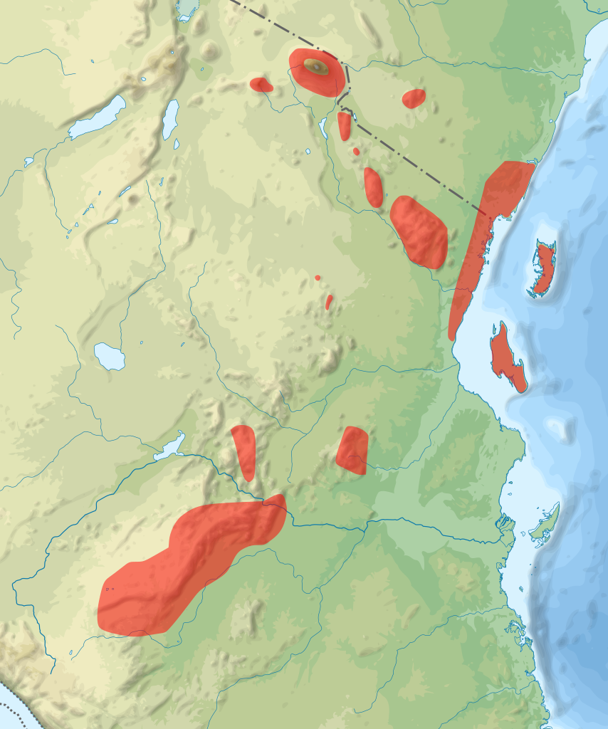
English: Distribution of Dendrohyrax validus |
|||||||||||||||||
| Date | ||||||||||||||||||
| Source | File:Tanzania relief location map.svg, [1] | |||||||||||||||||
| Author |
|
|||||||||||||||||
| Other versions | ||||||||||||||||||
| SVG | W3C-validity not checked. |
|||||||||||||||||

| Object location | | View this and other nearby images on: OpenStreetMap |
|---|

|
This map has been made or improved in the German Kartenwerkstatt (Map Lab). You can propose maps to improve as well.
|
Licensing[edit]

1. Provide a copy of, or the URI for, the applicable license: https://creativecommons.org/licenses/by-sa/4.0/de/legalcode,
2. my name as given above,
3. the title of the work,
4. in the case of an adaptation, a credit identifying the use of the work in the adaptation.
This license and the rights granted hereunder will terminate automatically upon any breach by you of the terms of this license. Any of the above conditions can be waived if you get permission from the copyright holder. If you have questions or wish differing conditions or a higher resolution, please contact me through: E-Mail via Wikipedia or my discussion page
This file is licensed under the Creative Commons Attribution-Share Alike 4.0 International license.
Attribution: Foto: Reinhard Kraasch, Lizenz: CC-BY-SA 4.0 DE
- You are free:
- to share – to copy, distribute and transmit the work
- to remix – to adapt the work
- Under the following conditions:
- attribution – You must give appropriate credit, provide a link to the license, and indicate if changes were made. You may do so in any reasonable manner, but not in any way that suggests the licensor endorses you or your use.
- share alike – If you remix, transform, or build upon the material, you must distribute your contributions under the same or compatible license as the original.

This file is licensed under the Creative Commons Attribution-Share Alike 3.0 Unported license.
Attribution: IUCN Red List of Threatened Species, species assessors and the authors of the spatial data.
- You are free:
- to share – to copy, distribute and transmit the work
- to remix – to adapt the work
- Under the following conditions:
- attribution – You must give appropriate credit, provide a link to the license, and indicate if changes were made. You may do so in any reasonable manner, but not in any way that suggests the licensor endorses you or your use.
- share alike – If you remix, transform, or build upon the material, you must distribute your contributions under the same or compatible license as the original.
This image is a derivative work of the following images:
File history
Click on a date/time to view the file as it appeared at that time.
| Date/Time | Thumbnail | Dimensions | User | Comment | |
|---|---|---|---|---|---|
| current | 11:23, 19 November 2017 | | 1,508 × 1,808 (3.09 MB) | Reinhard Kraasch (talk | contribs) | {{Information |Description={{en|Distribution of Dendrohyrax validus}} |Source=File:Tanzania relief location map.svg, [http://maps.iucnredlist.org/map.html?id=136599] |Date=2017-11-19 |Author={{Creator:Reinhard Kraasch}} |Permission= |other_version... |
You cannot overwrite this file.
File usage on Commons
The following page uses this file:
File usage on other wikis
The following other wikis use this file:
- Usage on de.wikipedia.org
- Usage on pl.wikipedia.org