File:Delineatio Præfecturæ Bahusiensis.jpg
Jump to navigation
Jump to search
Size of this preview: 800 × 307 pixels. Other resolutions: 320 × 123 pixels | 640 × 246 pixels | 1,024 × 393 pixels | 1,280 × 492 pixels | 4,125 × 1,584 pixels.
Original file (4,125 × 1,584 pixels, file size: 2.54 MB, MIME type: image/jpeg)
Captions
Captions
Add a one-line explanation of what this file represents
Summary
[edit]| Description |
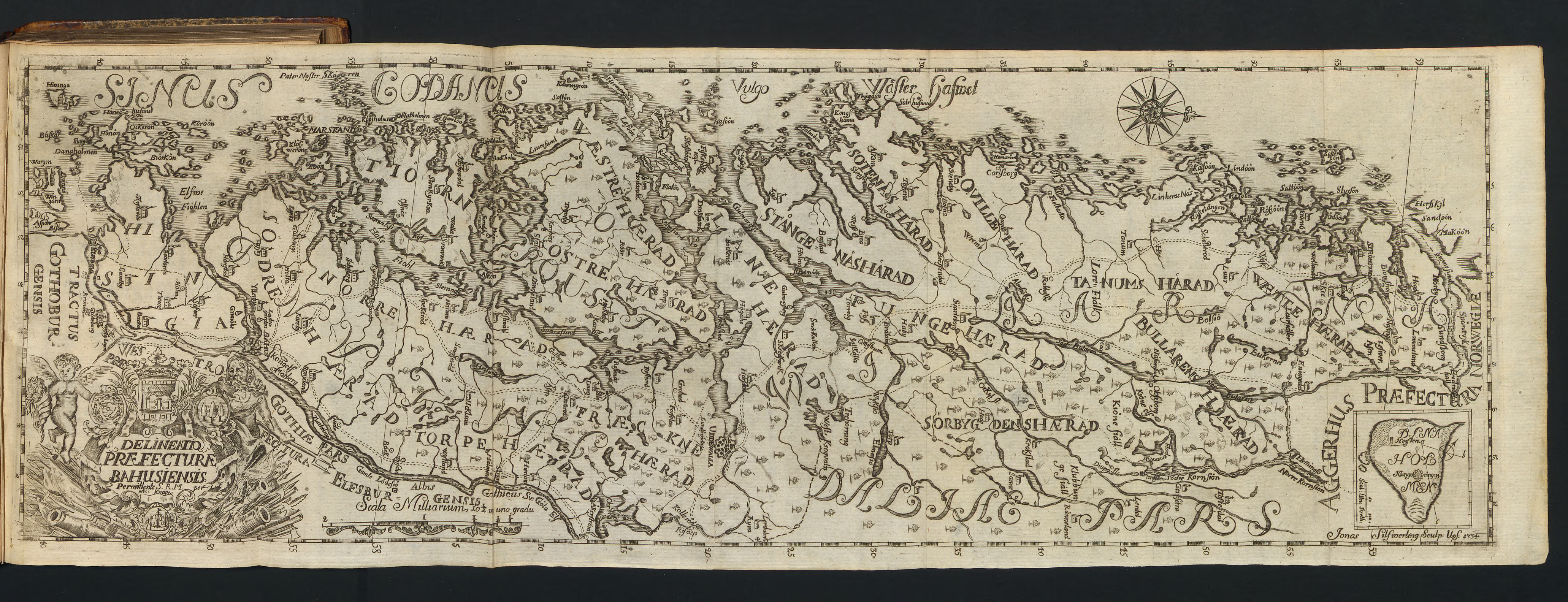
English: Engraved map of the Swedish province Bohuslän that accompanies some copies of "Bahus-Läns Beskrifning" by Johan Oedman. |
| Date | |
| Source | |
| Author | Nic: Knape, Jonas Silfwerling |

Licensing
[edit]
|
This work is in the public domain in its country of origin and other countries and areas where the copyright term is the author's life plus 100 years or fewer. This work is in the public domain in the United States because it was published (or registered with the U.S. Copyright Office) before January 1, 1929. | |
| This file has been identified as being free of known restrictions under copyright law, including all related and neighboring rights. | |
File history
Click on a date/time to view the file as it appeared at that time.
| Date/Time | Thumbnail | Dimensions | User | Comment | |
|---|---|---|---|---|---|
| current | 21:23, 15 April 2018 | 4,125 × 1,584 (2.54 MB) | Jaxner (talk | contribs) | User created page with UploadWizard |
You cannot overwrite this file.
File usage on Commons
There are no pages that use this file.
File usage on other wikis
The following other wikis use this file:
- Usage on sv.wikisource.org