File:DUN Stodulky III Praha 14 10 2019.png
Jump to navigation
Jump to search
Size of this preview: 800 × 376 pixels. Other resolutions: 320 × 150 pixels | 640 × 301 pixels | 1,024 × 481 pixels | 1,920 × 902 pixels.
Original file (1,920 × 902 pixels, file size: 2.91 MB, MIME type: image/png)
Captions
Captions
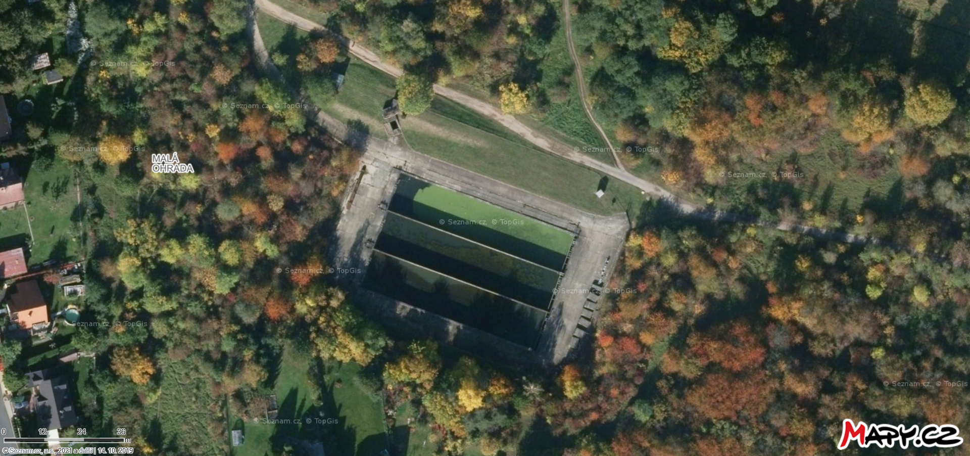
Aerial view of the Stodůlky III rainwater settling tank (DUN Stodůlky III) near the Aswan retention reservoir in Prague 5 - Jinonice
Summary
[edit]
| Description |
Čeština: Letecký pohled na dešťovou usazovací nádrž Stodůlky III (DUN Stodůlky III) poblíž retenční nádrže Asuán v Praze 5 – Jinonicích. Dešťová usazovací nádrž sbírá a svádí vody z okolních sídlišť a po předčištění je voda odváděna zatruběným vedením do retenční nádrže Asuán (Retenční nádrž N3 Stodůlky - Asuán
English: Aerial view of the Stodůlky III rainwater settling tank (DUN Stodůlky III) near the Aswan retention reservoir in Prague 5 - Jinonice. The rain settling tank collects and drains water from the surrounding settlements, and after pre-treatment, the water is drained through a pipeline to the Aswan retention tank |
| Date | |
| Source | Mapy.cz |
| Author | Mapy.cz: © Seznam.cz, a.s., © TopGis, s.r.o |
| Camera location | | View this and other nearby images on: OpenStreetMap |
|---|
Licensing
[edit]
| This screenshot comes from the map server Mapy.cz under a CC license. Their licence conditions of map bases states: "The Screenshot may also be distributed (i.e. in addition to the conditions already described) under the Creative Commons 4.0 license (CC-BY-SA 4.0) by indicating authors and sources and distributing them under the same license." |
| To the uploader: You must provide a link (URL) to the original file and the authorship information if available. |
This file is licensed under the Creative Commons Attribution-Share Alike 4.0 International license.
|
File history
Click on a date/time to view the file as it appeared at that time.
| Date/Time | Thumbnail | Dimensions | User | Comment | |
|---|---|---|---|---|---|
| current | 18:46, 26 June 2021 | | 1,920 × 902 (2.91 MB) | Mojmir Churavy (talk | contribs) | Uploaded a work by Mapy.cz: © Seznam.cz, a.s., © TopGis, s.r.o from [https://mapy.cz Mapy.cz] with UploadWizard |
You cannot overwrite this file.
File usage on Commons
There are no pages that use this file.
File usage on other wikis
The following other wikis use this file:
- Usage on cs.wikipedia.org