File:DEU Leidersbach COA.svg
Jump to navigation
Jump to search

Size of this PNG preview of this SVG file: 548 × 600 pixels. Other resolutions: 219 × 240 pixels | 439 × 480 pixels | 702 × 768 pixels | 936 × 1,024 pixels | 1,872 × 2,048 pixels | 968 × 1,059 pixels.
Original file (SVG file, nominally 968 × 1,059 pixels, file size: 75 KB)
Captions
Captions
Add a one-line explanation of what this file represents
Summary
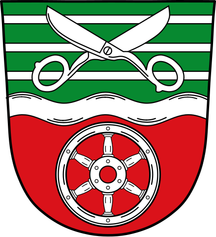
[edit]| Coat of arms | Deutsch: der Gemeinde Leidersbachim Landkreis Miltenberg, Bayern
English: of the municipality of Leidersbachin the district of Miltenberg, in Bavaria |
| Blazon | Deutsch: Durch silbernen Wellenbalken geteilt von Grün und Rot; oben drei silberne Leisten, überdeckt von einer geöffneten silbernen Schere, unten ein sechsspeichiges silbernes Rad. |
| Blazon reference | |
| Tincture (BY) | argentgulesvert |
| Date | 20 February 1979 |
| Object history |
Deutsch: Die Gemeinde Leidersbach besteht seit 1972 aus den ehemals selbstständigen Gemeinden Ebersbach, Leidersbach, Rossbach und Volkersbrunn. Das Gemeindegebiet kam im 13. Jahrhundert an den Kurstaat Mainz und blieb dort bis zum Ende des Alten Reichs 1803. Daran erinnern das sechsspeichige Rad, das Mainzer Rad, sowie die Farben Silber und Rot. Die drei silbernen Leisten stellen so genannte Streifengüter dar, eine für die Gemeindeflur typische Einteilung in blockförmige Hufen. Die Schere ist ein Symbol für das Schneiderhandwerk. Bis in das 19. Jahrhundert lebte die Bevölkerung fast ausschließlich von der Landwirtschaft und der Schafhaltung. Seit dieser Zeit begann das Schneiderhandwerk eine immer größere Rolle zu spielen, sodass bis in die 1980er-Jahre weit über die Hälfte der Bevölkerung auf irgendeine Weise mit der Bekleidungsindustrie verbunden war. Der Wellenbalken steht redend für den Ortsnamenbestandteil -bach der drei Orte Ebersbach, Leidersbach und Rossbach. |
| Artist | Original: traditional Vector: |
| Source | Own work using: [1] |
| Other versions |
|
| SVG development | Coat of arms created for the Project “Heraldry” of the German speaking Wikipedia |

Licensing
[edit]
This file depicts the coat of arms of a German Körperschaft des öffentlichen Rechts (corporation governed by public law). According to § 5 Abs. 1 of the German Copyright law, official works like coats of arms are in the public domain.
Note: The usage of coats of arms is governed by legal restrictions, independent of the copyright status of the depiction shown here.
|
 |
File history
Click on a date/time to view the file as it appeared at that time.
| Date/Time | Thumbnail | Dimensions | User | Comment | |
|---|---|---|---|---|---|
| current | 07:33, 27 March 2023 | | 968 × 1,059 (75 KB) | Gliwi (talk | contribs) | Wasserzeichen entfernt. |
| 06:18, 27 August 2015 |  | 512 × 559 (27 KB) | Gliwi (talk | contribs) | Eine Kleinigkeit ausgebessert | |
| 06:53, 12 June 2015 |  | 512 × 559 (27 KB) | Gliwi (talk | contribs) | {{Information |Description=Deutsch: Wappen von Leidersbach, English: Coat of Arms of Leidersbach |Source=https://www.verwaltungsservice.bayern.de/dokumente/behoerde/48885980627 |Date=12.06.2015 |Author=Gliwi |Permission= |other_versions= }} |
You cannot overwrite this file.
File usage on Commons
The following 7 pages use this file:
File usage on other wikis
The following other wikis use this file:
- Usage on ce.wikipedia.org
- Usage on da.wikipedia.org
- Usage on de.wikipedia.org
- Leidersbach
- Liste der Wappen im Landkreis Miltenberg
- Liste der Wappen mit dem Mainzer Rad
- Benutzer:Chjb
- Benutzer:Vorlage/aus Leidersbach
- Benutzer:Chjb/Seitenleiste
- Volkersbrunn
- Liste der Baudenkmäler in Leidersbach
- Kategorie:Benutzer:aus Leidersbach
- Ebersbach (Leidersbach)
- Roßbach (Leidersbach, Ort)
- Vorlage:Navigationsleiste Ortsteile von Leidersbach
- Liste der Gemeinden im Landkreis Miltenberg
- Usage on en.wikipedia.org
- Usage on eo.wikipedia.org
- Usage on es.wikipedia.org
- Usage on eu.wikipedia.org
- Usage on fa.wikipedia.org
- Usage on fr.wikipedia.org
- Usage on hu.wikipedia.org
- Usage on hy.wikipedia.org
- Usage on id.wikipedia.org
- Usage on it.wikipedia.org
- Usage on ja.wikipedia.org
- Usage on ku.wikipedia.org
- Usage on lld.wikipedia.org
- Usage on lmo.wikipedia.org
- Usage on ms.wikipedia.org
- Usage on nl.wikipedia.org
- Usage on pl.wikipedia.org
- Usage on pl.wikivoyage.org
- Usage on pt.wikipedia.org
- Usage on ro.wikipedia.org
- Usage on ru.wikipedia.org
- Usage on sh.wikipedia.org
- Usage on simple.wikipedia.org
- Usage on sr.wikipedia.org
- Usage on sv.wikipedia.org
- Usage on tt.wikipedia.org
- Usage on uk.wikipedia.org
- Usage on uz.wikipedia.org
- Usage on www.wikidata.org