File:DC-blank.svg
Jump to navigation
Jump to search

Size of this PNG preview of this SVG file: 480 × 600 pixels. Other resolutions: 192 × 240 pixels | 384 × 480 pixels | 614 × 768 pixels | 819 × 1,024 pixels | 1,638 × 2,048 pixels | 600 × 750 pixels.
Original file (SVG file, nominally 600 × 750 pixels, file size: 7 KB)
Captions
Captions
Add a one-line explanation of what this file represents
Summary[edit]
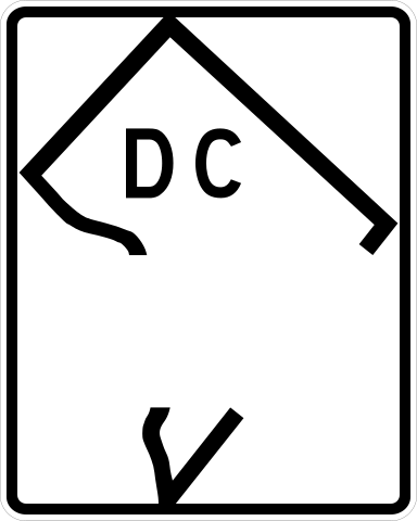
| Description | 600 mm by 750 mm (24 in by 30 in) blank District of Columbia shield, made to the specifications of the Manual on Uniform Traffic Control Devices (MUTCD), 2003 Edition (sign M1-5). Uses the Roadgeek 2005 fonts. (United States law does not permit the copyrighting of typeface designs, and the fonts are meant to be copies of a U.S. Government-produced work anyway.) Design based on [1] and Image:DC-295.png. |
| Date | |
| Source | Own work |
| Author | TwinsMetsFan |
| Permission (Reusing this file) |
Public domain |
![[1]](http://www.aaroadtrips.com/district_of_columbia/dc-295_sb_end_02.jpg)
Licensing[edit]
| This image of simple geometry is ineligible for copyright and therefore in the public domain, because it consists entirely of information that is common property and contains no original authorship. |  |
File history
Click on a date/time to view the file as it appeared at that time.
| Date/Time | Thumbnail | Dimensions | User | Comment | |
|---|---|---|---|---|---|
| current | 22:01, 1 January 2007 | | 600 × 750 (7 KB) | TwinsMetsFan (talk | contribs) | {{Information |Description=600 mm by 750 mm (24 in by 30 in) blank District of Columbia shield, made to the specifications of the Manual on Uniform Traffic Control Devices (MUTCD), 2003 Edition (sign M1-5). Uses the Roadgeek 2005 fonts. (United States law |
You cannot overwrite this file.
File usage on Commons
The following 3 pages use this file:
File usage on other wikis
The following other wikis use this file:
- Usage on en.wikipedia.org
- Talk:Interstate 66
- Talk:List of numbered highways in Washington, D.C.
- Talk:Interstate 395 (Virginia–District of Columbia)
- Talk:Interstate 266
- Talk:Interstate 295 (Maryland–District of Columbia)
- Talk:Interstate 695 (District of Columbia)
- Talk:George Washington Memorial Parkway
- Talk:U.S. Route 240
- Maine Avenue
- Talk:District of Columbia Route 295
- Talk:Rock Creek and Potomac Parkway
- Talk:Suitland Parkway
- Talk:Streets and highways of Washington, D.C.
- Observatory Circle
- Category talk:U.S. Route 1
- Wikipedia:WikiProject U.S. Roads/Shields task force/Database
- 18th Street NW
- Talk:District of Columbia Route 4
- Talk:North Central Freeway (Washington, D.C.)
- Talk:Northeast Freeway (Washington, D.C.)
- Talk:U.S. Route 50 in the District of Columbia
- Talk:Inner Loop (Washington, D.C.)
- Talk:U.S. Route 1 Alternate (Washington, D.C.)
- Columbia Road
- Wikipedia:WikiProject U.S. Roads/Stub templates
- Talk:E Street Expressway
- Talk:U.S. Route 1 in the District of Columbia
- Talk:U.S. Route 29 in the District of Columbia
- Talk:Whitehurst Freeway
- Template:WashingtonDC-road-stub
- Talk:Special routes of U.S. Route 1
- Talk:Interstate 95 in the District of Columbia
- Talk:Clara Barton Parkway
- Category talk:U.S. Route 29
- Template talk:WashingtonDC-road-stub
- Category talk:U.S. Route 50
- Category talk:Interstate 95
- Category talk:Roads in Washington, D.C.
- Category talk:Routes in Washington, D.C.
- Southern Avenue (Washington, D.C.)
- Wikipedia:WikiProject U.S. Roads/Userbox list
- Wikipedia:Userboxes/WikiProjects/Regional/03
- Wikipedia:WikiProject U.S. Roads/District of Columbia
- Wikipedia:WikiProject U.S. Roads/District of Columbia/Userbox
- Wikipedia talk:WikiProject U.S. Roads/District of Columbia/Userbox
- Category talk:Roads on the National Register of Historic Places in Washington, D.C.
- Talk:U.S. Route 240 in Washington, D.C.
- File talk:Interstate 395 Alternate 1.jpg
- File talk:Interstate 395 Alternate 2.jpg
- Category talk:File-Class District of Columbia road transport articles
View more global usage of this file.