File:Crozet Islands map-fr.svg
Jump to navigation
Jump to search

Size of this PNG preview of this SVG file: 800 × 521 pixels. Other resolutions: 320 × 208 pixels | 640 × 417 pixels | 1,024 × 666 pixels | 1,280 × 833 pixels | 2,560 × 1,666 pixels | 3,849 × 2,505 pixels.
Original file (SVG file, nominally 3,849 × 2,505 pixels, file size: 1.99 MB)
Captions
Captions
Add a one-line explanation of what this file represents
Summary[edit]
| Description |
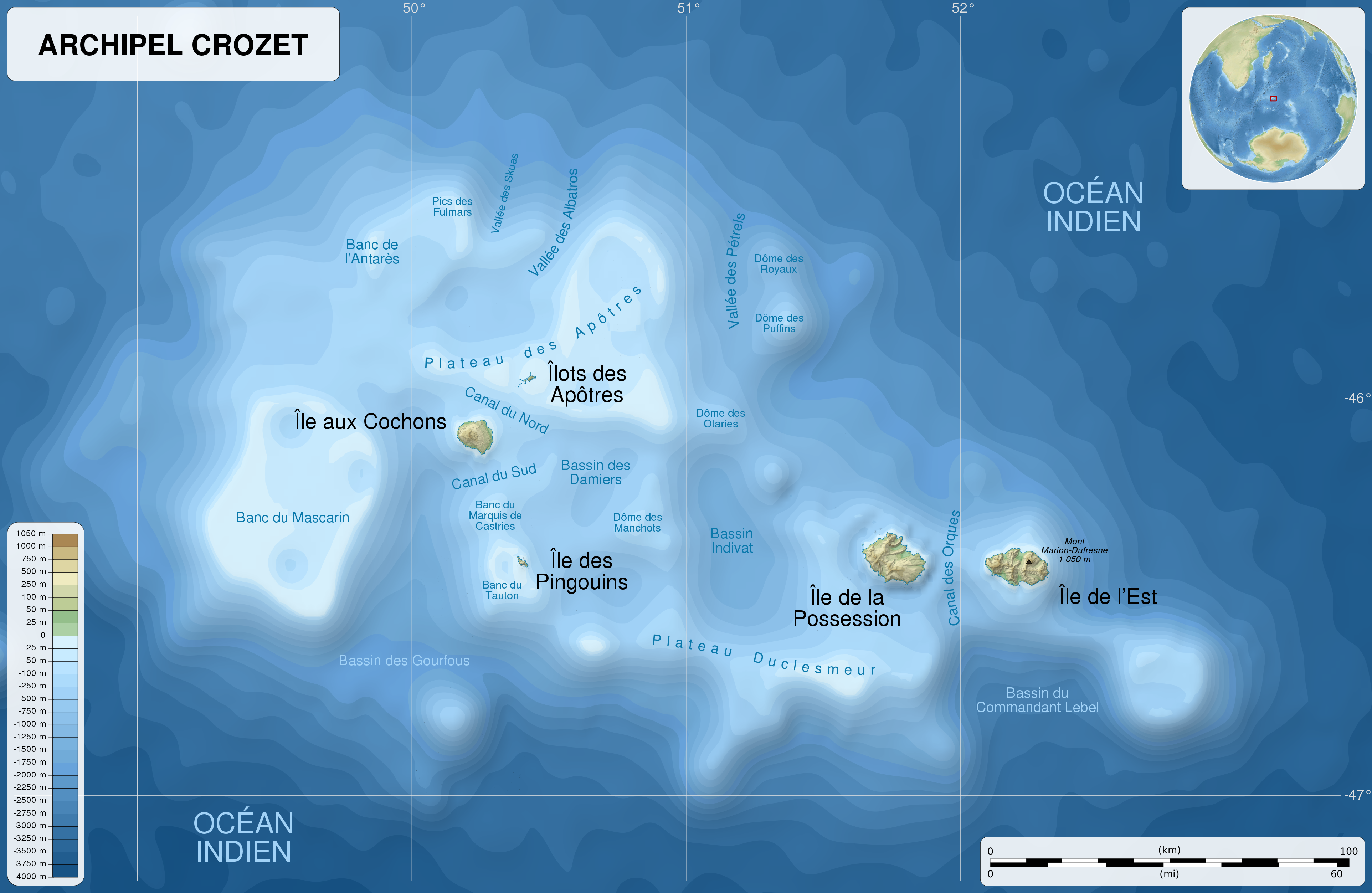
English: Map of the Crozet Islands, French Southern and Antarctic Lands, in French.
Equirectangular projection. -45° N, 48.25° W, 53.5° E, -47.25° S. Center : -46.125, 50.875 Español: Mapa de las Islas Crozet, Tierras Australes y Antárticas Francesas, en francés.
Proyección cilíndrica equidistante. -45° N, 48.25° O, 53.5° E, -47.25° S. Centro : -46.125, 50.875 Français : Carte de l'archipel Crozet, Terres australes et antarctiques françaises.
Projection cylindrique équidistante. -45° N, 48.25° O, 53.5° E, -47.25° S. Centre : -46.125, 50.875 |
| Date | (UTC) |
| Source |
Own work. English: Sources:
Français : Sources :
|
| Author | Sémhur (talk) |
| Other versions |
File:Crozet Islands relief location map.svg: blank map |
| Attribution (required by the license) | © Sémhur / Wikimedia Commons / |
| SVG development |
| Camera location | | View this and other nearby images on: OpenStreetMap |
|---|
Licensing[edit]
I, the copyright holder of this work, hereby publish it under the following licenses:
| Copyleft: This work of art is free; you can redistribute it and/or modify it according to terms of the Free Art License. You will find a specimen of this license on the Copyleft Attitude site as well as on other sites. |
This file is licensed under the Creative Commons Attribution-Share Alike Attribution-Share Alike 4.0 International, 3.0 Unported, 2.5 Generic, 2.0 Generic and 1.0 Generic license.
- You are free:
- to share – to copy, distribute and transmit the work
- to remix – to adapt the work
- Under the following conditions:
- attribution – You must give appropriate credit, provide a link to the license, and indicate if changes were made. You may do so in any reasonable manner, but not in any way that suggests the licensor endorses you or your use.
- share alike – If you remix, transform, or build upon the material, you must distribute your contributions under the same or compatible license as the original.
You may select the license of your choice.
File history
Click on a date/time to view the file as it appeared at that time.
| Date/Time | Thumbnail | Dimensions | User | Comment | |
|---|---|---|---|---|---|
| current | 20:52, 25 March 2017 | | 3,849 × 2,505 (1.99 MB) | Sémhur (talk | contribs) | == {{int:filedesc}} == {{Information |Description={{Multilingual description/start}} {{en|1=Map of the en:Crozet Islands, French Southern and Antarctic Lands, in French.<br>Equirectangular projection. -45° N, 48.25° W, 53.5° E, -47.25° S. Cen... |
You cannot overwrite this file.
File usage on Commons
The following 3 pages use this file:
File usage on other wikis
The following other wikis use this file:
- Usage on fr.wikipedia.org
- Usage on it.wikipedia.org
- Usage on www.wikidata.org