File:Croix de chemin dite La croix de Créteuil - Vue d'ensemble (revers) - Chaudenay - Médiathèque de l'architecture et du patrimoine - APMH00022793.jpg
Jump to navigation
Jump to search
No higher resolution available.
Croix_de_chemin_dite_La_croix_de_Créteuil_-_Vue_d'ensemble_(revers)_-_Chaudenay_-_Médiathèque_de_l'architecture_et_du_patrimoine_-_APMH00022793.jpg (372 × 512 pixels, file size: 31 KB, MIME type: image/jpeg)
Captions
Captions
Add a one-line explanation of what this file represents
Summary
[edit]_-_Chaudenay_-_M%C3%A9diath%C3%A8que_de_l%27architecture_et_du_patrimoine_-_APMH00022793.jpg&action=edit§ion=1)
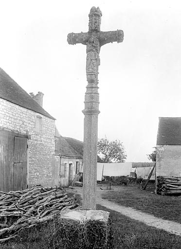
| Français : Croix de chemin dite La croix de Créteuil.
( |
|||||||||||||||||
|---|---|---|---|---|---|---|---|---|---|---|---|---|---|---|---|---|---|
| Photographer |
|
||||||||||||||||
| Title |
Français : Croix de chemin dite La croix de Créteuil. |
||||||||||||||||
| Description |
Français : Vue d'ensemble (revers). |
||||||||||||||||
| Depicted place |
Français : Chaudenay, Saône-et-Loire, France. |
||||||||||||||||
| Medium | Negative film | ||||||||||||||||
| Accession number |
MH0022793 |
||||||||||||||||
| References | Base Mémoire: APMH00022793 | ||||||||||||||||
| Source | Médiathèque de l'architecture et du patrimoine (image) | ||||||||||||||||
| Permission (Reusing this file) |
This file is licensed under the Creative Commons Attribution-Share Alike 4.0 International license.
|
||||||||||||||||
| Object location | | View this and other nearby images on: OpenStreetMap |
|---|
_-_Chaudenay_-_M%C3%A9diath%C3%A8que_de_l%27architecture_et_du_patrimoine_-_APMH00022793.jpg¶ms=046.915425_N_0004.795384_E_globe:Earth_class:object_region:FR_type:landmark_scale:1500_&language=en)
|
This building is inscrit au titre des monuments historiques de la France. It is indexed in the base Mérimée, a database of architectural heritage maintained by the French Ministry of Culture, under the reference PA00113210
|
File history
Click on a date/time to view the file as it appeared at that time.
| Date/Time | Thumbnail | Dimensions | User | Comment | |
|---|---|---|---|---|---|
| current | 04:59, 28 April 2020 | | 372 × 512 (31 KB) | Gzen92Bot (talk | contribs) | image from data.culture.gouv.fr |
You cannot overwrite this file.
File usage on Commons
The following 2 pages use this file:
_-_Chaudenay_-_M%C3%A9diath%C3%A8que_de_l%27architecture_et_du_patrimoine_-_APMH00022793.jpg)
File usage on other wikis
The following other wikis use this file:
- Usage on fr.wikipedia.org
- Usage on www.wikidata.org
_-_Chaudenay_-_Médiathèque_de_l%27architecture_et_du_patrimoine_-_APMH00022793.jpg&oldid=871241406)