File:Cridon.svg
Jump to navigation
Jump to search

Size of this PNG preview of this SVG file: 530 × 550 pixels. Other resolutions: 231 × 240 pixels | 463 × 480 pixels | 740 × 768 pixels | 987 × 1,024 pixels | 1,974 × 2,048 pixels.
Original file (SVG file, nominally 530 × 550 pixels, file size: 494 KB)
Captions
Captions
Add a one-line explanation of what this file represents
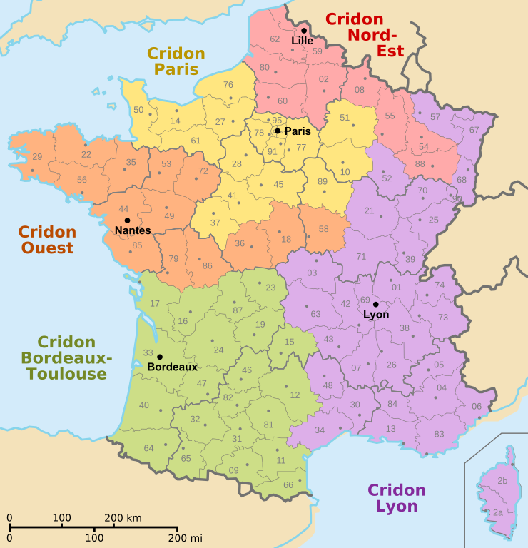
| Description | Map of France showing Cridon geographical areas |
| Source | Based on Départements et régions de France.svg by Bayo, modified by IP 84.5 |
| Author | Bayo, IP 84.5 |
Permission
[edit]
| This work has been released into the public domain by its author, Bayo. This applies worldwide. In some countries this may not be legally possible; if so: |
File history
Click on a date/time to view the file as it appeared at that time.
| Date/Time | Thumbnail | Dimensions | User | Comment | |
|---|---|---|---|---|---|
| current | 10:05, 12 April 2024 | | 530 × 550 (494 KB) | Jack ma (talk | contribs) | Updated regions of 2016 |
| 15:10, 16 April 2008 |  | 530 × 550 (524 KB) | IP 84.5~commonswiki (talk | contribs) | {{Information |Description=Map of France showing Cridon geographical areas |Source=Based on [[:Image:Départements et régions de France.svg|Départements et régions de France.sv | |
| 14:33, 16 April 2008 |  | 588 × 550 (441 KB) | IP 84.5~commonswiki (talk | contribs) | {{Information |Description=Map of France showing Cridon geographical areas |Source=Based on Image:Départements et régions de France.svg by User:Bayo, modified by [[Use |
You cannot overwrite this file.
File usage on Commons
There are no pages that use this file.
File usage on other wikis
The following other wikis use this file:
- Usage on fr.wikipedia.org
- Usage on lt.wikipedia.org