File:Craggy Gardens visitor center NC1.jpg
Original file (4,245 × 3,099 pixels, file size: 6.64 MB, MIME type: image/jpeg)
Captions
Summary
[edit]DescriptionCraggy Gardens visitor center NC1.jpg |
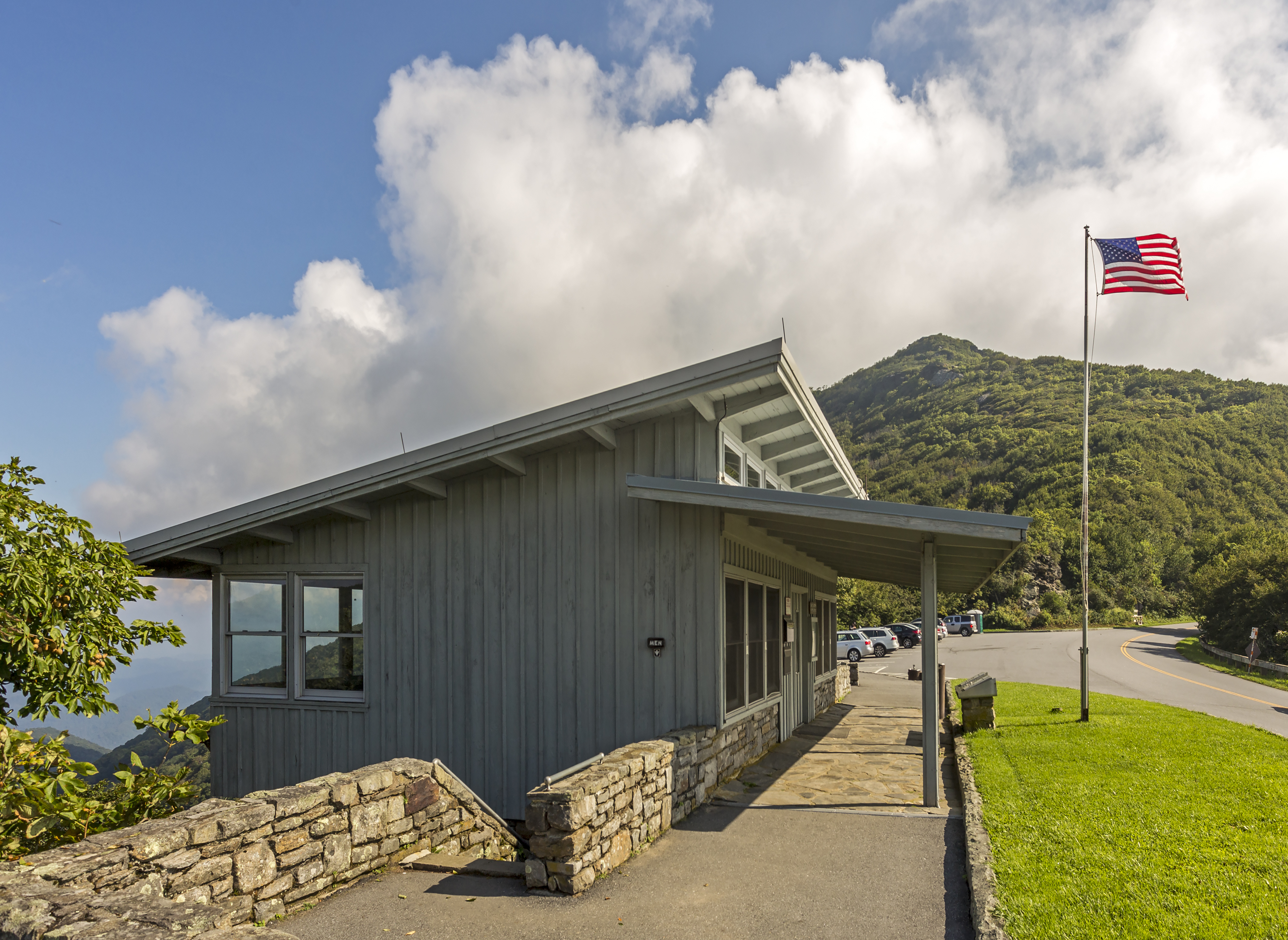
English: The Craggy Gardens visitor center on the Blue Ridge Parkway, North Carolina, USA |
Date | |
Source | Own work |
Author | Acroterion |
Camera location | 35° 42′ 00.73″ N, 82° 22′ 45.97″ W | View this and other nearby images on: OpenStreetMap | 35.700203; -82.379435 |
---|
This is a photo of a Historic Civil Engineering Landmark designated by the American Society of Civil Engineers. Its listing can be found at: blue-ridge-parkway.
|
This image was uploaded as part of Wiki Loves Monuments 2021.
Afrikaans ∙ Alemannisch ∙ azərbaycanca ∙ Bahasa Indonesia ∙ Bahasa Melayu ∙ Bikol Central ∙ bosanski ∙ brezhoneg ∙ català ∙ čeština ∙ Cymraeg ∙ dansk ∙ davvisámegiella ∙ Deutsch ∙ eesti ∙ English ∙ español ∙ Esperanto ∙ euskara ∙ français ∙ Frysk ∙ Gaeilge ∙ galego ∙ hrvatski ∙ Ido ∙ italiano ∙ latviešu ∙ Lëtzebuergesch ∙ Malagasy ∙ magyar ∙ Malti ∙ Nederlands ∙ norsk ∙ norsk nynorsk ∙ norsk bokmål ∙ polski ∙ português ∙ português do Brasil ∙ română ∙ shqip ∙ sicilianu ∙ slovenčina ∙ slovenščina ∙ suomi ∙ svenska ∙ Tagalog ∙ Türkçe ∙ Yorùbá ∙ Zazaki ∙ Ελληνικά ∙ беларуская ∙ беларуская (тарашкевіца) ∙ български ∙ кыргызча ∙ македонски ∙ русский ∙ српски / srpski ∙ українська ∙ ქართული ∙ հայերեն ∙ नेपाली ∙ हिन्दी ∙ বাংলা ∙ മലയാളം ∙ ไทย ∙ 한국어 ∙ +/− |
Licensing
[edit]- You are free:
- to share – to copy, distribute and transmit the work
- to remix – to adapt the work
- Under the following conditions:
- attribution – You must give appropriate credit, provide a link to the license, and indicate if changes were made. You may do so in any reasonable manner, but not in any way that suggests the licensor endorses you or your use.
- share alike – If you remix, transform, or build upon the material, you must distribute your contributions under the same or compatible license as the original.
File history
Click on a date/time to view the file as it appeared at that time.
Date/Time | Thumbnail | Dimensions | User | Comment | |
---|---|---|---|---|---|
current | 02:48, 9 October 2021 | 4,245 × 3,099 (6.64 MB) | Acroterion (talk | contribs) | {{Information |Description={{en|1=The Craggy Gardens visitor center on the Blue Ridge Parkway, North Carolina, USA}} |Source={{own}} |Date=2017-08-22 |Author=Acroterion |Permission= |other_versions= }} {{Wiki Loves Monuments 2021|us-nc}} Category:Craggy Gardens Visitor Center |
You cannot overwrite this file.
File usage on Commons
There are no pages that use this file.
Metadata
This file contains additional information such as Exif metadata which may have been added by the digital camera, scanner, or software program used to create or digitize it. If the file has been modified from its original state, some details such as the timestamp may not fully reflect those of the original file. The timestamp is only as accurate as the clock in the camera, and it may be completely wrong.
Camera manufacturer | Canon |
---|---|
Camera model | Canon EOS 6D |
Exposure time | 1/200 sec (0.005) |
F-number | f/9 |
ISO speed rating | 100 |
Date and time of data generation | 14:12, 22 August 2017 |
Lens focal length | 17 mm |
Latitude | 35° 42′ 0.73″ N |
Longitude | 82° 22′ 45.97″ W |
Altitude | 1,680.7 meters above sea level |
Orientation | Normal |
Horizontal resolution | 300 dpi |
Vertical resolution | 300 dpi |
Software used | Adobe Photoshop 22.5 (Windows) |
File change date and time | 22:45, 8 October 2021 |
Exposure Program | Aperture priority |
Exif version | 2.3 |
Date and time of digitizing | 14:12, 22 August 2017 |
APEX shutter speed | 7.643856 |
APEX aperture | 6.33985 |
APEX exposure bias | 0 |
Maximum land aperture | 4 APEX (f/4) |
Metering mode | Pattern |
Flash | Flash did not fire, compulsory flash suppression |
DateTime subseconds | 16 |
DateTimeOriginal subseconds | 16 |
DateTimeDigitized subseconds | 16 |
Color space | Uncalibrated |
Focal plane X resolution | 1,520 |
Focal plane Y resolution | 1,520 |
Focal plane resolution unit | 3 |
Custom image processing | Normal process |
Exposure mode | Auto bracket |
White balance | Auto white balance |
Scene capture type | Standard |
GPS time (atomic clock) | 14:12 |
Satellites used for measurement | 12 |
Receiver status | Measurement in progress |
Measurement mode | 3-dimensional measurement |
Geodetic survey data used | WGS-84 |
GPS date | 22 August 2017 |
GPS tag version | 0.0.3.2 |
Serial number of camera | 122025005461 |
Lens used | EF17-40mm f/4L USM |
Rating (out of 5) | 0 |
Date metadata was last modified | 18:45, 8 October 2021 |
Unique ID of original document | B57A69D3C35E495B4376C08B08C8CC9E |
Keywords | 2017 Eclipse trip |
Structured data
Items portrayed in this file
depicts
35°42'0.731"N, 82°22'45.966"W
0.005 second
17 millimetre
100
22 August 2017
image/jpeg
c62e6696766fa70ac9a0366161bb68d3793c18d5
6,962,352 byte
3,099 pixel
4,245 pixel
- Files with coordinates missing SDC location of creation
- Historic Civil Engineering Landmarks with known IDs
- Images from Wiki Loves Monuments 2021
- Images from Wiki Loves Monuments 2021 in the United States
- Images from Wiki Loves Monuments 2021 in North Carolina
- Images from Wiki Loves Monuments missing SDC location of creation
- CC-BY-SA-4.0
- Self-published work
- Wiki Loves Monuments 2021 in the United States unreviewed
- Pages with maps