File:Cool signpost for National Cycle Network route 4 - geograph.org.uk - 219649.jpg
Jump to navigation
Jump to search
No higher resolution available.
Cool_signpost_for_National_Cycle_Network_route_4_-_geograph.org.uk_-_219649.jpg (640 × 480 pixels, file size: 122 KB, MIME type: image/jpeg)
Captions
Captions
Add a one-line explanation of what this file represents
Summary[edit]
| Description |
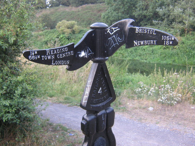
English: Cool signpost for National Cycle Network route 4. This very cool-looking sign with wavy fingerboards can be found just off Rose Kiln Lane, near the A33 roundabout. It marks National Cycle Network route 4 which runs from London to St David's on the west coast of Wales, via Reading. |
| Date | |
| Source | From geograph.org.uk |
| Author | Chris Matson |
| Attribution (required by the license) | Chris Matson / Cool signpost for National Cycle Network route 4 / |
| Object location | | View this and other nearby images on: OpenStreetMap |
|---|
_heading:45.00&language=en)
Licensing[edit]

|
This image was taken from the Geograph project collection. See this photograph's page on the Geograph website for the photographer's contact details. The copyright on this image is owned by Chris Matson and is licensed for reuse under the Creative Commons Attribution-ShareAlike 2.0 license.
|
This file is licensed under the Creative Commons Attribution-Share Alike 2.0 Generic license.
Attribution: Chris Matson
- You are free:
- to share – to copy, distribute and transmit the work
- to remix – to adapt the work
- Under the following conditions:
- attribution – You must give appropriate credit, provide a link to the license, and indicate if changes were made. You may do so in any reasonable manner, but not in any way that suggests the licensor endorses you or your use.
- share alike – If you remix, transform, or build upon the material, you must distribute your contributions under the same or compatible license as the original.
File history
Click on a date/time to view the file as it appeared at that time.
| Date/Time | Thumbnail | Dimensions | User | Comment | |
|---|---|---|---|---|---|
| current | 20:52, 31 January 2010 | | 640 × 480 (122 KB) | GeographBot (talk | contribs) | == {{int:filedesc}} == {{Information |description={{en|1=Cool signpost for National Cycle Network route 4. This very cool-looking sign with wavy fingerboards can be found just off Rose Kiln Lane, near the A33 roundabout. It marks National Cycle Network ro |
You cannot overwrite this file.
File usage on Commons
The following page uses this file: