File:Continental shelf boundaries parties insisted in ICJ cases of North Sea Continental Shelf.png
Original file (1,272 × 1,988 pixels, file size: 84 KB, MIME type: image/png)
Captions
Captions
Summary[edit]
| Description |
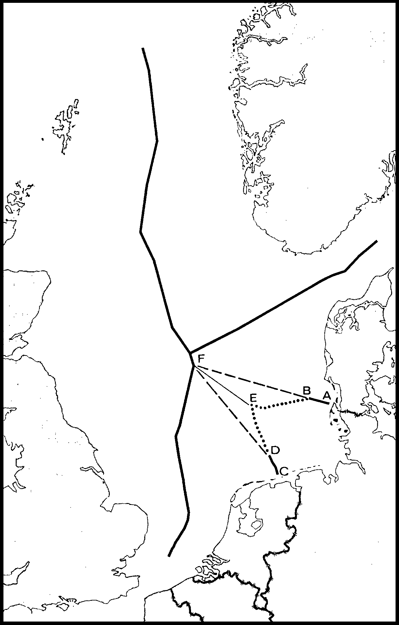
日本語: 北海大陸棚事件国際司法裁判所判決で当事国の西ドイツ、デンマーク、オランダが主張した大陸棚の境界線
|
| Date | |
| Source | North Sea Continental Shelf, Judgment, I.C.J. Reports 1969, pp.15-19, paras.5-9. http://www.icj-cij.org/files/case-related/52/052-19690220-JUD-01-00-BI.pdf |
| Author | International Court of Justice |
Licensing[edit]
| This image is a map derived from a United Nations map.
Unless stated otherwise, UN maps are to be considered in the public domain. This applies worldwide. UN maps are, in principle, open source material and you can use them in your work or for making your own map. UN requests however that you delete the UN name, logo and reference number upon any modification to the map. Content of your map will be your responsibility. You can state in your publication, if you wish, something like: based on UN map … (map name, map number, revision number and date). See: Geospatial Information Section. And: Geospatial, location data for a better world. |
 |
File history
Click on a date/time to view the file as it appeared at that time.
| Date/Time | Thumbnail | Dimensions | User | Comment | |
|---|---|---|---|---|---|
| current | 13:55, 5 February 2014 | | 1,272 × 1,988 (84 KB) | Henares (talk | contribs) | User created page with UploadWizard |
You cannot overwrite this file.
File usage on Commons
There are no pages that use this file.
File usage on other wikis
The following other wikis use this file:
- Usage on ja.wikipedia.org
- Usage on tr.wikipedia.org