File:Conscription map of the world(1968).svg
Jump to navigation
Jump to search

Size of this PNG preview of this SVG file: 800 × 406 pixels. Other resolutions: 320 × 163 pixels | 640 × 325 pixels | 1,024 × 520 pixels | 1,280 × 650 pixels | 2,560 × 1,300 pixels | 1,339 × 680 pixels.
Original file (SVG file, nominally 1,339 × 680 pixels, file size: 1.1 MB)
Captions
Captions
Add a one-line explanation of what this file represents
Summary[edit]
.svg&action=edit§ion=1)
| Description |
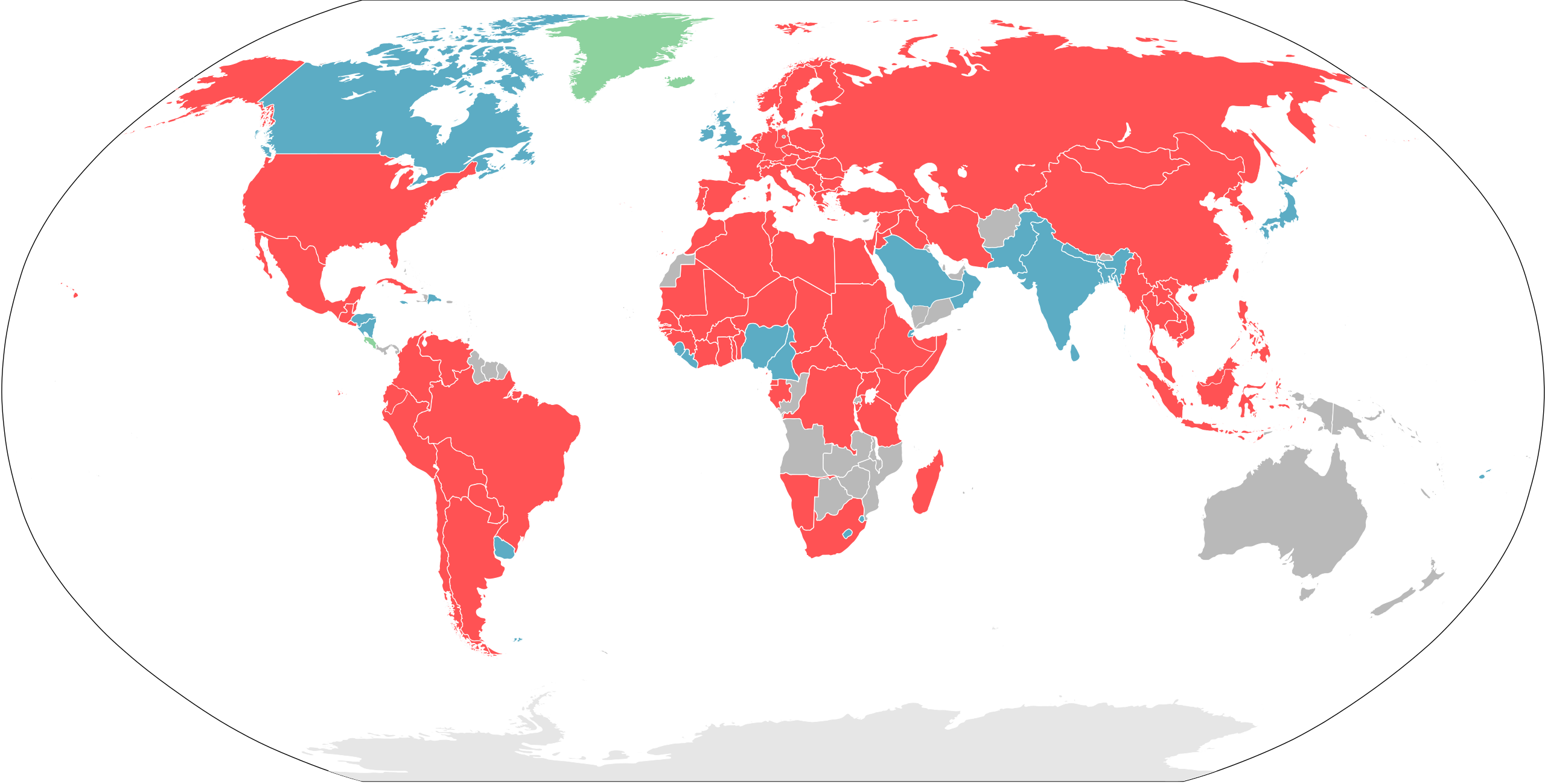
English: World map of the Conscription countries(1968)
Green: Countries that do not have any armed service. 日本語: 徴兵制度の世界地図(1968年)
緑: 軍隊を保有していない国家. 한국어: 징병제 국가 세계지도(1968년)
초록: 군대 없음 |
| Date | |
| Source | Own work |
| Author | Kowikimapupload |
Licensing[edit]
.svg&action=edit§ion=2)
| I, the copyright holder of this work, release this work into the public domain. This applies worldwide. In some countries this may not be legally possible; if so: I grant anyone the right to use this work for any purpose, without any conditions, unless such conditions are required by law. |
File history
Click on a date/time to view the file as it appeared at that time.
| Date/Time | Thumbnail | Dimensions | User | Comment | |
|---|---|---|---|---|---|
| current | 18:18, 25 January 2022 | | 1,339 × 680 (1.1 MB) | Kowikimapupload (talk | contribs) | Uploaded a work by Kowikimapupload from {{own}} with UploadWizard |
You cannot overwrite this file.
File usage on Commons
There are no pages that use this file.
.svg&oldid=867574600)