File:Conflict Group.png
Jump to navigation
Jump to search

Size of this preview: 800 × 461 pixels. Other resolutions: 320 × 184 pixels | 640 × 369 pixels | 878 × 506 pixels.
Original file (878 × 506 pixels, file size: 938 KB, MIME type: image/png)
Captions
Captions
Add a one-line explanation of what this file represents
Summary
[edit]
| Description |
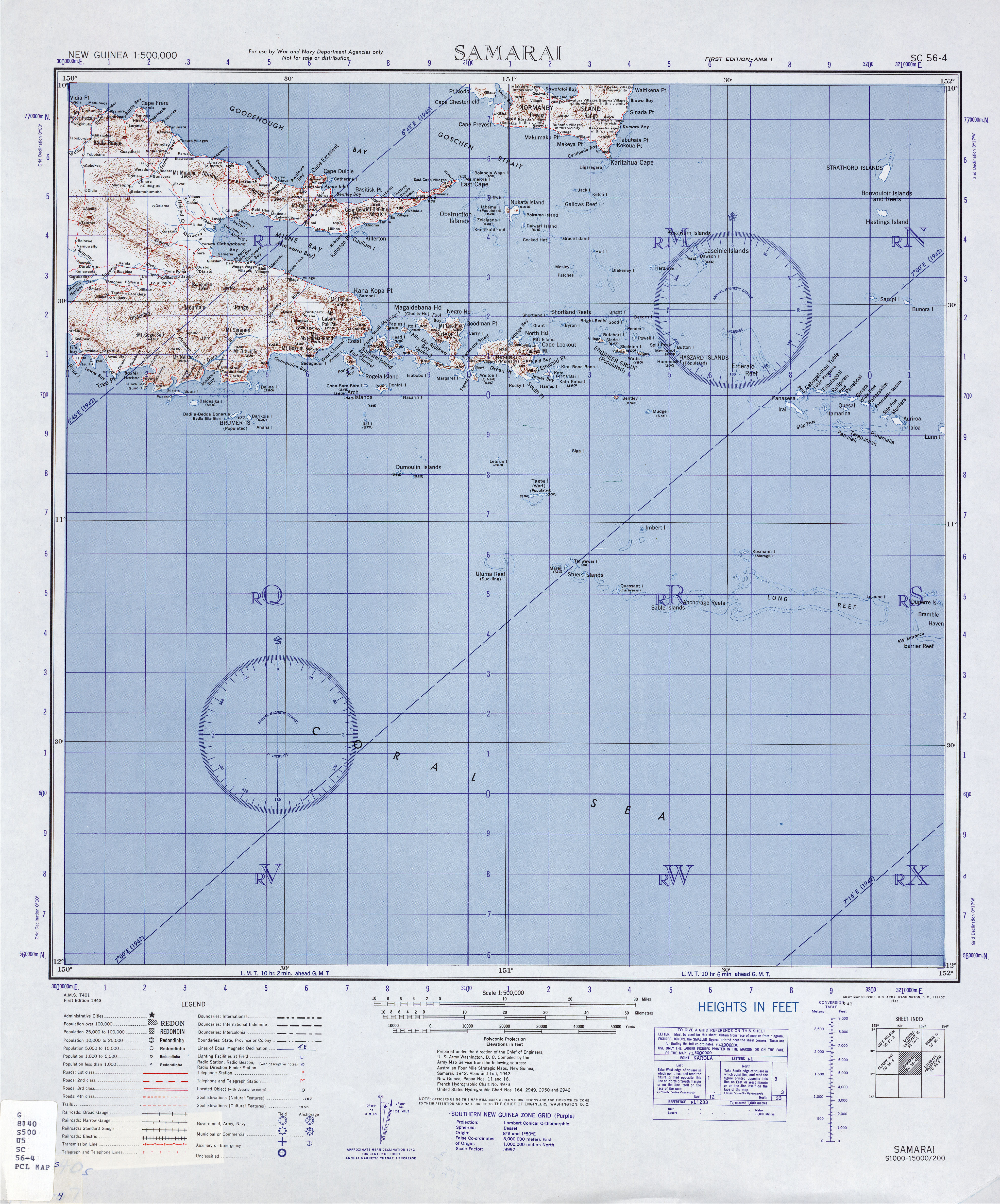
English: portion of original map, cropped for Conflict Group (Atoll), Milne Bay Province, Papua New Guinea |
| Date | |
| Source | http://www.lib.utexas.edu/maps/ams/new_guinea_500k/txu-oclc-6558822-sc56-4.jpg |
| Author | Army Map Service, Corps of Engineers, U.S. Army |
Licensing
[edit]
This file is a work of a U.S. Army soldier or employee, taken or made as part of that person's official duties. As a work of the U.S. federal government, it is in the public domain in the United States.
|
 |
File history
Click on a date/time to view the file as it appeared at that time.
| Date/Time | Thumbnail | Dimensions | User | Comment | |
|---|---|---|---|---|---|
| current | 19:03, 16 March 2010 | | 878 × 506 (938 KB) | Ratzer (talk | contribs) | {{Information |Description={{en|1=portion of original map, cropped for Conflict Group (Atoll), Milne Bay Province, Papua New Guinea}} |Source=http://www.lib.utexas.edu/maps/ams/new_guinea_500k/txu-oclc-6558822-sc56-4.jpg |Author=Army Map Service, Corps of |
You cannot overwrite this file.
File usage on Commons
There are no pages that use this file.
File usage on other wikis
The following other wikis use this file:
- Usage on de.wikipedia.org
- Usage on en.wikipedia.org
- Usage on fr.wikipedia.org